Monarch Pass to Twin Lakes.
Days 59 to 62.
Miles 1084 to 1167.
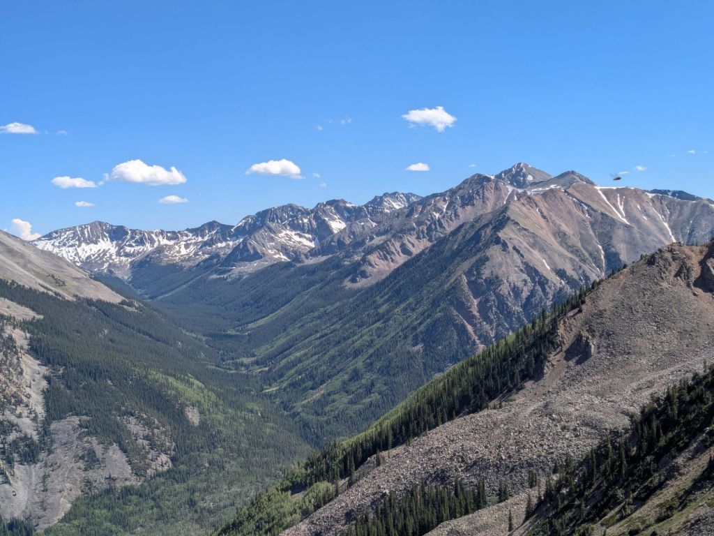
The section of the Continental Divide Trail between Monarch Pass and Twin Lakes is known as the Collegiate West. This section contains multiple mountain passes, long stretches above or near treeline, and views of nearby 14,000-foot peaks. The trail here is almost as strenuous as it is beautiful. But not quite.
Day 59
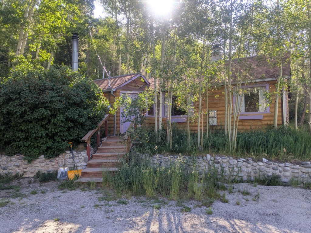
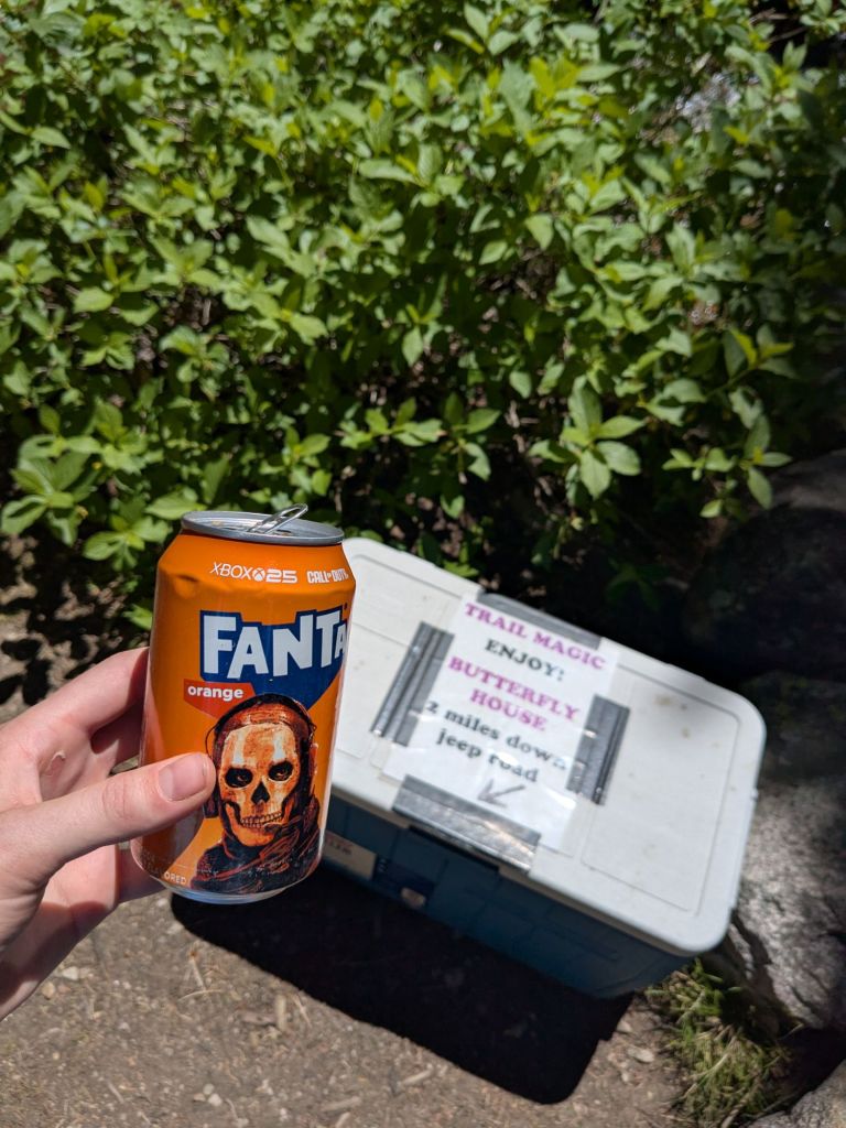
I tried to take advantage of my cozy bed at the Butterfly House Hostel by sleeping in as late as I could. This is a donation-based hiker hostel and was very comfortable. It had everything a thru-hiker could hope for – laundry, showers, beds, electricity, a hiker box, and even hot coffee in the morning.
My hitch back up to Monarch Pass took longer than my hitch down to the hostel yesterday. But I still got picked up within 20 minutes of thumbing it. A couple picked me up – the wife had hiked the John Muir and Colorado Trails. They were on their way to Monarch Pass for a day hike.
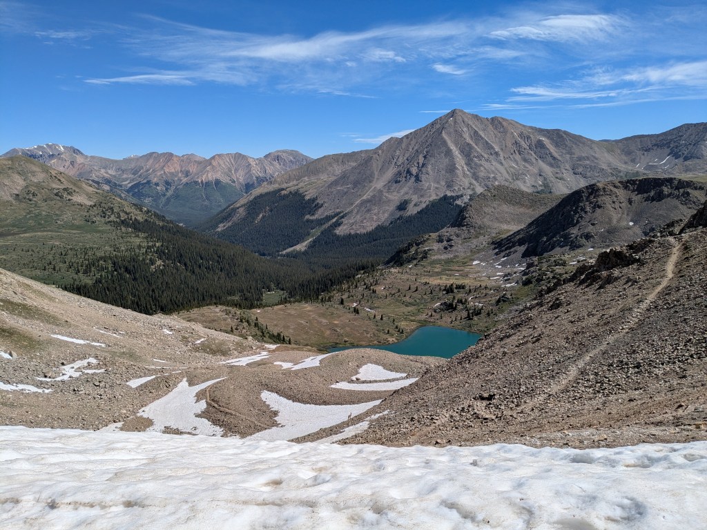
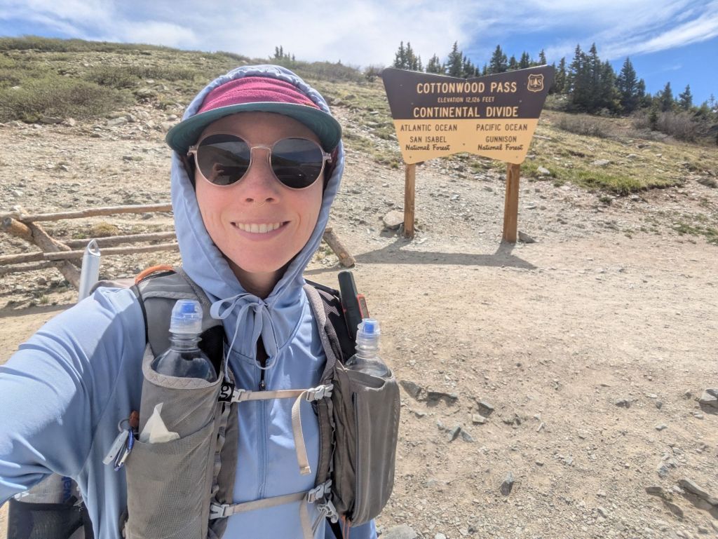
From Monarch Pass, I began my hike up into the Collegiate Range. There are two main routes through the Collegiates – the Collegiate West and Collegiate East. The Collegiate West is higher elevation with epic mountain views and significant time spent above treeline. The Collegiate East is also very lovely, though it’s lower elevation. In the past, I’ve hiked each of these routes multiple times, as they’re only a few hours drive from where I lived in northern Colorado.
This time, I opted to take the Collegiate West. I’d originally planned to take the Collegiate East on my thru-hike. But after missing part of the San Juans by taking the Creede Cut-off, I’ve felt starved for mountain views.
I had a big day planned. I would climb over not one, not two, but three mountain passes – each of which is over 12,000 feet.
I hiked up through the Monarch Crest Ski area towards the first pass. This Pass is one of my favorites – to get to it, there’s a long walk along a massive, hilly ridge above the treeline. According to an interpretive sign, Native Americans used this area for thousands of years to hunt elk and buffalo herds grazing at high elevations, using a series of ambush pits and rock walls.
The wind grew stronger as I climbed higher on the pass. It was the type of wind that blows the tears out of your eyes and the snot out of your nose.
In general, the CDT has been an extremely windy trail for me. Lately, I rarely see days in the forecast with anything less than 40 mph gusts. I wore my rain gear to provide some wind protection, and the thin, plastic-y fabric undulated so rapidly in the nonstop wind that it was practically vibrating. I found myself wondering what wind speed would shread my rain gear.
After the pass, I had lunch at Hunt Lake and started climbing toward the next pass. Not long after that, I started feeling a headache and nausea come on. It seems that I’m still struggling at altitude. I thought I was doing better, but that might just be because the trail has stayed well below 12,000 feet for the last few days. But not anymore.
Fortunately, I gradually started feeling better as the day went on. I crested Chalk Creek Pass – my second pass of the day. I stopped to eat dinner part way up the climb towards my third pass.
It was a strenuous day, and a frustrating one at times. But also very beautiful. Despite the challenges on the climbs, I found myself feeling appreciative as I walked over the top of my third pass in the golden hour before sunset. How lucky am I to be up here, and have this mountain pass all to myself at sunset?
Day 60
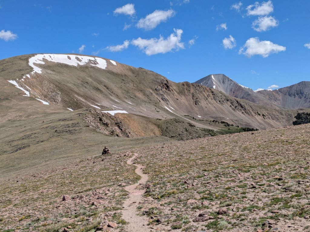
Though I slept at the relatively low elevation of 11,000 feet, I woke up cold several times in the night. A little groggy, I started my first climb of the day. But rather than going up and over a pass, today the trail gets high and then stays high. For about 15 miles, the CDT stays above or near the treeline. I’ve hiked this section 3 other times, and it is one of my all time favorite places to backpack. Today I had perfect weather for it too.
Just because it is one of my favorite hikes though, doesn’t mean it was easy. The altitude definitely slowed me down. So did the loose rocks and a few small remaining patches of snow.
This section also contains one of my favorite water sources. It’s a small crack in a massive, solid rock cliffside, around 12,000 feet. Water spurts directly out of the stone. While I typically treat my water with AquaMira, I don’t bother at this particular source.
After this beautiful, high section, I dropped in elevation toward Texas Creek. I’ve found that when I lose significant elevation my appetite reappears. I stopped partway down the descent and ate 800+ calories of snacks that had just been sitting in my food bag uneaten during the last day and a half at high elevation.
In the last few hours of the day, I turned onto a part of the trail that I hadn’t hiked yet. That’s because this section was rerouted since I hiked the Colorado Trail (CT) in 2016. And when I hiked the Collegiate Loop in 2024, I used an old guidebook that didn’t show the rerouted trail. I’m excited about this new bit of trail – it’s a little higher than the old trail so I expect it will have nicer views.
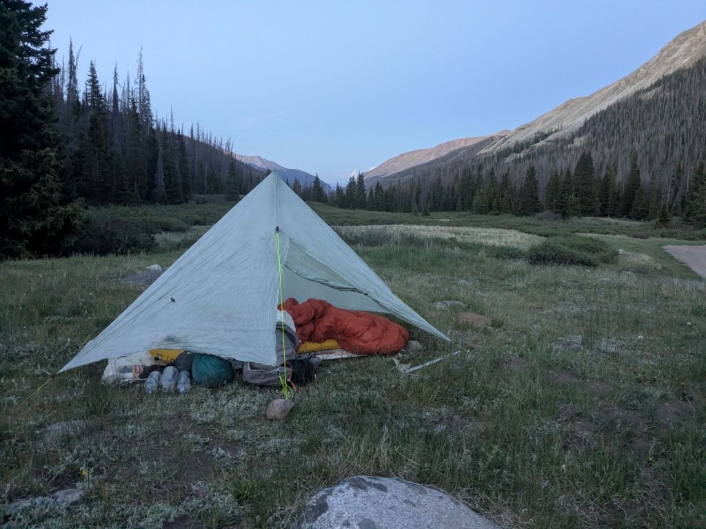
The new trail brought me partway up my next climb. I’ll finish the climb tomorrow, which tops out at Lake Ann Pass. I camped in the woods partway up the climb. It’s a little higher than I’d like to camp, and I’m nervous about being cold overnight or aggravating my altitude-related symptoms.
Day 61
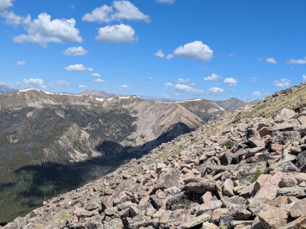
My day started with finishing the climb to Lake Ann Pass. I love the new trail. It’s only a little higher than the old trail, but it’s just high enough to be above the trees. I was looking at fantastic mountain views the whole way up to the pass this morning.
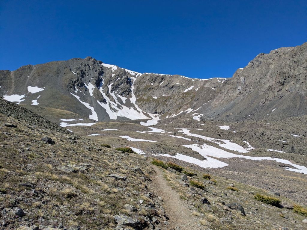
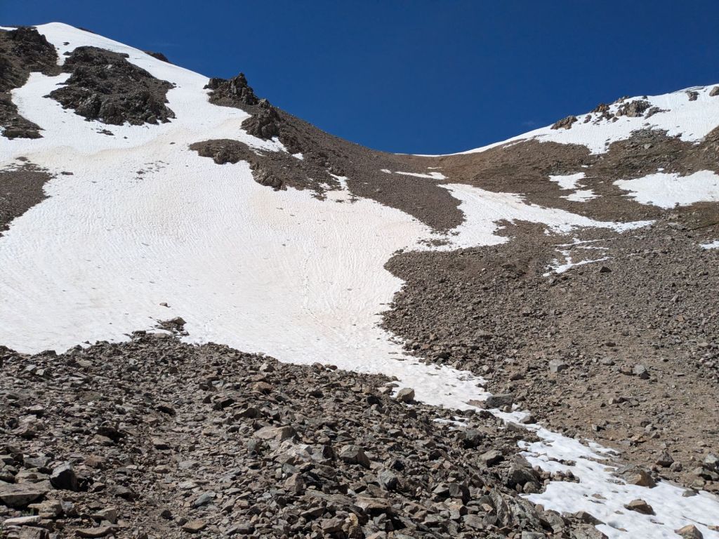
After a few long, final switchbacks, I reached the pass, around 12,600 feet above sea level. I felt slightly dizzy – perhaps from the altitude, or perhaps due to vertigo from looking down the steep terrain on the backside of the pass. The back side of Lake Ann Pass is a large, rocky bowl. At the bottom of the bowl, there’s a large, brilliant blue alpine lake – Lake Ann.

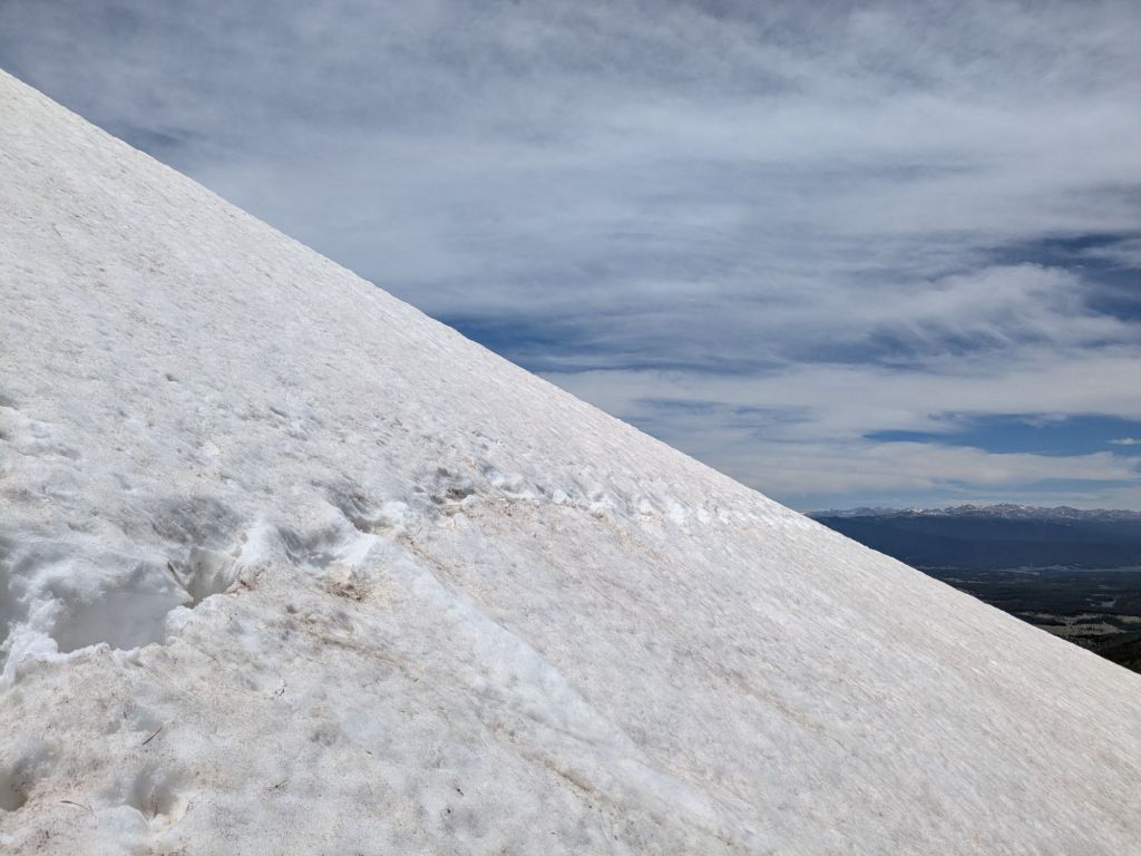
The backside of Lake Ann Pass had the most snow I’ve seen in a while. Though since it’s a low snow year, there is only slightly more snow than there was when I hiked Lake Ann Pass in mid-July on my CT thru-hike, in 2016.
I carefully began picking my way down through the steep rocks and patches of snow. Next the trail, there was one particularly large snowfield left on a steep side of the bowl. I decided to have some fun. I took out my ice ax, which I’ve been carrying but haven’t used in a while. I traversed over to the middle of the snowfield. Then, I glissaded (butt slided) down the slightly-slushy snow.
After the pass, I walked gradually downhill next to a creek for a few hours. I walked fast, because I have plans to meet my friend Lindsey at Twin Lakes this evening. She lives in the nearby trail town of Leadville, and I’ve been looking forward to spending a zero-day off-trail with her.
But before reaching Twin Lakes and my planned rest day, I have one more pass to climb: Hope Pass. Fortunately, on a beautiful, sunny day like today I can hike two passes in a day without worrying about getting caught above the treeline in the afternoon thunderstorms. Afternoon storms are common in Colorado in summer.
I consider Hope Pass the most strenuous pass on the Collegiate West route. Hope Pass might not be the highest or the snowiest. But it is without a doubt the steepest. In 2.4 miles, the trail gains 2,400 feet of elevation.
Hiking up Hope Pass was equal parts hiking and stopping, stooped over to catch my breath. It takes me well over an hour, but I finally reach the last few steep switchbacks near the top of the pass.
As I trudge towards the top, a group of Colorado Trail thru-hikers come marching over the pass and start striding down the switchbacks towards me.
It strikes me how strong they look. They are about 200 miles into their thru-hike and have just gotten their trail legs. They are enthusiastic and motivated. Their clothes are unstained, their gear untorn. They are toned but not gaunt. I think about how disheveled and haggard us CDTers must look to their eyes.
I saw many CDT thru-hikers headed the other direction when I hiked the Colorado Trail too. I also saw them while hiking the Collegiate Loop and on other short backpacking trips in this part of Colorado. I remember thinking the CDTers looked weathered and seemed like they’d seen some shit. They weren’t typically the most cheerful or personable hikers, if you tried to talk to one. More often than not, if greeted with a friendly “Hello there, how’s it going?” the CDTer would just grunt and keep walking. Occasionally they’d snip a snarky reply.
After the hours and sometimes days of isolation I’ve experienced on the CDT, I can begin to appreciate why some CDTers act this way. After the long road walks, horrifying water sources, and deep snow, I can see why they look so worn out. Someone once told me the CDT is the trail where thru-hikers become jaded, and I’m beginning to understand why.
Before I started this thru-hike, I made it a goal of mine to not become one of these checked-out CDT zombies, which I’ve encountered so many of. Even so, I catch myself every now and again slipping into this persona.
I want to be present in my thru-hike – with the people I interact with and the beautiful areas I walk through. While sometimes a little disassociation is beneficial in endurance sports, I lament the parts of the Appalachian Trail (AT) and Pacific Crest Trail (PCT) where I was mentally checked out. For example, I was too exhausted and distracted in the White Mountains of New Hampshire to properly enjoy them. Even though I hiked every step of the AT through the White Mountains, in some ways it feels like I never did them at all.
I would hate to finish the CDT but leave it feeling unfinished.
Day 62
Yesterday evening, my friend Lindsey picked me up at Twin Lakes and took me to her house in Leadville. Today, I took a very restful zero.
I felt more than ready for a day off, after hiking the Collegiate West in 3 days. This is “only” about 25 miles per day, but due to the challenging nature of this section, each day felt like a big effort.
My experience on the Collegiate West these last three days has given me a new appreciation for how strong I was in 2024 when I hiked the Collegiate Loop (the Collegiate East and Collegiate West together; a ~160-mile backpacking loop). Then, I hiked 30-35 miles per day on this same stretch of trail and felt much stronger on the uphills and coped better with the altitude. I guess thru-hiking isn’t the quintessence of being in great hiking shape, at least for me.
On all three of my thru-hikes, I’ve noted that there comes a certain point where I stop getting stronger and start feeling weaker. Hiking all day, every day makes me stronger, up to a point. Eventually, poor quality sleep, inadequate rest, and lacking nutrition start catching up with me. I hope I am not approaching that point yet, as I’m only about ~1,000 miles in, and have another ~2,000 to go still.
In hopes of staving off that point, I did my best to rest up today. I resupplied and visited the post office, but mostly I relaxed and ate. Lindsey helped me repair some gear and we made cookies and pasta from scratch. Or more accurately, Lindsey made cookies and pasta, and I ate them.
I had one other exciting errand: I went to Melanzana! Melanzana is a Colorado clothing company based in Leadville that makes activewear, mainly micro grid hoodies. Typically you need an appointment to shop at Melanzana. But they make an exception for people visiting Leadville mid-thru-hike. I’ve lived in Colorado for 12 years and never owned a “Melly”. After this hike, I plan to move out of state. It seems only fitting that I own a Melly now, to identify where I come from.

Leave a comment