Doc Campbell’s to Pie Town.
Days 10 to 15.
Gila River Alt Mile 40 to CDT Mile 423.
After Doc Campbell’s, the Gila River Alt continues crossing back and forth across the river for many miles. Hikers have the option to take side trips to cliff dwellings and hot springs. But eventually, the alt deposits hikers onto a long gravel road, which reconnects to the CDT main route and leads to Pie Town.
Day 10
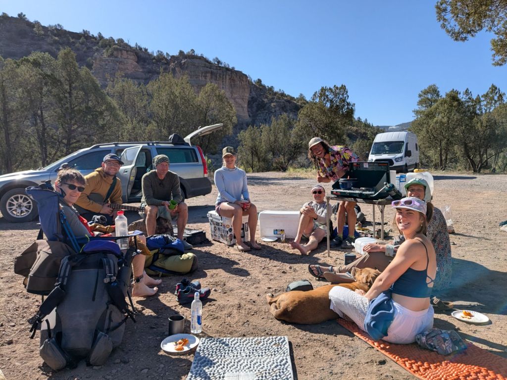
I woke up this morning in the free campground where Gucci, Moc, Critter, and Geode (2025 PCTers) had done trail magic last night. This morning, they were at it again. They made pancakes on their Coleman stove and served me breakfast in my sleeping bag.
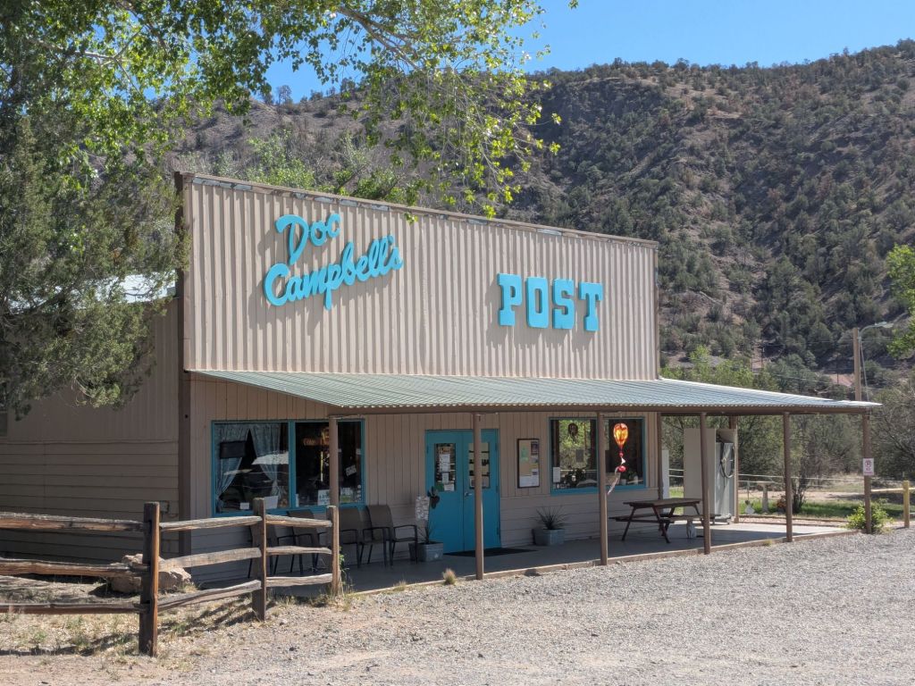
After being pampered so thoroughly, I struggled to get up and hike on. But by late morning, I finally got moving. I made my way a mile down the paved road to Doc Campbell’s Post. This is a small, hiker-friendly store. I picked up a resupply package that I sent there and bought a sports drink.
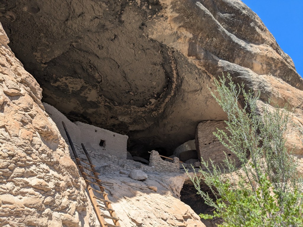
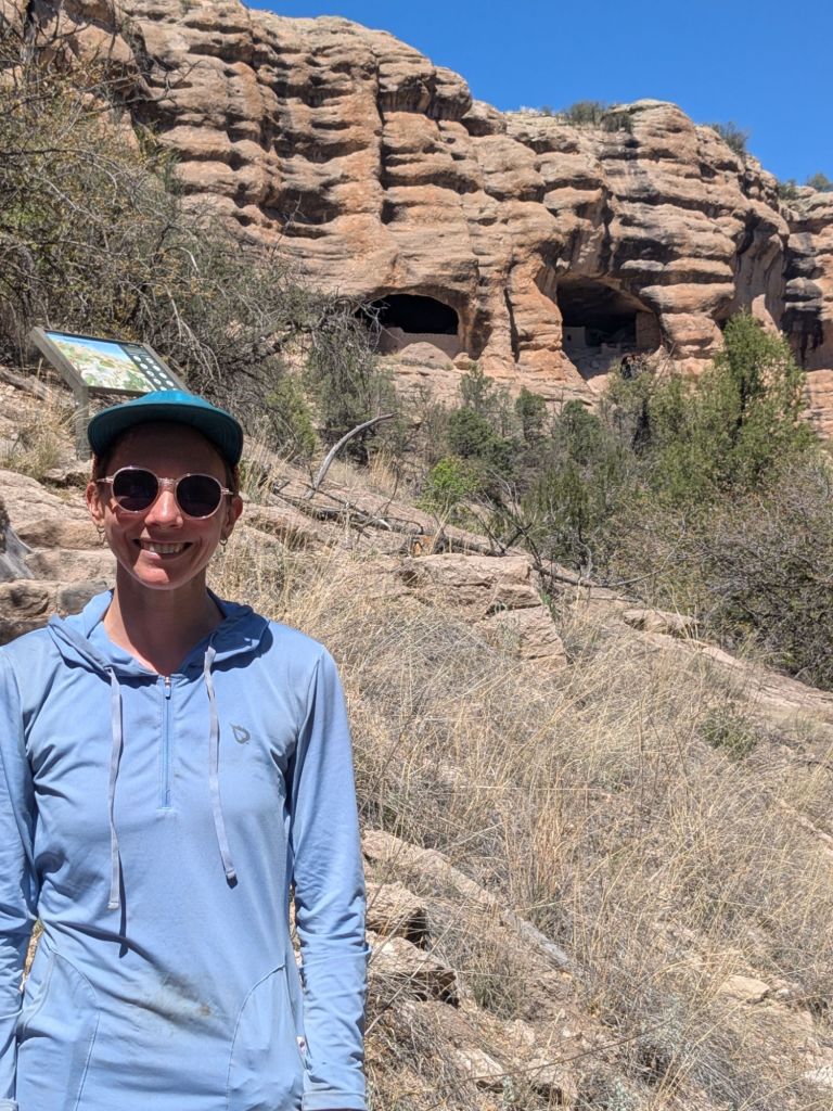
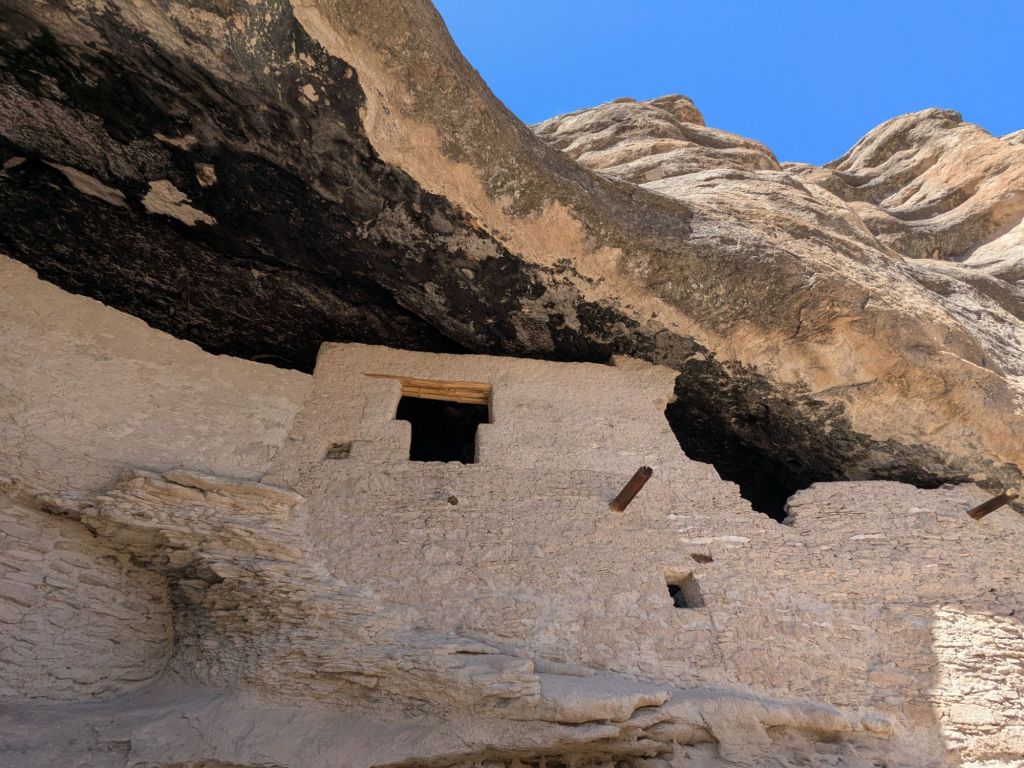
I rolled out of Doc’s around 1 pm, and once again hit the paved road. The alternate route I’m taking follows the paved road for a few miles, before rejoining a single-track trail. However, I tacked on a few extra miles of road walking to take a side-trip to some cliff dwellings.
The cliff dwellings were located just a mile from my route. Once I arrived, I dropped off my pack at a ranger station and hiked the 1-mile loop trail to the dwellings pack-free. It feels quite odd to take a side trip on a backpacking trip to go for a day hike. But I found the cliff dwellings a worthwhile detour.
The dwellings were built and lived in from about 700 to 800 years ago. I tried to imagine what life in these canyons would have been like back then – before paved roads and manicured trails were constructed. How crucial water must have been, in choosing where to live.
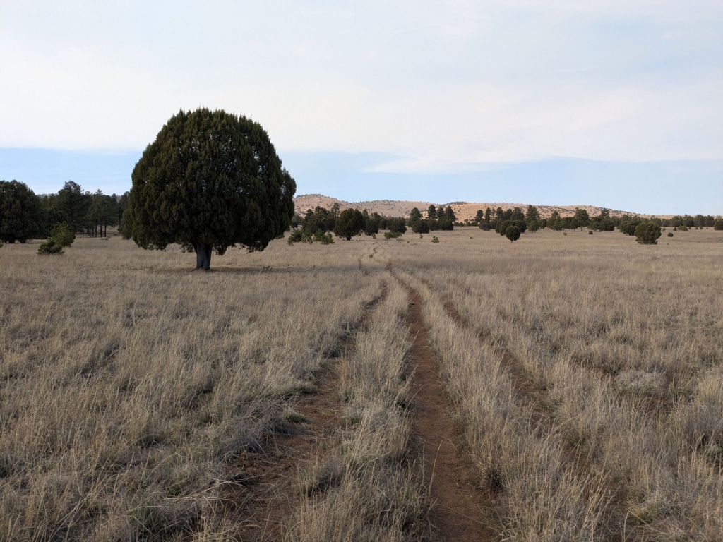
I returned from the cliff dwellings to my route. I hiked across the mesa for a bit, then dropped into a narrow tributary canyon which I followed all the way back into the Gila River. Once in the Gila, I continued working my way upstream – crossing the river 16 times in less than 3 miles.
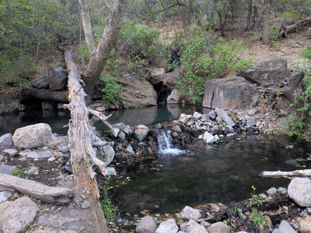
I ended my day at Jordan Hot Spring – a natural backcountry hot spring along this alt. Soaking in the warm pools was the perfect end to a short but sweet day of hiking.
Day 11
My day began with something horrid: putting on wet socks. But there was no point in putting on my dry ones. I’d once again spend the day fording back and forth across the Gila River.
Today, by my count, I crossed the river a whopping 127 times. But the fords weren’t the only thing that made today challenging. As I worked my way upstream, the trail was harder to follow. Eventually, I was bushwhacking through overgrown willows and crawling over log jams. At one point I scaled some rocky ledges to get around a tiny waterfall.
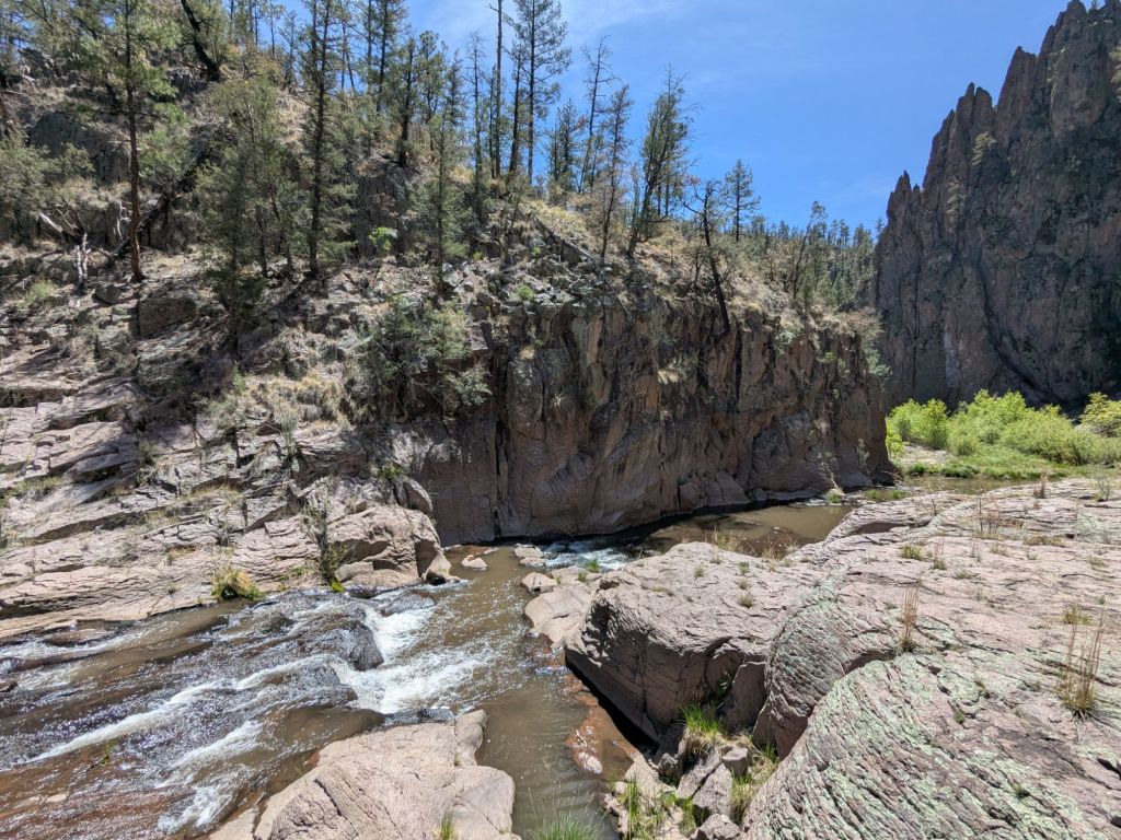
After 19 miles of this, I reached my final crossing of the Gila River. It’s a much smaller stream here than it was where I entered the canyon the day before yesterday.
I’ll miss this place. The Gila River is so full of life. I’ll miss watching pairs of mergansers lazily float downstream and tadpoles swimming past my ankles as I walk through the water. I bid the river goodbye, and turned onto a different trail: the Gila River High Route.
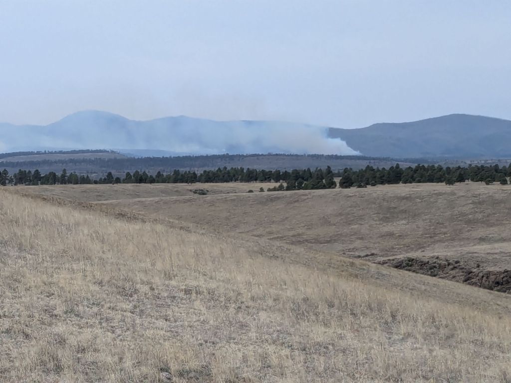
I hadn’t originally planned to take the Gila River High Route, but there’s a small wildfire in the area. Several miles of the main Gila River Alt that follows the river are closed, unfortunately.
I enjoyed the high route. It took me onto juniper-covered Aeroplane Mesa, then down a gravel road. Eventually, I reconnected with the Gila River Alt, just past the end of the section that’s closed for the fire.
I hiked off my route slightly to reach a campground, where I filled all my bottles at a spigot. Tomorrow, I have a long water carry. In fact, the next few days will be full of many long, heavy water hauls. Even now, before my socks are fully dry, I miss the river and its abundant water.
I’ve been hesitant to night hike on the CDT thus far, since the route finding is often challenging, even in the daytime. However, since the trail just follows a gravel road for a while, I decided to hike a little after dark this evening. I flipped on my headlamp.
Somehow, I managed to find something that could serve as a campsite off the side of the dirt road in the dark. I picked a nice flat spot with minimal cow manure, shell casings, and broken glass. I didn’t expect rain overnight, but set up my tarp nonetheless. Some nights I just need that thin layer of DCF fabric to protect me from the weird vibes of a strange campsite.
Day 12
It was chilly enough this morning that I struggled to take off my puffy jacket. However, the uphill morning miles had me sweating soon enough.
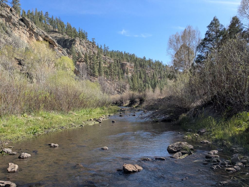
The route briefly returned onto single-track trail, and followed a ravine that would be the Gila River – if there were any water in it. Instead, there’s a dry creek bed. This has been an especially dry year. Water sources that are typically running are dry.
Soon, I left the ravine and hiked up onto a grassy mesa. From there, I got some great views back towards the Hummingbird Fire. I’m relieved to be past the fire. But I’m apprehensive that this was just a taste of what the months ahead will bring. Dry conditions this year don’t just mean fewer water sources. It also means the forests are more likely to burn.
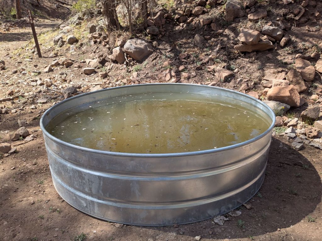
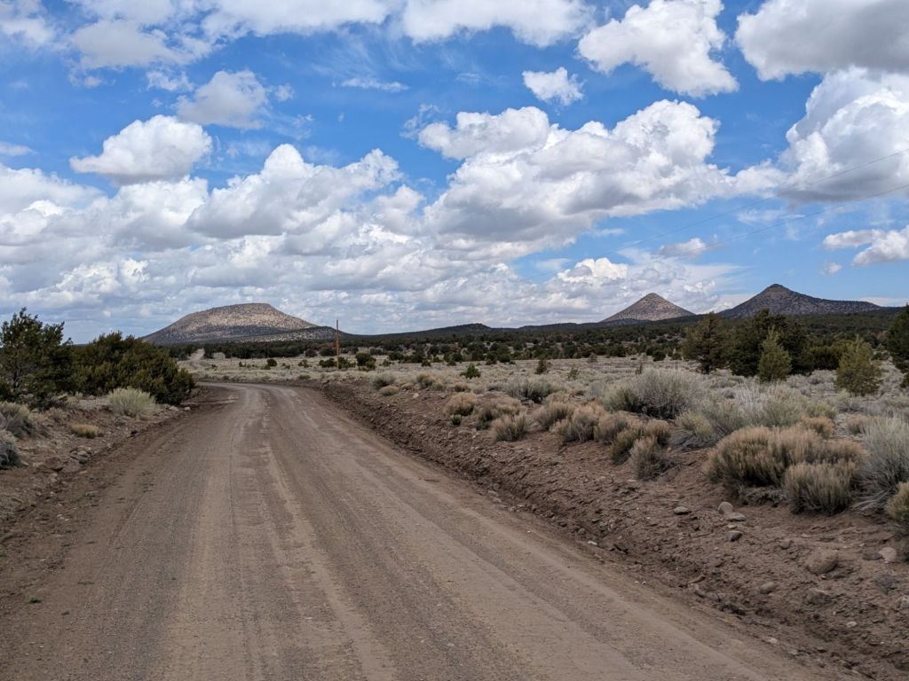
On the grassy mesa, I began an approximately 20-mile section in which my route followed a gravel road. The water sources, which were few and far between, were slimy, murky cattle troughs. Cattle were everywhere, and sometimes were unwilling to let approach or pass by. Honestly, I find the cattle more intimidating than the vast majority of wild animals out here.
In the afternoon, I came upon a cattle trough that was less gross than average and not surrounded by aggressive longhorn bulls. I seized the opportunity to tank up. I’m looking at an approximately 25-mile water carry to the next promising-looking water source, which I should reach tomorrow, mid-day.
In the evening, I finally left the road and returned to the official route of the CDT. I haven’t been on the actual CDT for over 100 miles, since I chose to take the Gila River Alternate after Silver City.
I was hopeful that my return to the official route of the CDT would bring me something more scenic than roads. And my evening miles delivered that. The trail became a lovely single track, bobbing up and down along a knobbly ridge around 8,000 feet above sea level. I hiked in my puffy jacket, as it is quite cold and windy up high.
Overall, today was not my favorite day. But I did manage to hike 30 miles. My last two long days have me feeling beat, and I’m looking forward to some rest in Pie Town soon.
Day 13
Like most nights on this trail so far, I camped alone last night. I started stirring around 7 am, ate breakfast in my sleeping bag, and began hiking around 8 am. This is becoming my routine.
I spent a lot of the morning preoccupied with thoughts about water. A preoccupation with water is also becoming routine. Water dictates so much of my day-to-day here. I’m also realizing that a lot of my photos are of water sources. Finding a non-murky cow trough or a surprise water cache is an exciting, photo-worthy event. And the yuckier water sources must be documented too for their ick factor.
I came across one such icky water source on the Govina Canyon Alt today – a short alternate route through a forested canyon. This water source was an algae-filled cow pond. Even though I had just barely enough water to make it to the next “good” source, I grabbed a liter from the icky pond just in case.
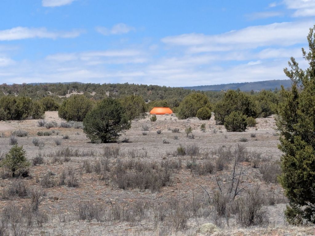
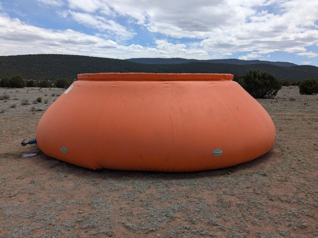
The “good” source, which I reached around lunch time, was a large, inflatable orange water tank. I have no idea who put this tank out here in the middle of nowhere, or why, but I’m thankful to that person or persons.
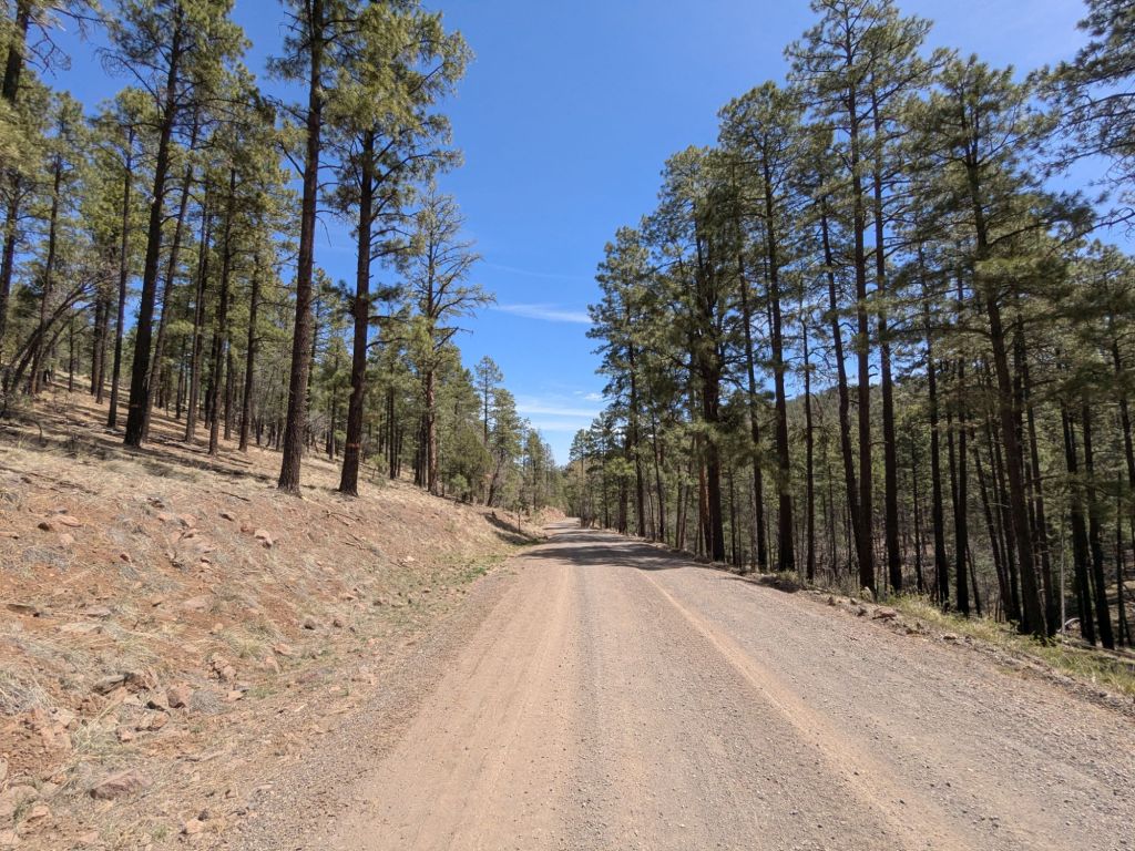
Not long after lunch, I turned onto a dirt road. I’ll be hiking on dirt roads for the next 40 miles or so, all the way to Pie Town.
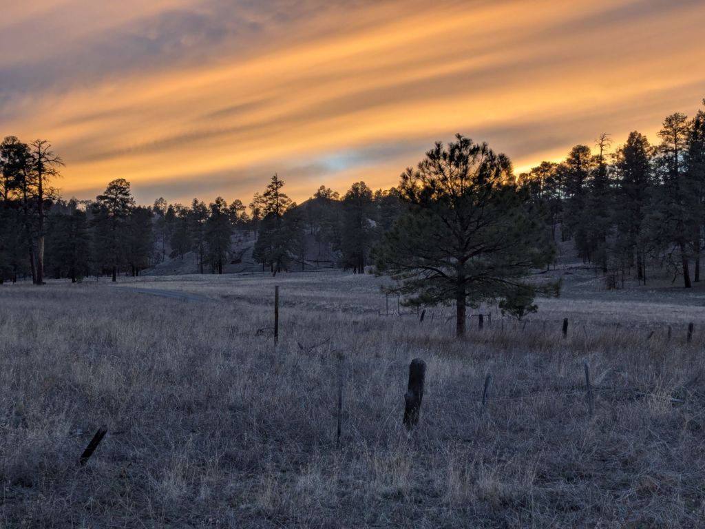
I reached my planned campsite at a free campground, only to find that it was deserted and kinda creepy. So I pushed on a short distance and found a nice spot to pitch my tarp on top of a little forested hill.
It will be cold tonight, again. Though it’s sometimes chilly at night, the daytime temps have been very pleasant for hiking overall so far. However, every time I meet a local recently, they say something about a storm rolling in soon. I expected to be hot and dry in New Mexico. It never occurred to me I might be cold and wet.
Day 14
I rolled out of my campsite before 8:30 am. Not bad for a chilly morning.
The first several miles today took me near the summit of Mangas Mountain – over 9,600 feet. I believe that’s the highest I’ve hiked so far on this trip.
After the mountain came a long downhill on dirt roads. These soon fed onto a more substantial gravel road through ranchland. The forest on either side of the road was soon replaced by barbed wire fencing with “No Trespassing” signs.
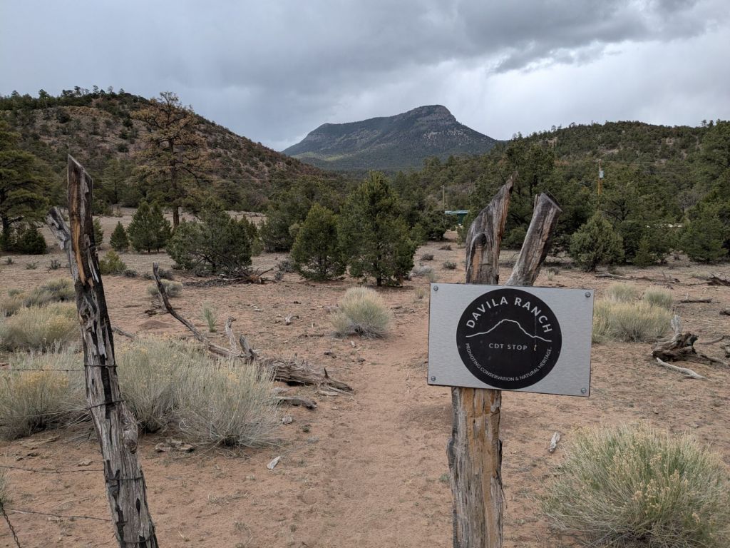
However, some of the ranches welcome CDT hikers. Just as it started to hail lightly, I arrived at Davila Ranch. I knew that Davila Ranch was some sort of hiker rest spot, but I didn’t really know what to expect.
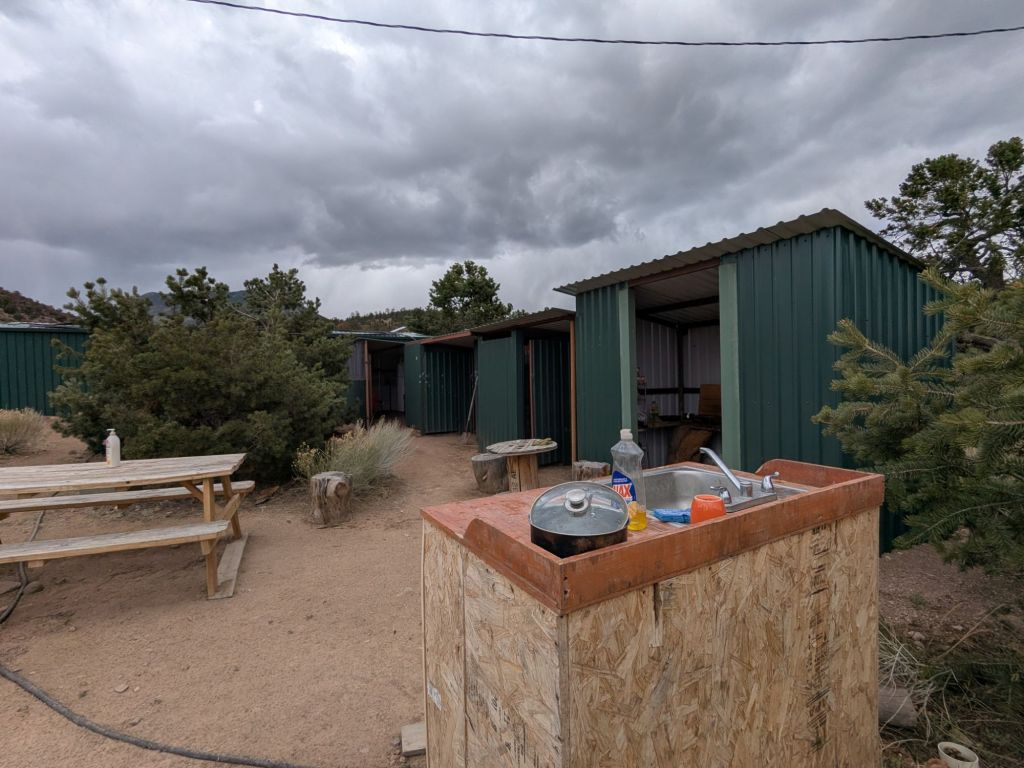
When I arrived, I found a sign indicating that hikers should walk through the open gate over to a large lean-to. There, I found an outdoor kitchen, shower, flush toilet, laundry machines, and a charging station. Plus areas for sitting and setting up tents.
I later learned the origins of Davila Ranch’s CDT rest stop. As the story goes, for many years the owner of the ranch drove by CDT hikers on the long road walk into Pie Town. The hikers were thirsty, tired, hungry, and dirty. Many were on the verge of quitting. The owner of Davila Ranch would pull over and help them out with a ride, a meal, or some water. Eventually, he decided to just create a place along this long and notoriously grueling road walk for hikers to rest and recharge so they could continue on.
The ranch was great! It had everything a hiker could want, and it is donation-based. This afternoon, it was also totally deserted. I helped myself to laundry and a shower. When I got out of the shower, a few other hikers had arrived.
I hung out at Davila Ranch for 3 hours enjoying its fantastic amenities. Then, I decided to head on and tackle the remaining ~14 miles of gravel road to get to Pie Town.
I made quick work of the gravel road walk. I was motivated to walk fast by the storm clouds in every direction. Somehow, it seemed to be raining everywhere but right where I was. I arrived in Pie Town at dusk. My destination was the Toaster House.
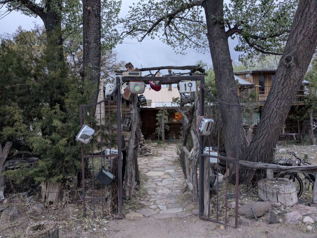
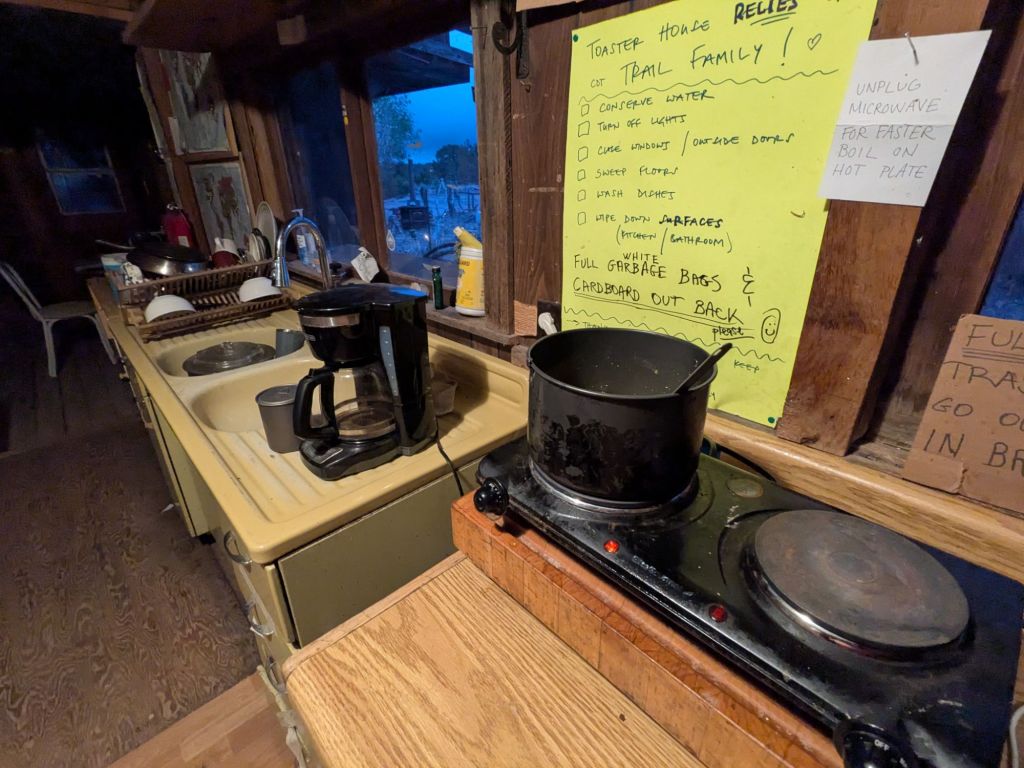
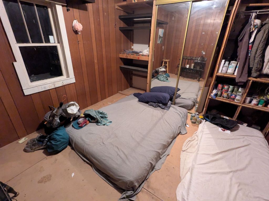
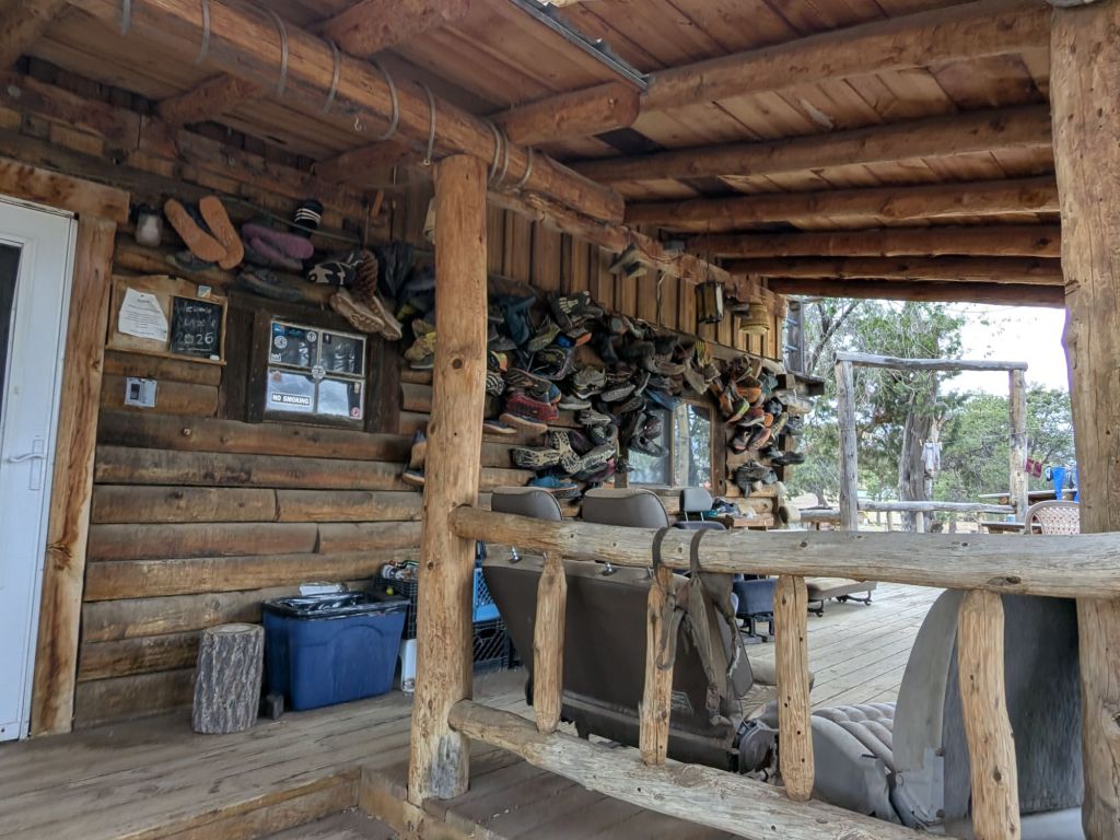
Like Davila Ranch, I’d heard about the Toaster House, but didn’t fully understand what it was. I think it is best described as a communal space that is open to long-distance hikers and bikers to spend the night. It is named for its front fence, which is covered in many toasters. It is a kinda odd place, but it feels cozy.
The Toaster House came to be thanks to its late owner, Nita Larronde. Nita welcomed hikers into her family home for years. After she passed in 2023, her children strived to uphold Nita’s wish that the Toaster House remain open to travelers passing through Pie Town.
I used the hot plate in the kitchen to cook my couscous, instead of cold soaking it like usual. I also helped myself to instant decaf coffee from the hiker box.
Tonight, I go to bed on a mattress in one of the rooms in the Toaster House. As I get ready to sleep, I can hear the sound of rain pinging on the roof. I’m happy I pushed to make it here tonight.
Day 15
Today I took my first zero (day off hiking) of the CDT.
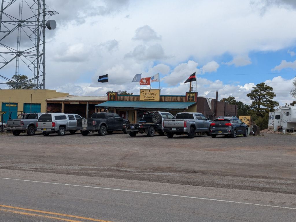
I started my day by going over to the Gatherin Place – one of two restaurants in Pie Town. I had breakfast and picked up my boxes. Many other hikers showed up – I think I saw 15 or so other thru-hikers in Pie Town today. That’s a lot by CDT standards.
I waffled for most of the day about whether I wanted to zero or walk on. I got fully ready to leave town, and then it began to hail. I waited a bit, feeling increasingly antsy to walk.
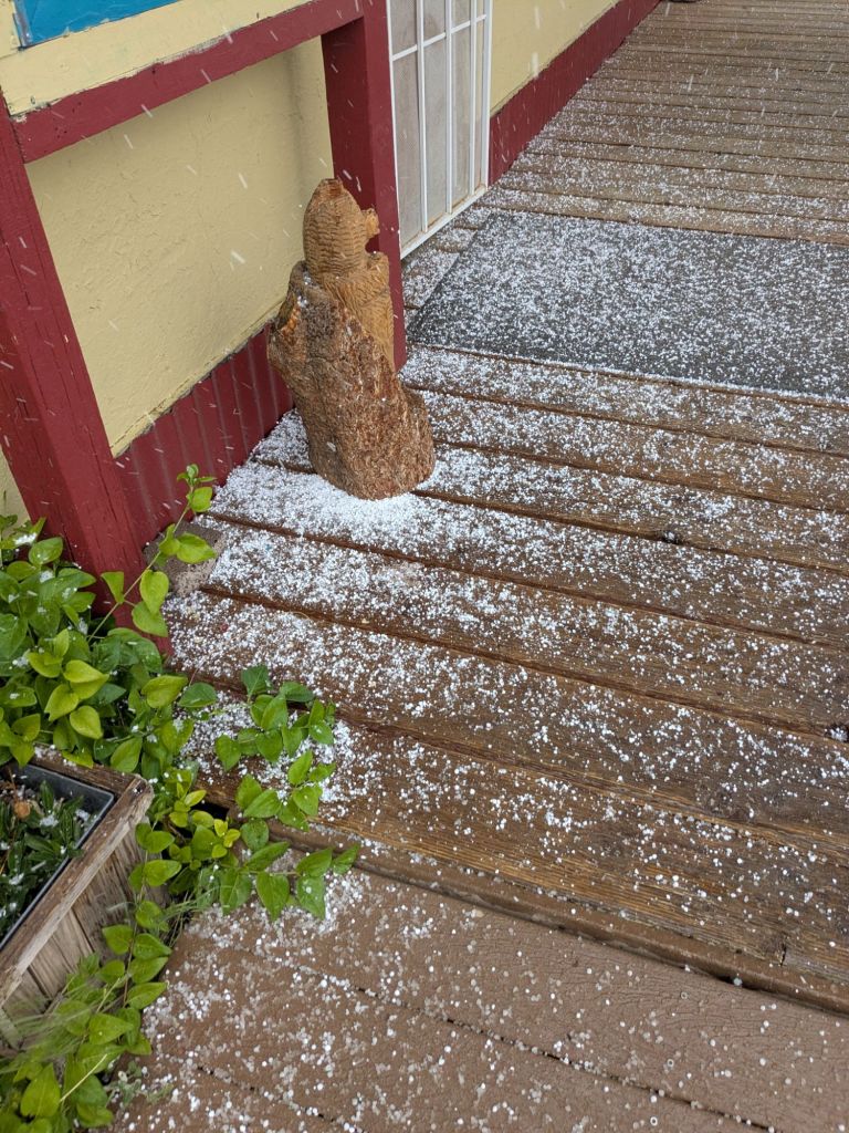
Around 3 pm, the hail stopped and I started hiking down the road. I made it about a tenth of a mile and suddenly stopped. What was I doing? There was a free place to sleep, the weather looked awful, and I hadn’t taken a zero yet. Why did I feel the need to push on?
I turned around and walked back to the Toaster House. Even though my body feels good, I think my brain needs a rest. The start of a thru-hike is an exciting time for me. There’s a lot of momentum and excitement. It can be hard to remember that rest is necessary too.
Back at the Toaster House, I enjoyed an afternoon sitting on the deck with the 5 other hikers staying there. I found a needle and thread and repaired some of my gear and clothes. For dinner, I made a huge pot of Mac n Cheese from the hiker box.
Tomorrow, hopefully the weather will improve and I’ll tackle the long gravel road walk out of Pie Town.

Leave a comment