Frisco to Winter Park.
Days 66 to 68.
Miles: 40-some miles on the Silverthorne Range Alt, Vasquez Peak Wilderness, and other trails, plus one mile on the genuine CDT.
In the section between Frisco and Winter Park, I only hiked about 1 mile on the actual Continental Divide Trail. Instead, I strung together a series of “official” CDT alt routes as well as other trails in the area. This served two purposes. First, exploring some places in Colorado where I’ve never hiked before. Second, avoiding the highest elevations while I’m feeling unwell. My route cut through the heart of Summit County, then crossed through the Williams Fork Range and the Vasquez Peak Wilderness before dropping into Winter Park.
Day 66
This morning, trail angel Hannah made me a delicious coffee and dropped me back off at the Frisco Safeway grocery where she picked me up yesterday. I continued walking on my made-up bike path alt route.
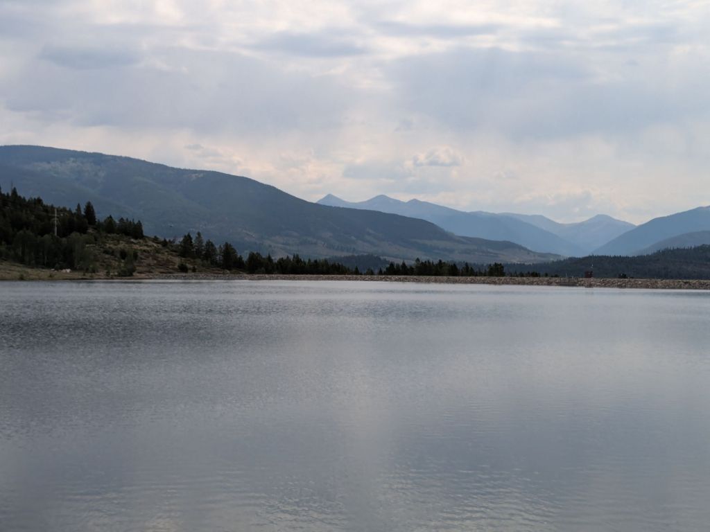
From Safeway, I walked briefly on a blacktop bike path next to the Dillon Reservoir. I then cut up and over a hill on some single-track trails to the town of Dillon. Here, my bike path route joined a more “official” CDT alt: the Silverthorne Alt through the Gore and Williams Fork Ranges. While this alt is lower than the official CDT in this area, it’s still quite high. It goes over passes and ridges around 12,000 feet. But relative to 14,000 feet on the “red line” over the top of Gray’s Peak, it doesn’t seem so high in comparison.
I’m sad to miss this piece of the CDT that goes over the top of a 14er (14,000-foot peak). But not that sad. The Gore and Williams Fork Ranges sound really interesting too, and far less trafficked than Gray’s Peak. And unlike Gray’s Peak, the Silverthorne Alt is somewhere I’ve never hiked before.
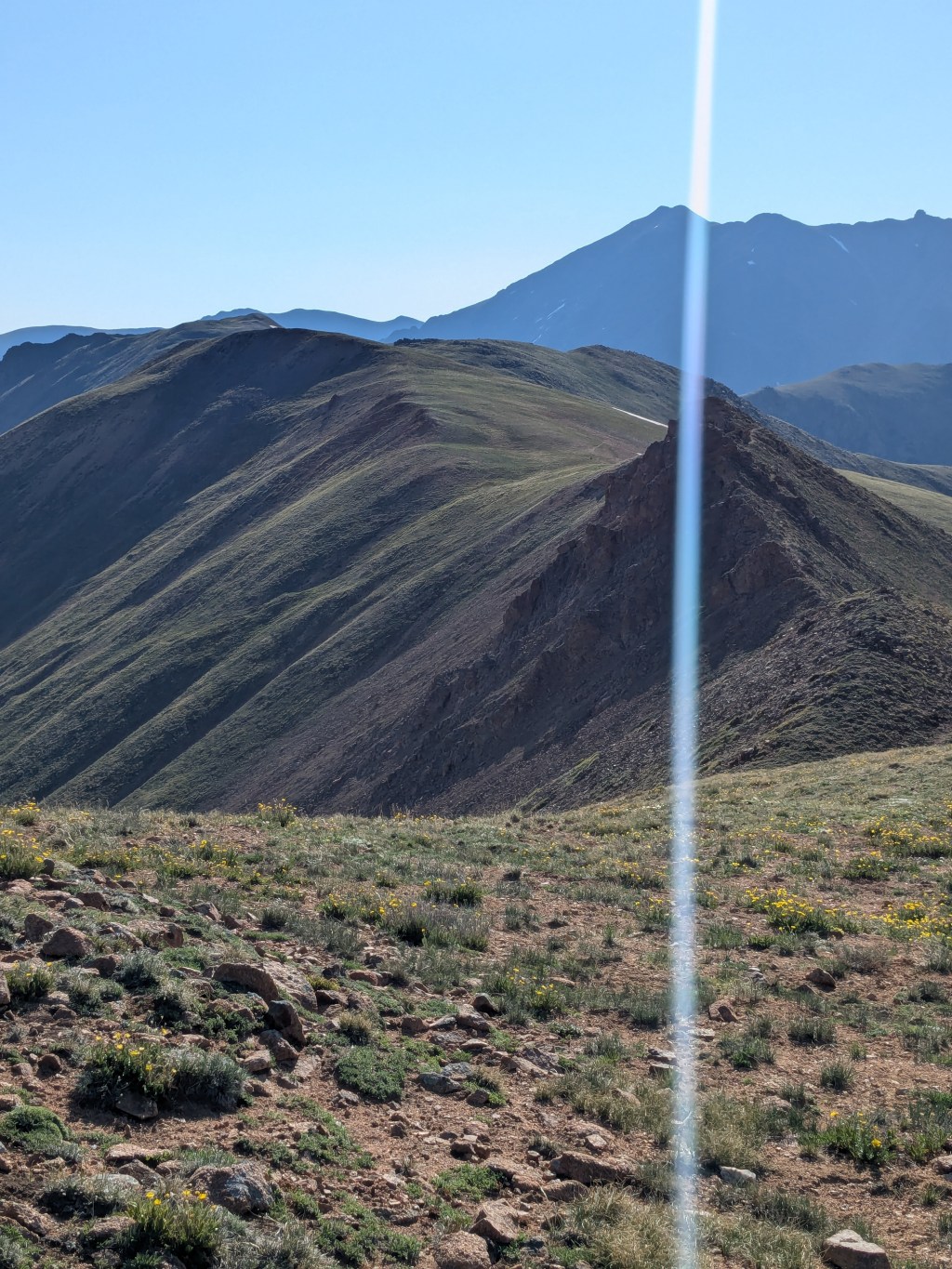
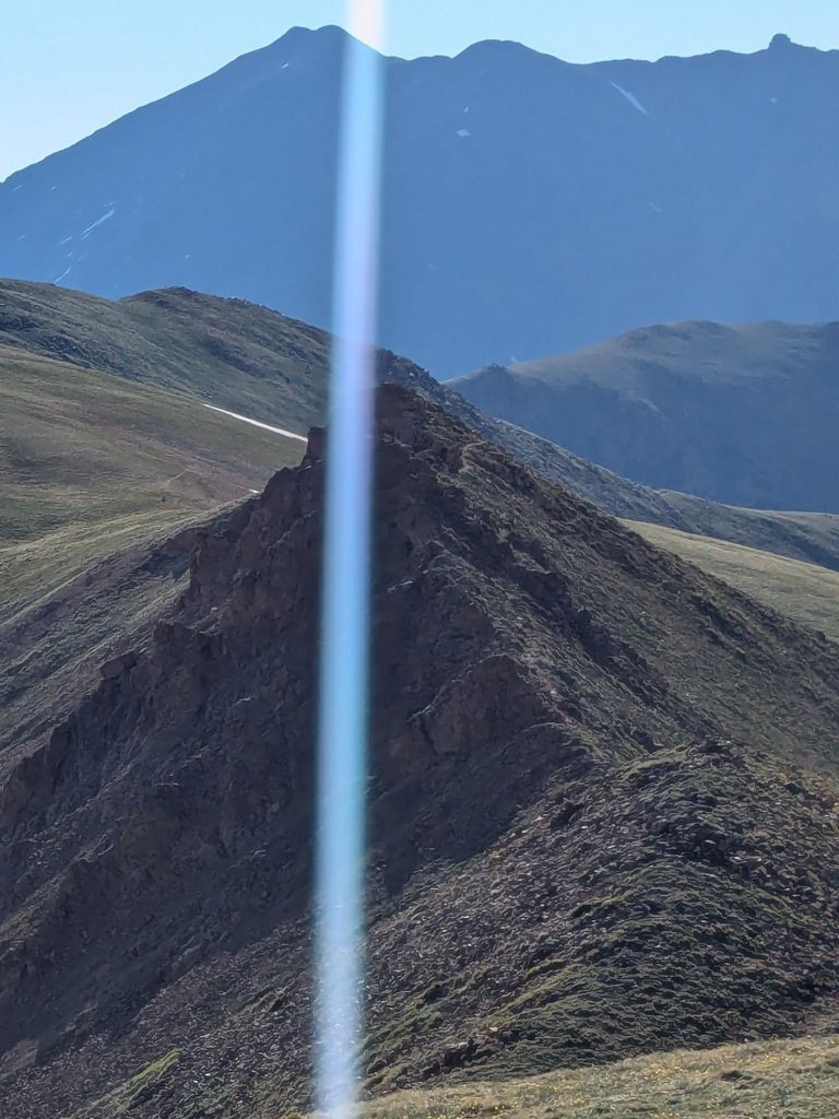
The Silverthorne Alt today was rugged, challenging, and beautiful. In some places, the trail was faint or non-existent. I might have lost my way, if not for the many trusty rock cairns marking the route across the grassy mountainside and through the steep forested valleys.
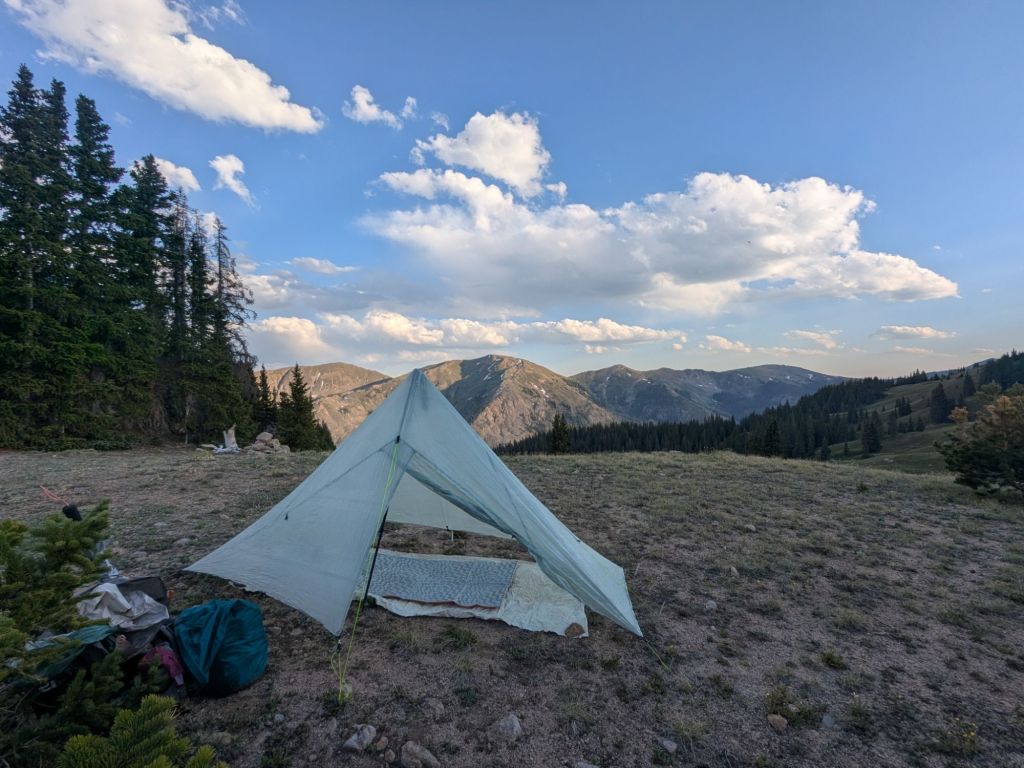
I only made it 12 miles or so up into the Williams Fork Range. I camped on a partially forested saddle with some incredible mountain views. This area feels especially remote, for some reason. I doubt there is another soul anywhere around.
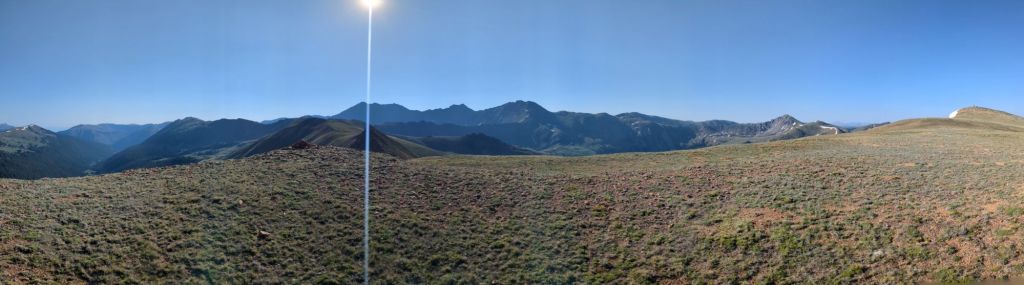
As I sit on the saddle at camp, I look around at the 360-degree views of the mountains. There isn’t a sign of civilization other than my tarp and airplane contrails in the sky. Amidst the vast wilderness, I feel alone and feeble. How absurd that I got here by walking from Mexico, every step of the way, all by myself.
Day 67
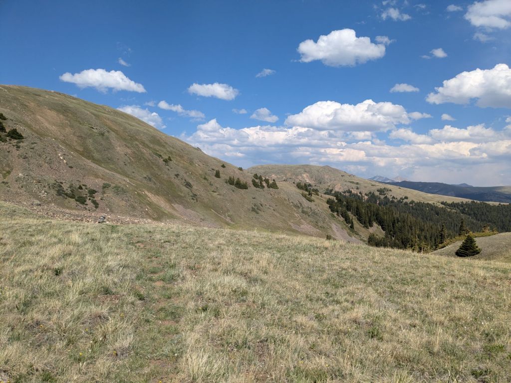
I was nauseated when I woke, and couldn’t stomach any breakfast – the price I pay for sleeping at such a high and beautiful campsite. From the saddle where I slept, I continued upward onto a nearby treeless ridge. The first several miles today followed the ridge closely.
At the beginning, the ridge was broad and grassy. Without a well-defined trail, I felt like I was wandering rather than hiking. “The Hills Are Alive with the Sound of Music” got stuck in my head.
Toward the end, the ridge became narrower and steeper. I crossed a very small knife-edge section. Then, I traversed some steep, loose hillslopes, carefully planting each foot on the sandy, sideways-slanting trail before transferring my weight forward. A bad misstep could send me sliding down the loose, angled sediment toward the valley bottom. In one place, I cautiously worked down and around an area where the faint trail appeared to have been washed out entirely by a rock slide.
The ridge section finished out by traversing a steep scree field to the top of a pass. I was extremely thankful I was hiking up rather than down through this scree slope – I surely would have ended up falling on my butt. The last few miles of the ridge were definitely spicier than I expected from this alt route – a good reminder that lower elevation does not always mean easy.
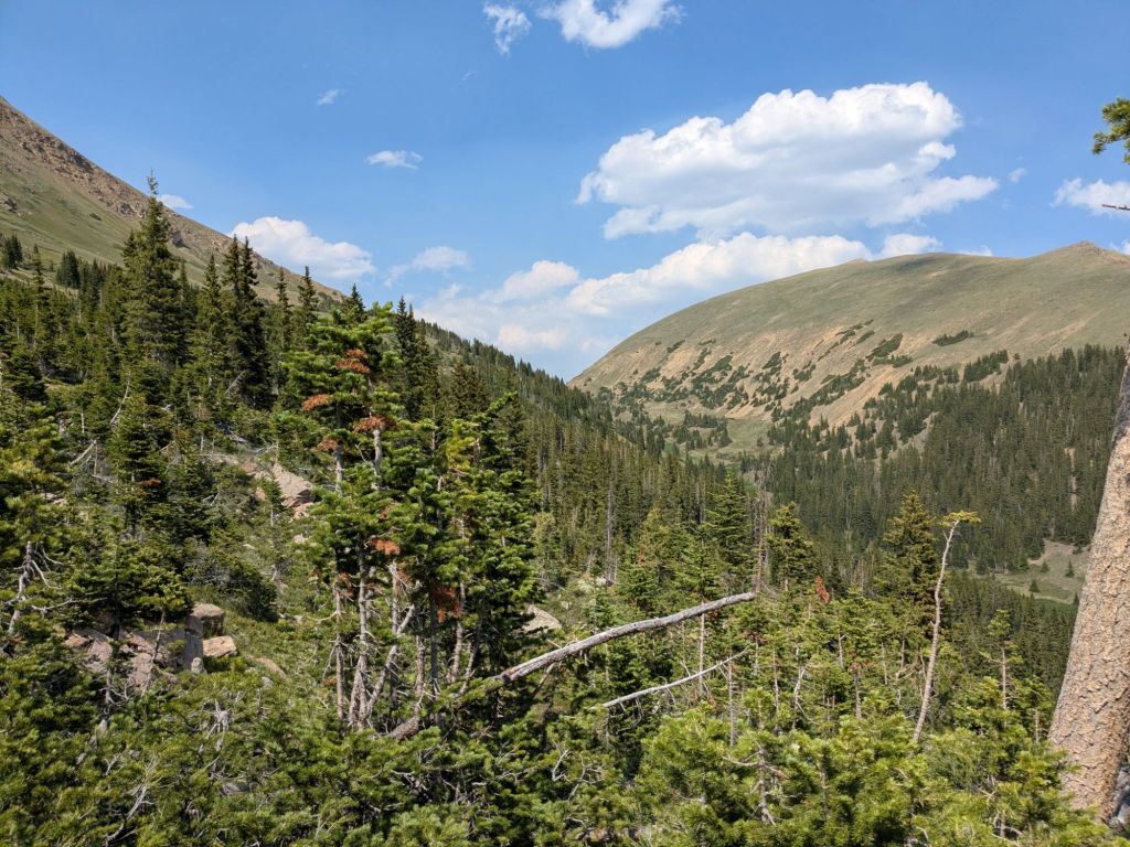
After the ridge section, the alternate route dropped into a long valley and followed a creek. I crossed the creek by hopping rock-to-rock and then joined a gravel road.
In three steep miles, this road gained over 2,000 feet on the way up to Jones Pass. At Jones Pass, the CDT crosses this road. There, I could get back on the “red line”, which follows along a very high ridge.
However, as I climbed higher and higher towards Jones Pass, I grew dizzy. By the time I reached the pass and the intersection with the CDT, I was zig-zagging all over the road, like someone failing a drunk driving test. I took a short rest break at the pass, then turned onto the CDT and began hiking the ridge-top trail.
Compared to the narrow, loose, and sometimes scarcely visible trail on the alt, the CDT felt like a four-lane paved highway. But in my dizzy state at this elevation, I didn’t quite trust myself not to veer off the wide trail. The vertigo-inducing hillslopes beside the trail plunged 2,000 feet to the valley bottom.
I only made it about a quarter mile on the CDT before I decided to turn back and find a lower-elevation alternative. Dizzy and a bit shook up, I walked back to Jones Pass.
I wasn’t sure where I’d go, but I desperately wanted to get down to a lower elevation. I used Gaia, one of my navigation Apps, to plot out a lower elevation route.
I ended up hiking down the road on the other side of Jones Pass for a couple of miles. From there, I took a switch-backed connector trail back up to the CDT. I followed the CDT for just one mile before popping up and over Vasquez Pass, a small pass on the ridge next to the CDT. From the top of Vasquez Pass, it was only 11 miles (with 3,000 feet of elevation loss!) on trail and road to reach the town of Winter Park.
Motivated by the idea of a night of rest in a hotel room after a long, challenging day I hiked quickly down from Vasquez Pass. The trail eventually turned to a gravel road, but it was a pleasant road walk through a forest with zero traffic. By 7:30 pm, I was only a mile or so from Winter Park – and the promise of a real bed and clean socks!
And then, catastrophy struck.
I reached a 10-foot-high chain link fence spanning the gravel road, and blocking my path. The road was closed for construction! So that’s why there were no cars on the road.
I wasn’t going to let this fence stop me. Not when I was a mere mile from town. I was not going back the way I came. The horrifying thought of hiking miles back uphill on the road lit a fire under me.
I turned to the right and took off through the forest, trying to find a way around the construction area. I came face-to-face with a disgruntled-looking female moose. Ok. Not that way.
I hurried back to the road and this time, tried the forest to the left of the construction. After scrambling down a steep slope and sneaking through somebody’s yard, I found myself back on the road on the opposite side of the construction. Success!
I reached town soon after and checked into a room at the Viking Lodge, a very hiker-friendly hotel in Winter Park. I washed my clothes, grabbed some takeout, and was in bed by 10 pm. I was happy to lie down in a temperature-controlled room on a mattress, but even happier to be on solid ground down below 9,000 feet where the air is thick with oxygen.
Day 68
Today was an unplanned zero in Winter Park. My stressful day at high elevation wore me out more than I realized. And Winter Park turned out to be a much more inviting and comfortable trail town than I’d expected. I decided to enjoy a day there and fully rest up.
Usually, when I zero, I spend much of the day doing chores. But I hadn’t originally planned to go into Winter Park to resupply, so I still had enough food in my bag to get to Grand Lake. Also, I’d already done laundry last night at the hotel. So today I got the rare luxury of fully relaxing.
I took naps, drank coffee, and even watched a movie. The only walking I did was the hundred feet from my hotel to the restaurants across the street.

Leave a comment