~Cuba to ~Ghost Ranch.
Days 23 to 24.
Miles 636 to Ghost Ranch Alt Mile 8.
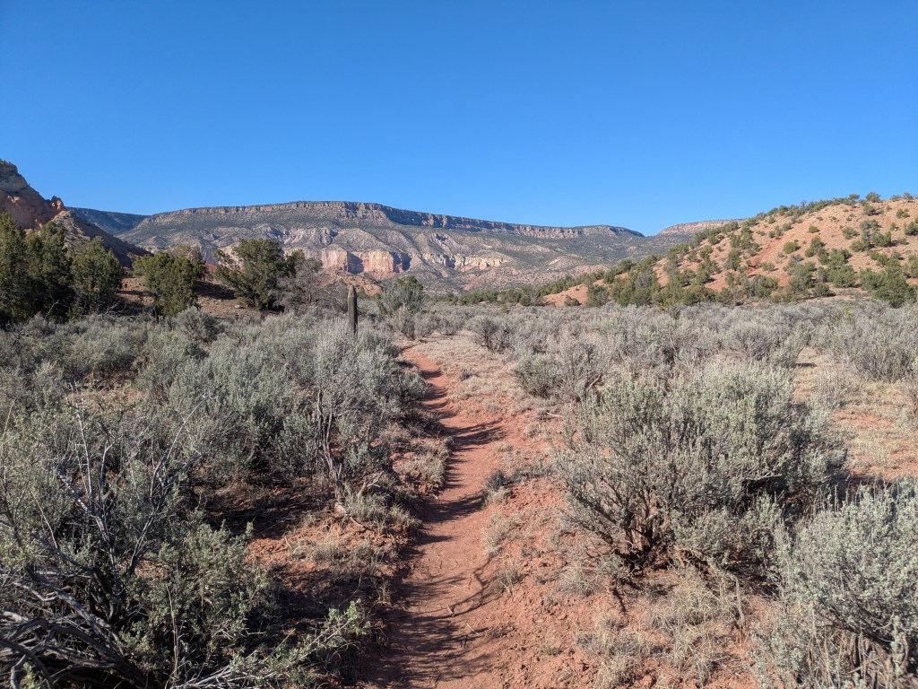
Leaving Cuba, hikers face 8 miles on paved and gravel roads. But soon they’re rewarded for their persistence with a long climb up into the scenic San Pedro Parks Wilderness. Here, the desert cacti and shrubs are replaced by pines and aspen. Water is suddenly abundant. The climb tops out at 10,500 feet. Then, the trail descends back down through all the mountain micro-biomes in reverse order. The descent bottoms out at the Rio Chama, around 6,300 feet. This is the first major river the trail crosses, since the Gila. At the Rio Chama, hikers can turn off the CDT onto the 25-mile Ghost Ranch Alternate route.
Day 23
Today, there’s a nearly 4,000-foot difference in elevation from where I woke up and where I went to sleep.
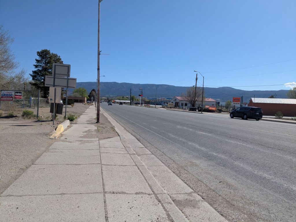
My day began with a short (5-mile) road walk into the town of Cuba. I’ve actually been to Cuba twice before, which might be surprising because it is a tiny town in the middle of nowhere. Both times, I was on my way to or from Chaco Canyon – one of my favorite places nearby, which the CDT does not go through.
I got in and out of Cuba quickly. I charged my phone at a Mexican restaurant where I ate breakfast. Then I stopped by the grocery store to top off my food bag. It will only take me two or three days to reach Ghost Ranch, where I have a resupply box waiting for me.
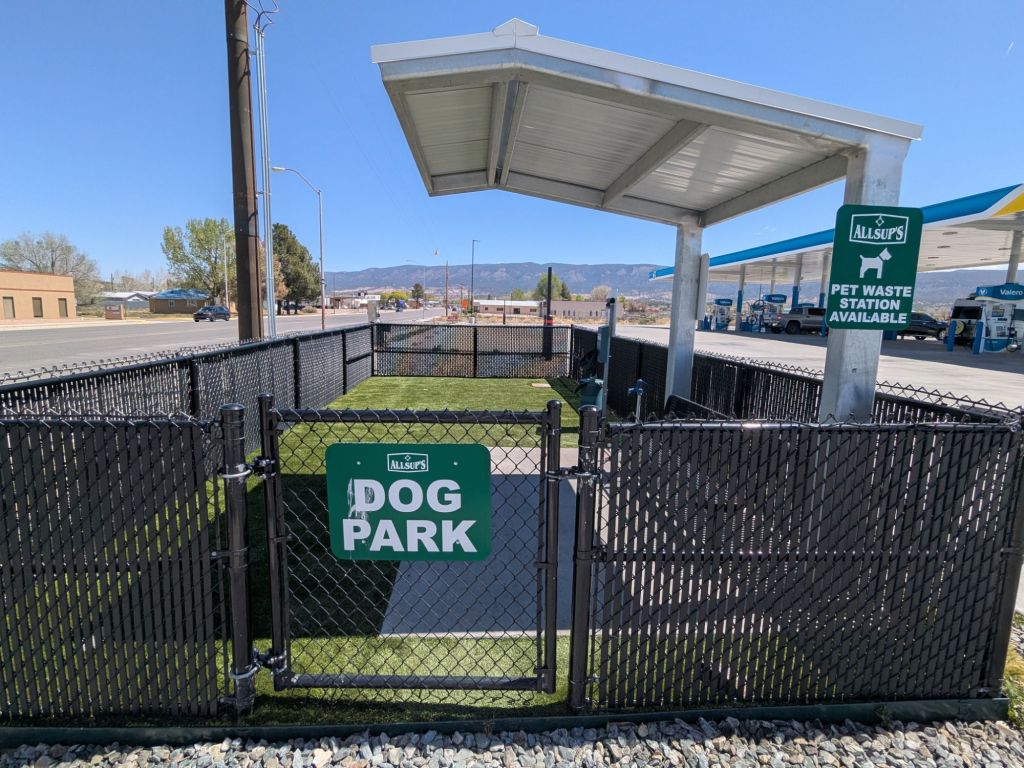
My final chore before I could leave town was locating some water. The grocery store didn’t have anywhere to fill water bottles. Fortunately, I saw a spigot in a public dog park. I went into the dog park and helped myself to plenty of water to fill my bottles.
I had another 8 miles or so of road walking after I left Cuba. I made the time go by quicker by talking on the phone as I walked. Toward the end of the road walk, I went past a mine. Just another scenic stop on the CDT.
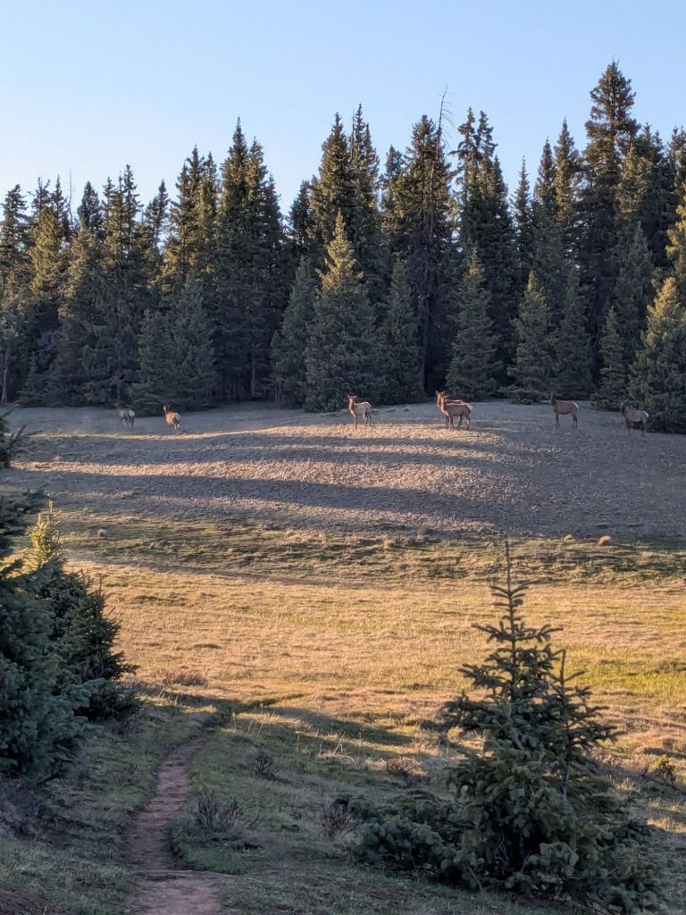
Eventually, I left the roads and began the climb up into the San Pedro Park Wilderness. I really enjoyed this climb. I watched the plants along the trail change from desert-like shrubs to a juniper-pinyon forest, then to ponderosa pines, and eventually to alpine spruce and fir trees. I saw at least two dozen elk grazing in the mountain meadows alongside small streams.
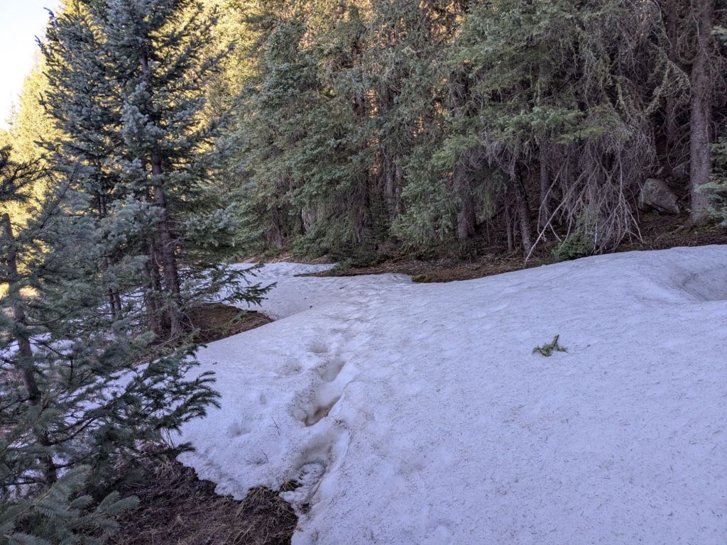
I camp tonight at 10,500 feet above sea level – the very top of my climb. It’s a bit of an experiment. I am curious to see how my sleep system performs at this elevation in May. When I reach the huge mountains just over the Colorado border, I’ll have no choice but to camp this high or higher.
Day 24
My sleep experiment didn’t go well. I awoke cold several times during the night. This does not bode well for my impending journey into the South San Juan range in Colorado.
In the morning, my tarp glistened with frozen condensation, but my water bottles weren’t ice. Though, they were cold enough to give me a brain freeze when I drank from them. I estimate the overnight low was in the low 30s. All night, I could feel the cold sneaking into my quilt through the openings and seeping up from the ground through my thin foam mat.
Considering my findings, I got on my phone (I had cell service at my campsite up so high) and ordered an item online. An item that I’ve long deemed too frivolous for thru-hiking: a blow-up inflatable sleeping pad.
I’ve happily slept on a cut-short eggshell foam sleeping pad for all my past thru-hikes. But I’ve never hiked through the San Juans in May before. I’m hopeful the extra insulation from the ground will help me sleep well at freezing temperatures up at 10-12,000 feet.
Pad ordered, I packed up and headed down the hill. Quickly, I undid almost all the climbing I did yesterday. As I approached Highway 96, I began recognizing my surroundings. That’s because I visited this section several years ago. The next 20 miles or so I’d hiked once before.
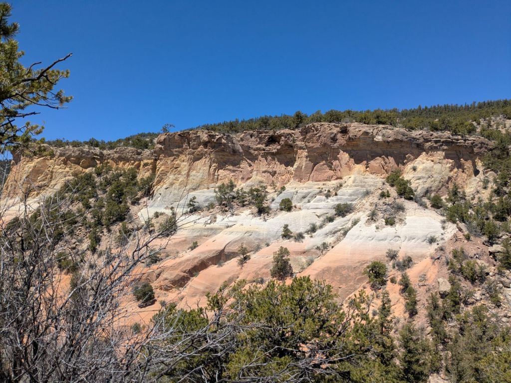
This was a good area to visit twice, as it is quite interesting. There are beautiful exposed sandstone cliffs in shades of yellow, red, and white. The trail makes its way over a small mesa and down into a large, dramatic canyon that houses the Rio Chama.
To reach the Rio Chama, the trail briefly follows a small tributary stream through a deep, narrow valley. This valley burned in a fire in 2024. Flooding and landslides following the fire completely washed out the trail in this area and changed the entire valley bottom. I ran into a trail maintenance crew trying to reconstruct a trail through this area. It surely will be a big project.
At the Rio Chama, I turned off the CDT and onto the Ghost Ranch Alternate Route. I mailed a box to the Ghost Ranch, which I plan to pick up tomorrow. Tonight, I wanted to get as close to Ghost Ranch as possible to camp.

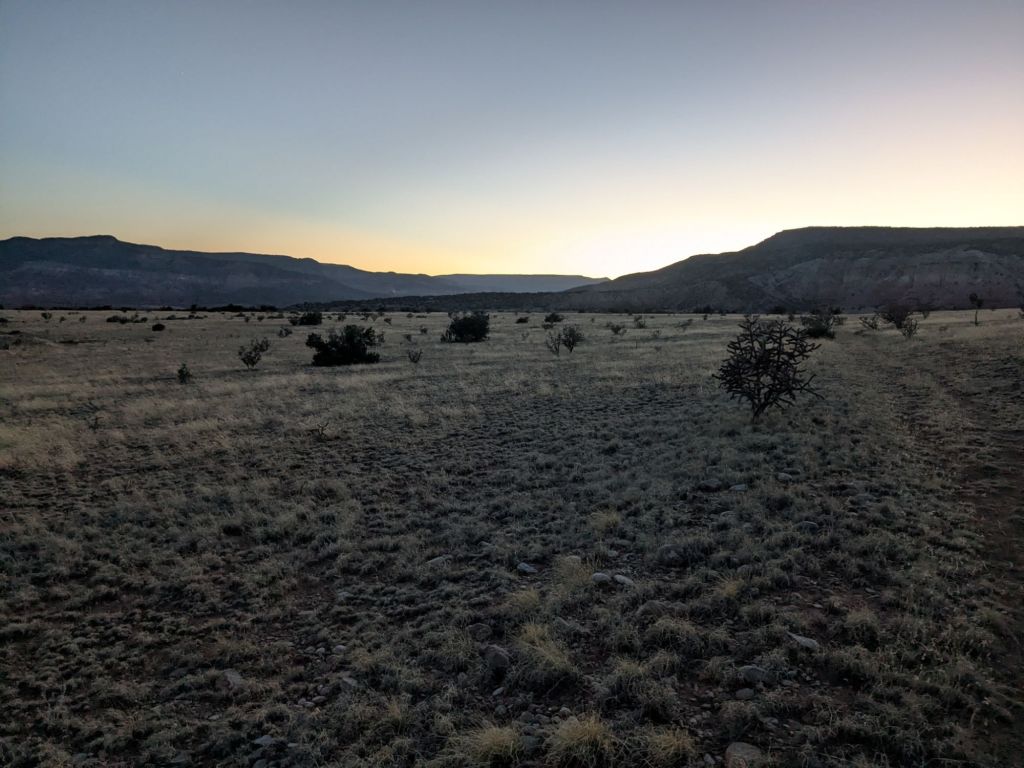
The first few miles of the alt were on a gravel road. Thankfully, as the sun set, my route turned off the gravel road and cut through a field. After bushwhacking through shrubs and cholla and hopping over a barbed wire fence, I round myself on a grassy hill dotted with junipers.
Exhausted from my long day (33 miles!) I collapsed in a flat-ish spot under one of the junipers. I felt too tired to make dinner. So instead I ate all the remaining snacks and crackers in my food bag. After all, I resupply tomorrow.

Leave a comment