Southern Terminus to Lordsburg.
Days 1 to 3.
Miles 0 to 85.
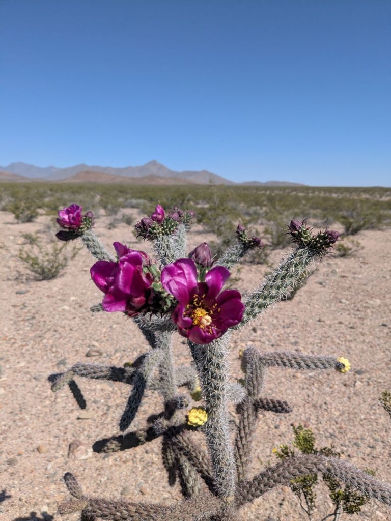
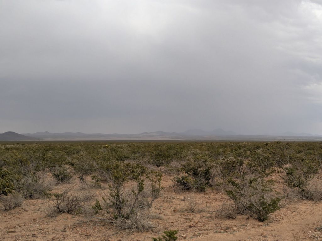
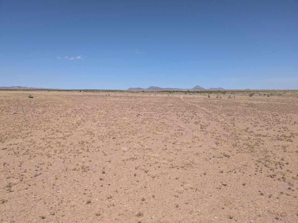
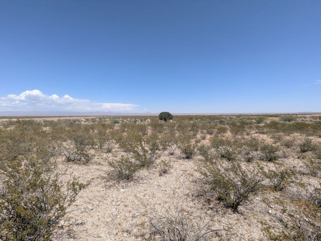
The Continental Divide Trail begins at the US-Mexico border in a part of New Mexico known as the boot heel. The boot heel is characterized by shrub-steppe desert vegetation and small mountain ranges separated by wide, pancake-flat basins. This area is a true desert. It can be a dry, shadeless, and generally unforgiving environment to begin a thru-hike. But there is also a lot of beauty in this place, especially in spring when the desert wildflowers are in bloom.
Day 1
I woke up at 5:30 am in my hotel room in Lordsburg, NM. An hour later, I boarded the shuttle that would take me to the Mexican Border and the start of the Continental Divide Trail. The shuttle is run by the Continental Divide Trail Coalition (CDTC). It’s less of a shuttle, and more of a dusty, run down SUV. Myself and 6 other aspiring thru-hikers piled in and we were off.
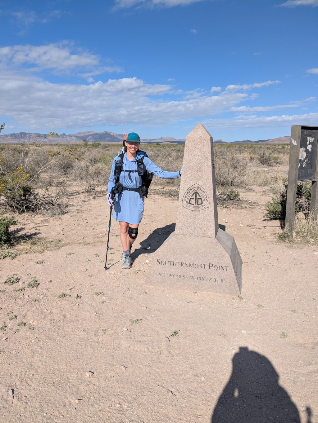
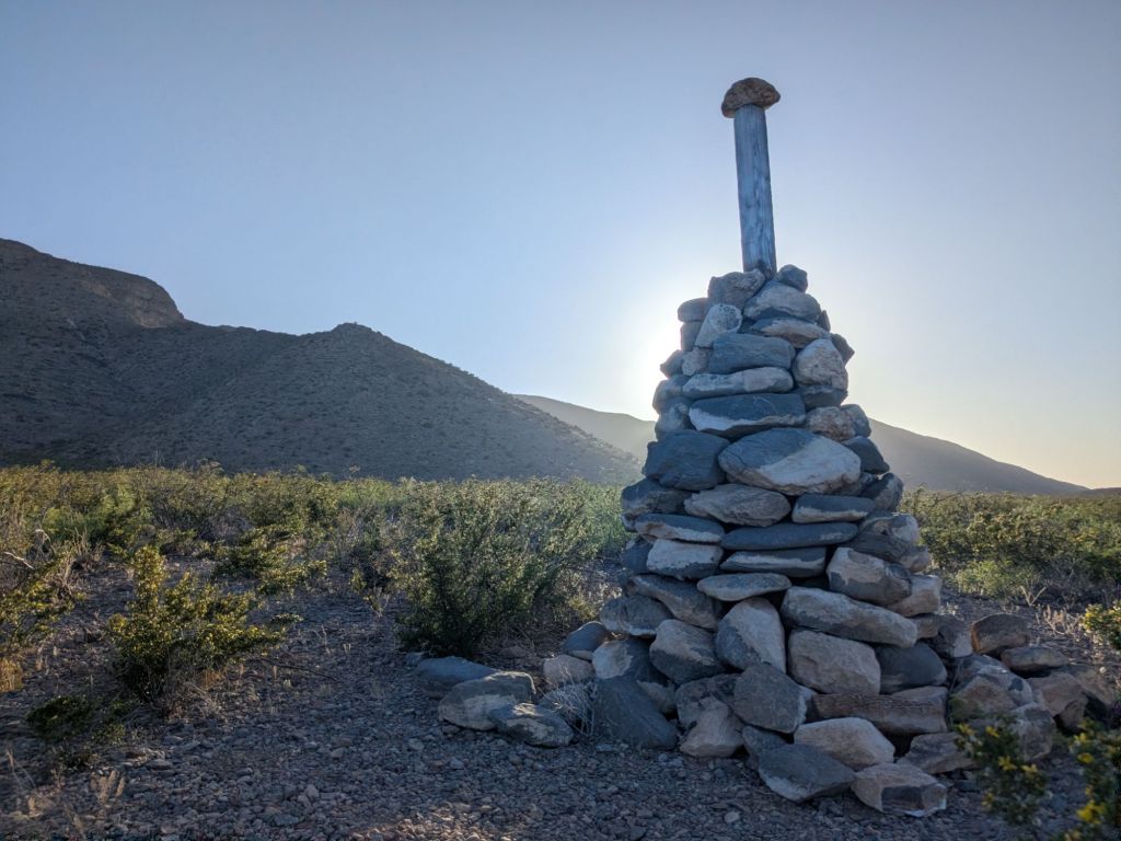
After 2 hours of highways and dirt roads, we reached our destination – the US-Mexico border. Jamie, the driver, let us out. The seven of us walked the short distance over to the small stone monument that marks the start of the CDT. We all took pictures and chatted a bit. By 9:30 am, I was taking my first steps on the CDT.

I mostly hiked alone throughout the morning, getting acquainted with this trail. My first impression is that the start of the CDT is everything that I expected from the start of the Pacific Crest Trail (PCT), which I thru-hiked last year.
Specifically, the start of the CDT is more desert-y, flatter, and has fewer other people, relative to the start of the PCT.
The first two will certainly change. Although the CDT starts in a desert, it won’t stay there forever. I’ll gradually move into mountain areas dominated by coniferous trees as I make my way towards Colorado. And also in Colorado, I’ll reach the trail’s high point, at over 14,000 feet! Though it’s as flat as a pancake here, I know I’ve got plenty of climbing in my future.
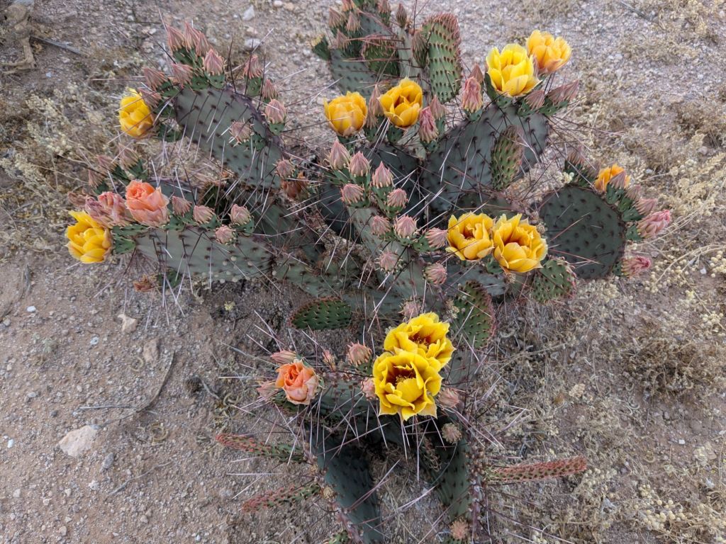
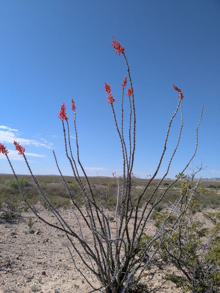
The best surprise of all today was that the desert is currently in bloom. I saw little yellow creosote blossoms. Big fuchsia flowers on the cholla. Clusters of golden prickly pear blossoms. And best of all, the ocotillo is flowering.
Ocotillo is a desert plant that, for much of the year, looks like a bundle of dead, thorny, brown sticks. But after rainy times in spring, they sprout a coating of little green leaves and striking red flowers at their tips.
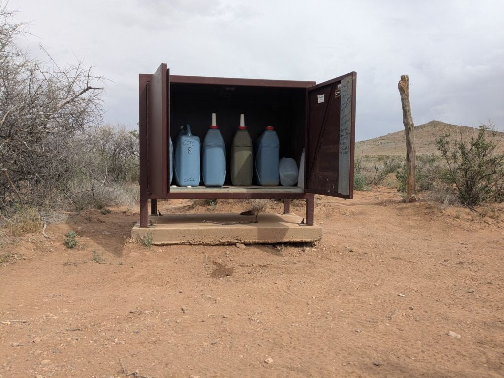
In the early afternoon, I reached my first water source on the CDT. This isn’t a natural water source. It’s a water cache that the CDTC maintains. There are CDTC caches here and there throughout the first 80 miles of the trail. This one is a big metal box with several water jugs inside.
I filled up my water bottles and took a nice long break in the shade. Fortunately, today wasn’t too hot. Only in the mid-70s. But I know that will change in the coming days and weeks.
After the cache, I faced my first choice. The CDT is a route with many alternates. Basically, places where the trail goes two separate ways and then later comes back together. Here, I had to pick between a 10-mile dirt road walk, or 10 miles following the official CDT along the base of a small, short chain of mountains.
I picked the official CDT, in the hopes it would be more scenic. I set off.
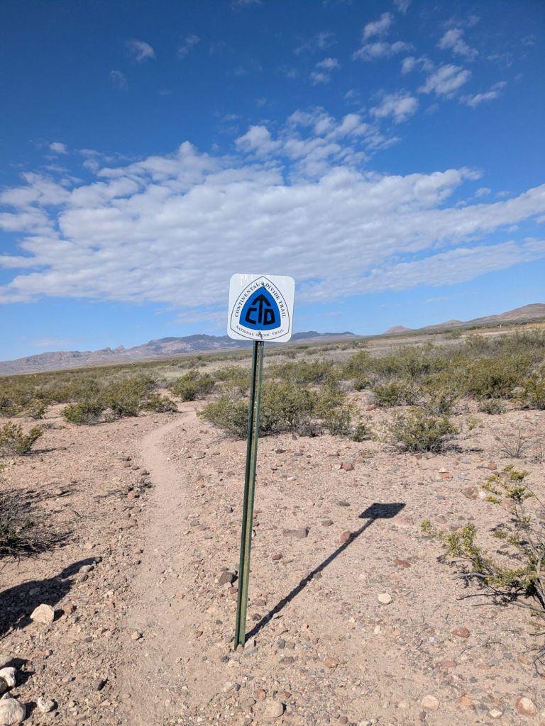
For those 10 miles, the CDT was less of a trail, and more of a suggested general direction. Instead of a single trail, there were tall marker posts. Between them, it was up to me to find the path of least resistance through the spiny desert brush and steep arroyos (little canyons). The route finding and cross-country hiking were fun, but tiring.
I hiked well into the late afternoon as the sun lowered in the sky. Around sunset, I found a nice flat spot to camp at the junction of the trail and road alt.
All in all, I hiked over 24 miles. That’s a big first day!
Adequately tired from my long day, I’m excited for bed now – cowboy camping in the desert at night beneath the constellations and a toenail moon. What a place to fall asleep.
Day 2
I didn’t get the best sleep due to the wind and not being accustomed to camping on the ground yet. It’s only been 220-some days since I finished the PCT. In some ways, it feels like I never got off trail at all. It’s like I took 220 consecutive zeros. But I sure got used to sleeping on a mattress again quickly.
After hiking my first couple of miles today, I reached the first water source of the day – another water cache box. After that, I had 13 or so miles to the next water. Calling the CDT in this area a trail would be an exaggeration. Sometimes, it is a loose network of cattle paths cutting across the desert floor. Other times it follows dirt roads.
I found myself cutting corners a lot, simply walking the shortest path between one marker and the next. Normally, I might feel bad about stomping around off-trail and trampling plants. But here, it’s an open cattle grazing range. Everything already seems pretty trampled.
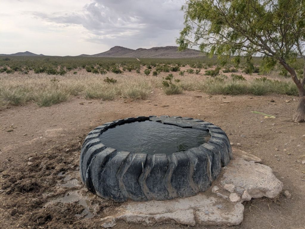
I had lunch at the next water source – a big metal water cistern. The cistern holds water for livestock which is fed into a pond or trough. Even though these types of water sources are primarily for cows, we hikers benefit from them. So far there have been no natural water sources. I can’t imagine hiking this trail without these man-made sources.
In the afternoon I got sprinkled on for a little bit. By definition, deserts get 10 inches or less of precipitation per year. So I felt like I was witnessing something special – and refreshing. It’s showers like this that provide the water that keeps all the desert plants alive. And it allows them to flower in the spring.
I hiked further than I meant to today. Though with all the cutting cross-country and the lack of one true trail in several spots, it’s hard to really say how far I hiked. Certainly no more than 28 miles.
I camped alone, setting up my tarp in case of another rare desert rain shower overnight.
Day 3
It was just another day walking through the desert in the New Mexican boot heel.
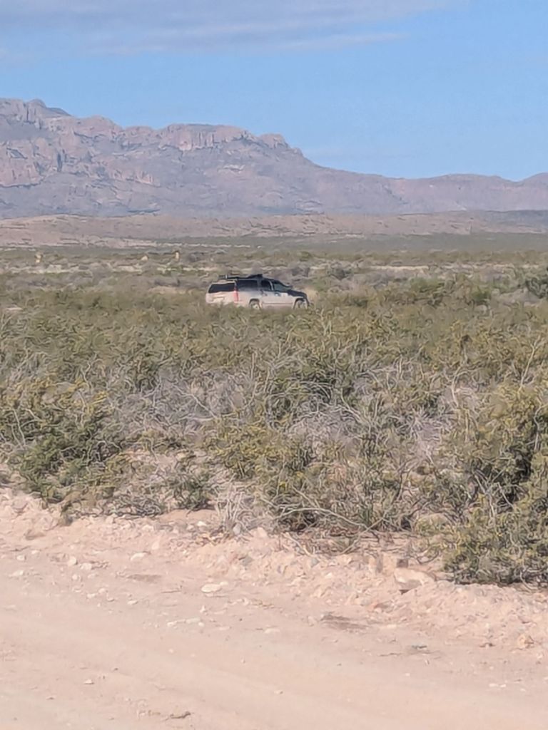
I woke when the sun hit my tarp. I packed up and started walking. Six miles into my day, I reached a road with a water cache box. As I approached, I saw in the distance an SUV with its trunk popped open. Could it be… Trail magic?
It was! A trail angel was handing out Gatorade and soda. I’d assumed that trail magic on the CDT would be relatively rare compared to the Appalachian and Pacific Crest Trails. So I was extra excited.
While at the trail magic, I chatted with Jamie (the shuttle driver, out for a section hike), the trail angel, and another thru-hiker who began my day and was on the Greyhound to Lordsburg with me, named Mindy. Folks keep getting her and me mixed up since we both have the same color clothes, orange foam pads, and shiny silver umbrellas. I’ve seen a few other thru-hikers on and off since the start, but it has overall been a lot of time spent alone.
After lunch, I hiked 9 miles across a particularly flat and shadeless stretch of trail to reach the next water source. This source was a simple cow trough. The sun beat down on me – it felt much hotter today than yesterday.
As I approached the cow trough, hot and thirsty, I saw a herd of cows surrounding it. Complete with calves and two bulls. Now what?
I don’t love negotiating with cattle. Cattle were something I dealt with a little on the Appalachian Trail, but I always felt a bit nervous about it. They are large and it’s intimidating when they all turn their heads and stare at me. I especially don’t like it when they walk towards me.
But I was thirsty. So I worked up some courage, tried my best to look confident, and walked directly towards the trough. The cattle looked up. As I got closer, they began walking towards me – and fast! I sensed we were in a standoff over the water and they could tell I was bluffing.
Not knowing what else to do, I stopped walking and said “HEY COWS” as loudly and firmly as I could.
The cows stopped. And slowly, the herd began moving away. Even the two bulls eventually retreated, though only a short distance. Seizing the opportunity, I strode over to the water and filled two bottles from the murky trough as quickly as I could.
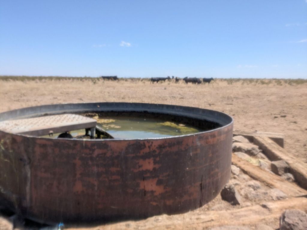
Not wanting to test the bulls’ patience, I walked away as quickly as possible, not even pausing to treat my water.
As the cows faded into the distance behind me, I grinned and felt giddy. I made it through my first cattle encounter of the CDT. I recall feeling similar after successfully fording my first creek on the PCT or seeing my first bear on the Appalachian Trail. It’s a big confidence boost to do something that intimidates me and discover it is not such a big deal after all.
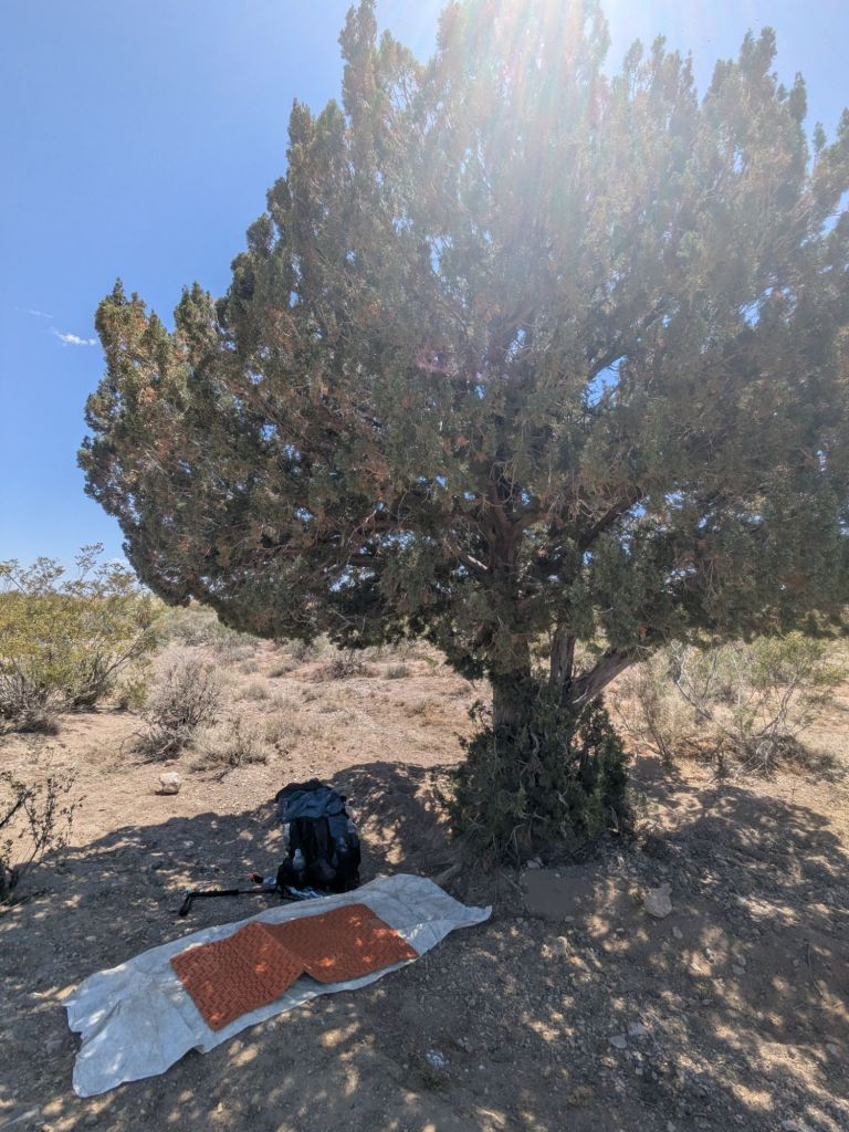
Shortly past the water, I spotted a lone tree not far off the trail. Seizing this rare opportunity for shade, plopped down under it for a long break during the hottest part of the day. I treated my water, ate, aired out my sweaty feet, and did a little writing.
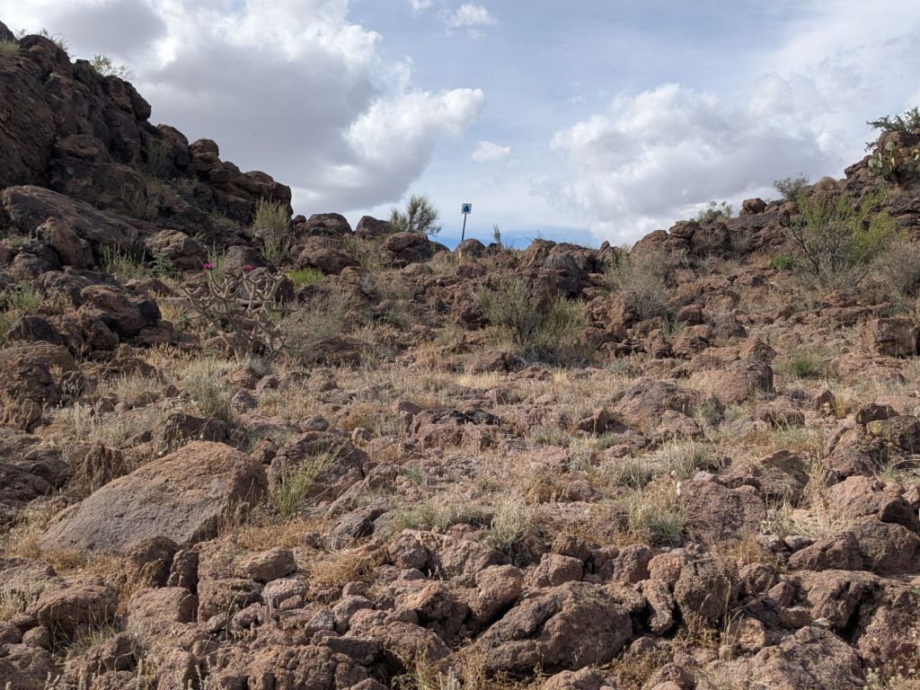
I started hiking once it cooled off and some clouds rolled in, around 4 pm. The trail made its way across the rest of the flat bit to some nearby hills. Surprisingly, these hills are all made from a bubbly, reddish volcanic rock.
I hiked and chatted for a little bit with another thru-hiker who started on the same day as me, named Die Hard. At the next water cache, I met another thru-hiker named Rocket.
I carried on only a short way past the water cache by myself looking for a campsite. I found one atop a little hill that was too pretty to pass up. However, as soon as I set up my cowboy camp, the wind whipped up and it started sprinkling. Annoyed, I pitched my tarp, struggling to hammer my stakes into the rocky soil.
Of course, as soon as I finished setting up my tarp, the rain and wind stopped.
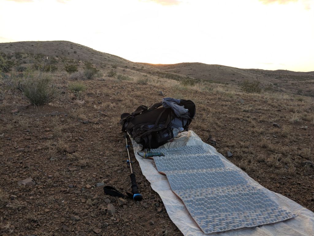
I fell asleep with my tarp flaps open, facing the town lights of Lordsburg down in the valley below. Tomorrow, I’ll hike six miles in the morning to reach Lordsburg. There, I’ll resupply, relax a bit, and then carry on.

Leave a comment