~Steheikin to ~Harts Pass.
Mile 2,570 – 2,634.
Days 126 – 128.
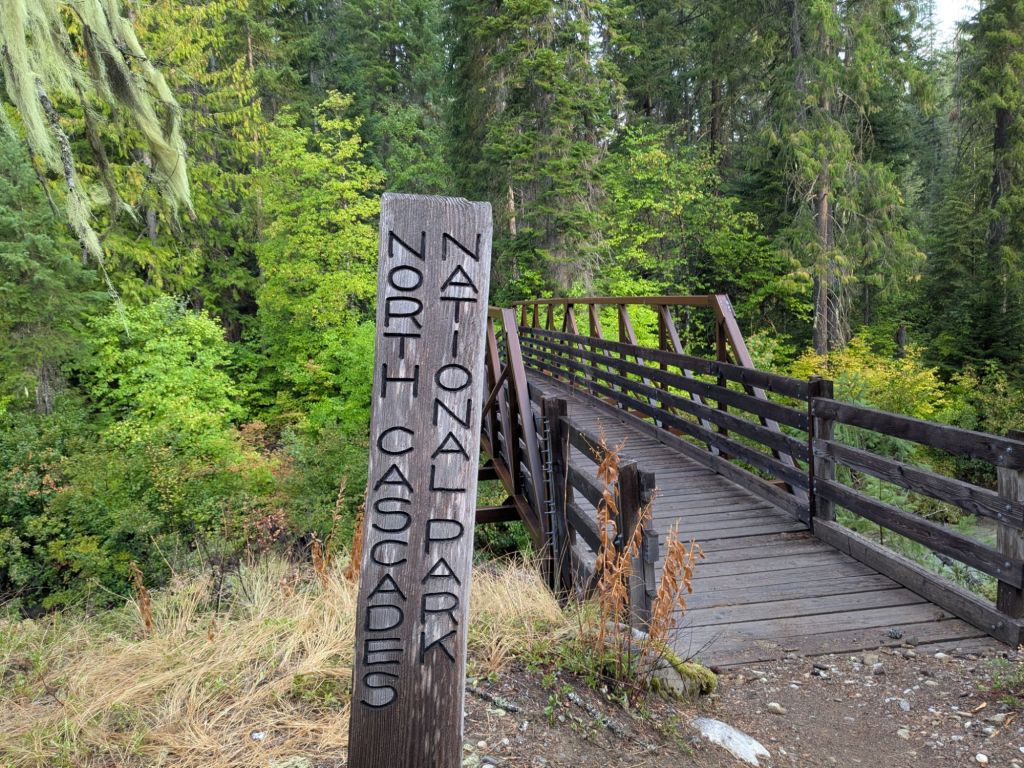
And so begins the grand finale of the Pacific Crest Trail. Truly some of the best is saved for last regarding scenery and terrain. The section begins near Steheikin, a small town on the shores of Lake Chelan. The town can only be reached by ferry or hiking over the surrounding mountainous landscape. From there, the trail continues through North Cascades National Park. Just beyond the park’s border, the PCT crosses its final paved road, and then its final dirt road at Harts Pass.
Day 126
It poured overnight. The loud patter of drops on my DCF tarp kept me awake through the early hours of the morning. But despite my groggy state when I awoke, I was delighted to find that the rain knocked much of the wildfire smoke out of the air. For the first time in days, I could see the views and breathe without smelling smoke.

I quickly hiked the 4 miles to the trailhead. There, I found 20 or so other backpackers and thru-hikers all waiting to catch the shuttle bus into the resupply town of Steheikin. Fortunately, the shuttle was a school bus and had plenty of room for us all. The shuttle was $10 per hiker for a 10-mile drive – but since the trailhead is located at a dead end on a dirt road, none of us stood much chance of hitching. So we all paid up and piled onto the bus.
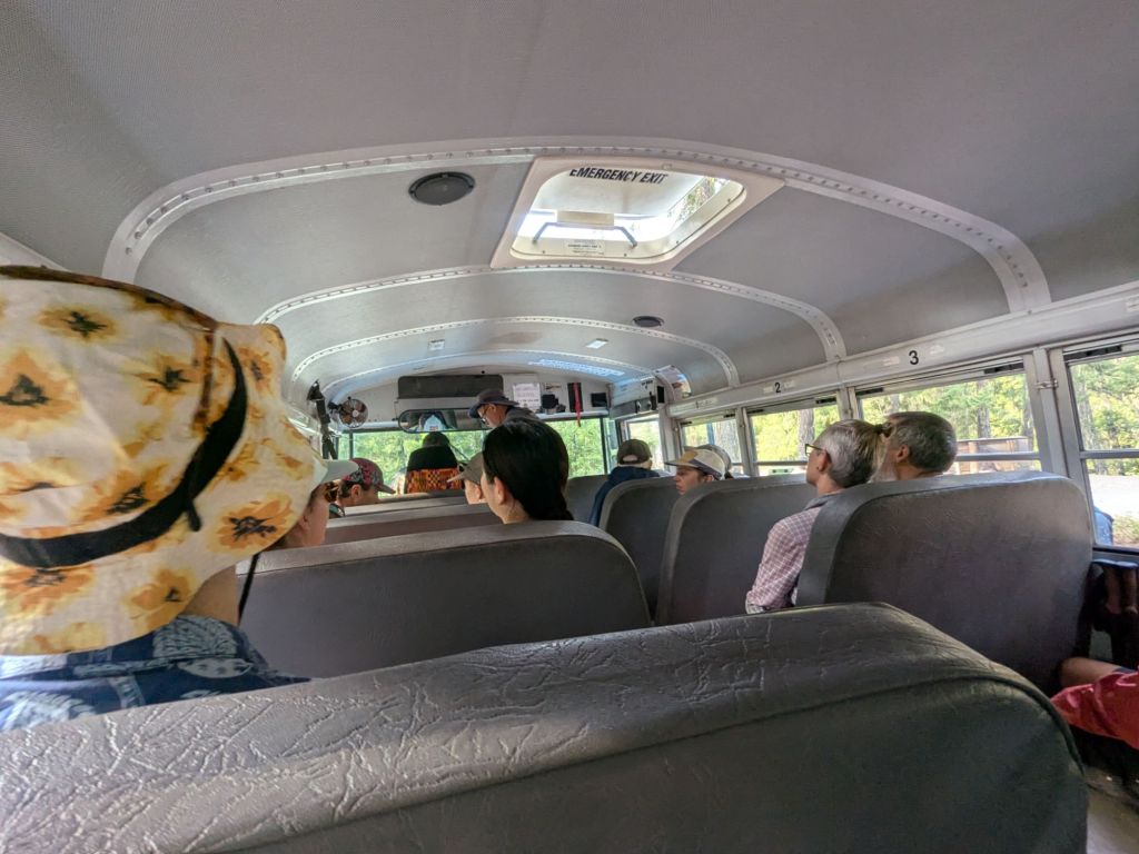
Though the drive was only 10 miles it took over an hour, so we didn’t reach town until 10:30 am. The road was narrow and bumpy. And the driver made several stops – including at a bakery where passengers had 10 minutes to purchase baked goods before reboarding.
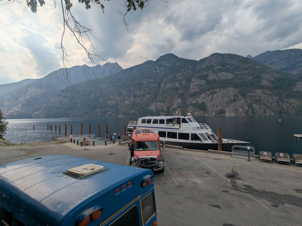
There’s not much in the town of Steheikin. I learned from the bus driver that there are under 200 year-round residents. Stehekin is located on the remote side of Lake Chelan, surrounded by water and steep mountains on all sides. The only ways in are by ferry, or to hike.
After the bus dropped me off, I picked up my final resupply box from the post office. This box contained about 5 days of food, which should be enough for the 80 miles to the Northern Terminus at the Canadian Border, plus the 30-mile back track to Harts Pass – the closest road to the Terminus on the US side.
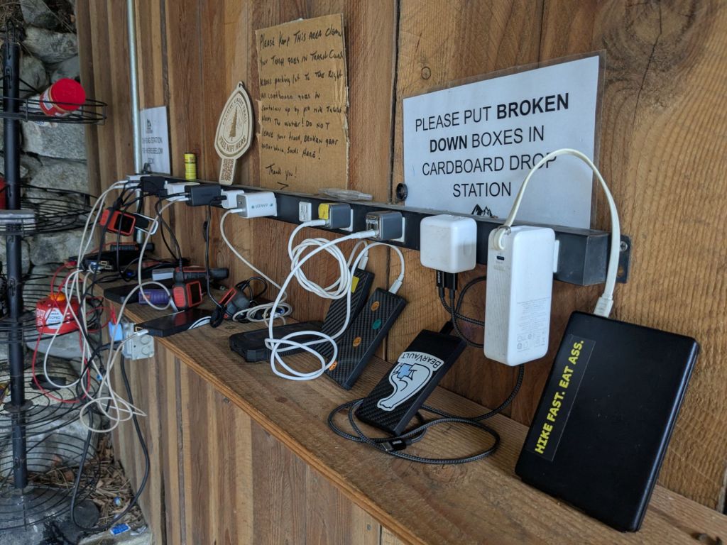
I didn’t do much else in town. I skipped the shower and laundry, figuring I’m still clean enough from Leavenworth. Mostly, I sat with Swish under the deck at the restaurant/general store, loitering and waiting for our phones and battery banks to charge.
While we sat there, two day hikers approached us and started chatting about the trail and our thru-hikes, noting our stained and tattered clothes.
“You really look like you walked here from Mexico,” one of the two women commented.
She is not the first to note that Swish and I seem to be two of the dirtiest and most homeless-looking thru-hikers. She walked away, but a few minutes later, returned, handed Swish forty bucks, and told us to get a hot meal! We did as we were told, and headed up onto the deck for a burger.
I caught the shuttle back out of the town, stopping at the bakery a second time. Then, I began the long 5,000+ foot climb up from the road. After the road, the trail immediately entered North Cascades National Park. This is the 7th and final national park of my thru-hike. The national parks I’ve walked through (in order) are:
- Kings Canyon National Park
- Sequoia National Park
- Yosemite National Park
- Lassen Volcanic National Park
- Crater Lake National Park
- Mt Rainier National Park
- North Cascades National Park
There are two campsites in the park that my PCTA Long Distance Hiking Permit (thru-hiker permit) covers – one 5 miles from the road, and one 11 miles out. I opted for the further one, and reached there right around dark.
It was a crowded site, with about 8 other thru-hikers sleeping there. Somehow, I’d met none of them before. It was the largest group I’ve camped with in a while. I set up my tarp so that it could dry out overnight, but cowboy camped next to it.
Day 127
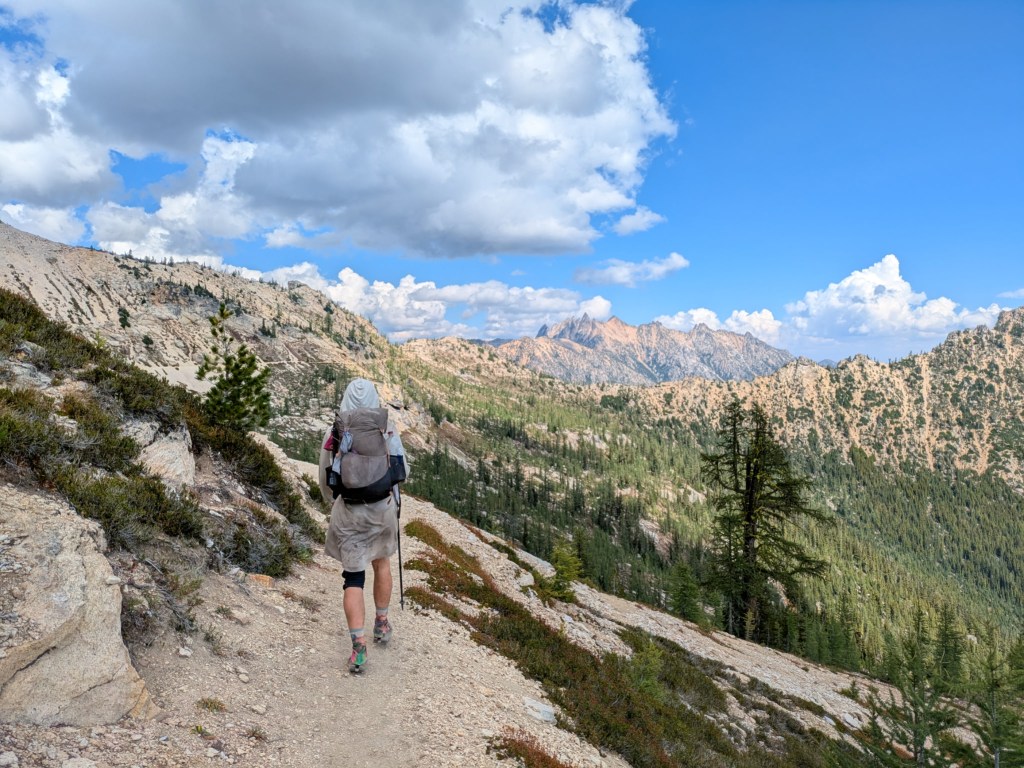
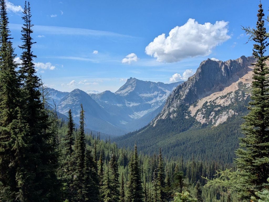
What a day! The trail in this area is absolutely beautiful – comparable to Goat Rocks and the section between Snoqualmie and Stevens Passes!
I got going early, breaking camp by 7:30 am. First up, I needed to finish the 5,000-foot climb I began last night. I still had about 4,000 feet remaining over the next 13 miles. The climb followed along Bridge Creek, staying high above the rocky ravine of the raging creek. Then, the trail diverged and left the park, following switchbacks up to Cutthroat Pass.

Shortly after leaving the park, I was stopped by a ranger, to check my permit. This is only the second time on the trail that a ranger has checked my permit. The other time was just outside of Kings Canyon National Park. Astonishingly, both times I’ve had my permit checked, I’ve technically been outside of the parks’ boundaries, where permits are not required for backpacking.
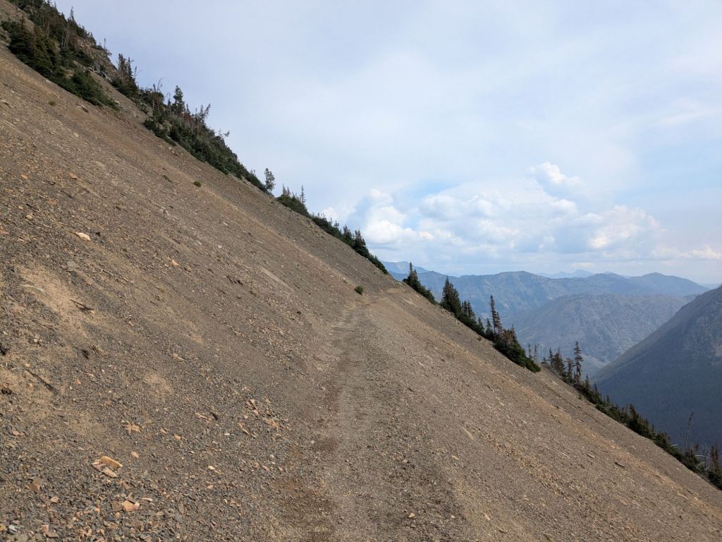
After the pass, the trail became extremely gorgeous, following a rocky and treeless ridge for many miles. The trail hit a second, smaller pass, then descended into the trees.

About a mile before my planned campsite, it started to rain and hail. Quickly, my shoes, socks, and pack soaked through. I felt eager to reach camp, remove my wet clothes, and get cozy in my tarp.
However, when I arrived at my planned site, I found the only good tent spot already taken. The only other spot was filled with a huge puddle.
I opted to walk another 2.5 miles to the next campsite in the rain. I walked a total of 29 miles for the day – my favorite distance, though I haven’t walked that far in a while due to the more challenging terrain in Washington and my desire to slow down and enjoy the end of the trail.

Day 128
Overnight, I woke several times to the sound of rock falling in the mountains above me. Every hour or so, rocks tumbled within the steep, nearby boulder fields at the bases of the tall peaks. While my camp in the valley bottom was a safe distance from the rockfall, the distant sound was still eerie and distracting.
I don’t know if it was the sound of the rock or the damp, seeping cold, but I slept poorly. I tried to make up for it by sleeping in and didn’t hit the trail until well after 10 am. Even so, I covered the 10 miles to Harts Pass in good time.
Hart’s Pass is the final (dirt) road crossing of the PCT – 30 miles before the Northern terminus at the Canadian Border, where my journey ends. The Northern Terminus of the PCT is not located at a road or trailhead. Instead, it is marked by a lonely monument in the woods, the twin of the one at the Southern Terminus on the Mexican border.
In the past, thru-hikers continued past the northern terminus, and hiked another 8 miles to a trailhead on the Canadian side. However, this year, hikers are not permitted to enter Canada via the trail. Instead, we must turn around at the terminus and retrace our footsteps for 30 miles going south – back to Harts Pass.
Because of this, for the final 30 miles of the trail, I’ll see thru-hikers going both directions. While the backtrack (or “victory lap”) tacks some extra miles onto an already-long hike, it gives us all a chance to see friends who are a day or two ahead of us or behind us going the opposite way in this section.
I crossed the dirt road at Harts Pass just as it started raining. The trail quickly climbed towards a ridge. With thunder ominously sounding in the not-so-far distance, I decided to stop and wait out the storm below the ridge in the trees. I pitched my tarp, got out my food bag, and hunkered down.
I was rewarded for my patience with a wonderful evening. Once the storms broke up, I saw a beautiful sunset. I enjoyed it from atop the ridge during my last few miles of the day. I camped up on the ridge too. Though it was cold and a bit windy up top, it felt only fitting to end my thru-hike at a campsite with a beautiful sunset view, after I’d enjoyed so many throughout my journey, from desert to mountains.

Tomorrow is my final day on the PCT. When I wake up, I’ll hike the final 20 or so miles to the Northern Terminus.

Leave a comment