
Stevens Pass (Leavenworth) to ~Steheikin.
Miles 2,467 – 2,570.
Days 121 – 125.
After Stevens Pass, the Pacific Crest Trail begins a particularly remote ~100-mile stretch with no road crossings. In this section, the PCT goes through the Glacier Peak Wilderness area. Hikers tackle several ~2,000 to 3,000-foot ascents and descents and get rewarded at the top of each climb with views of Glacier Peak and its neighboring mountains. The section ends near Steheikin, a small town on the shores of Lake Chelan.
Day 121
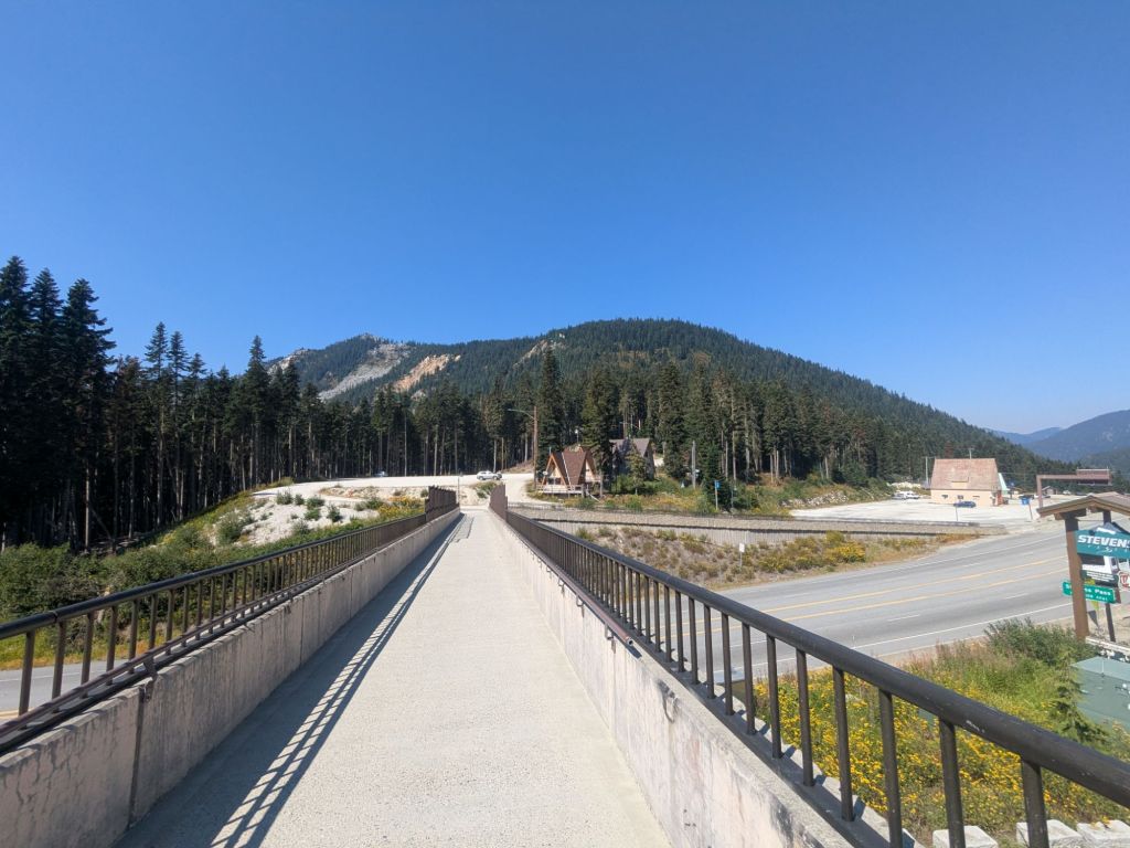
Today I returned to the trail after a restful zero (day off) in Leavenworth. Swish and I took our sweet time packing up, then Juliana, the trail angel we stayed with, gave us a ride back to the trailhead at Stevens Pass.
I’d hoped that during my day off a few of my friends who are slightly behind now might catch up. Right when I got out of the car, I briefly saw AC before he caught a hitch into Leavenworth.
I sat outside the ski lodge at Stevens Pass for an hour, hoping to see a few of my other friends heading down the hill. I also had lots of food and felt like eating through some pack weight before hitting the trail. However, no more friends showed up, and I failed to make much of a dent in my food bag.
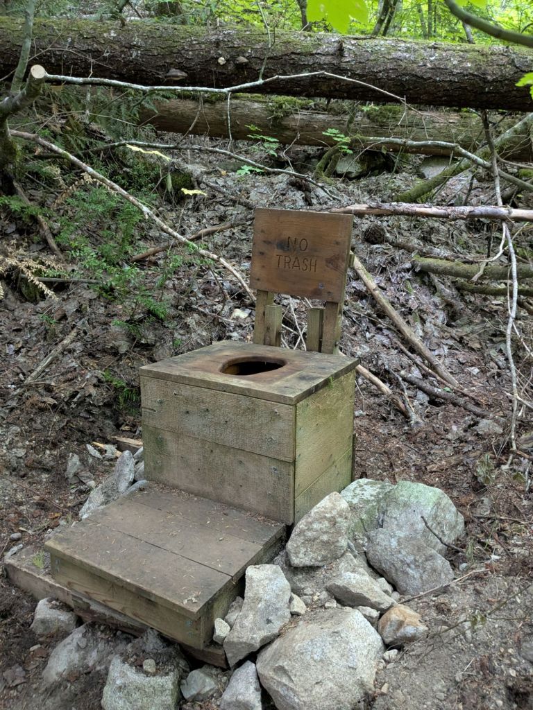
Despite my heavy pack, the 10 miles to camp flew by. I stayed at Lake Janus, a beautiful and popular campsite complete with a privy. I hear this is one of the few parts of the PCT where thru-hikers can travel toilet-to-toilet, or “porcelain blaze”.
Day 122
I got up early and hiked down the short side trail in the woods to the privy near the campsite. It turned out to be nothing more than a small wooden box about 1 foot by 1 foot by 1 foot placed on the forest floor with a hole in the top. Certainly not up to the caliber of the privies on the Appalachian Trail.
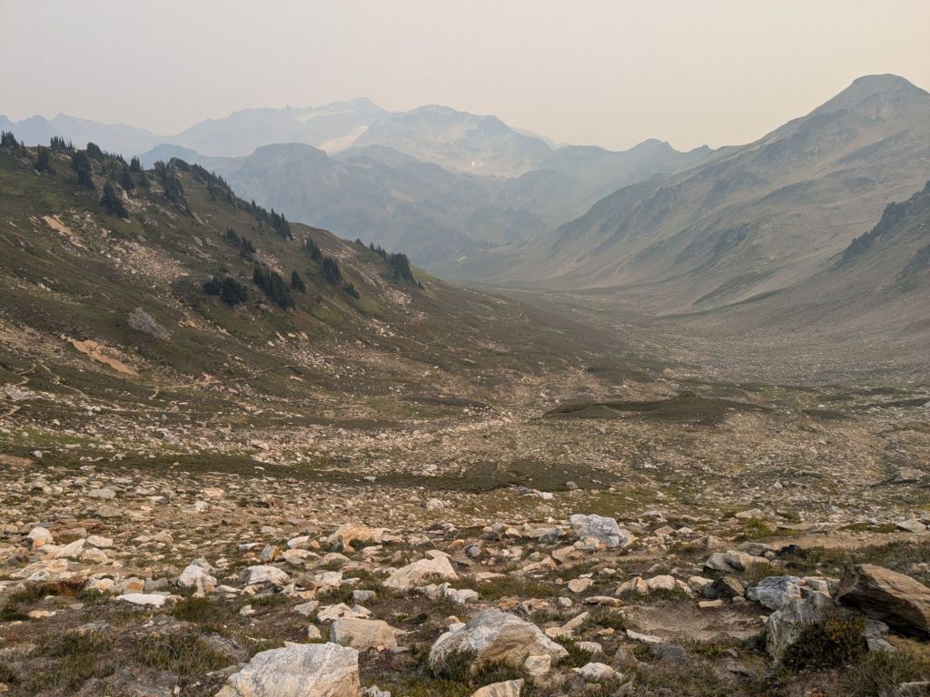
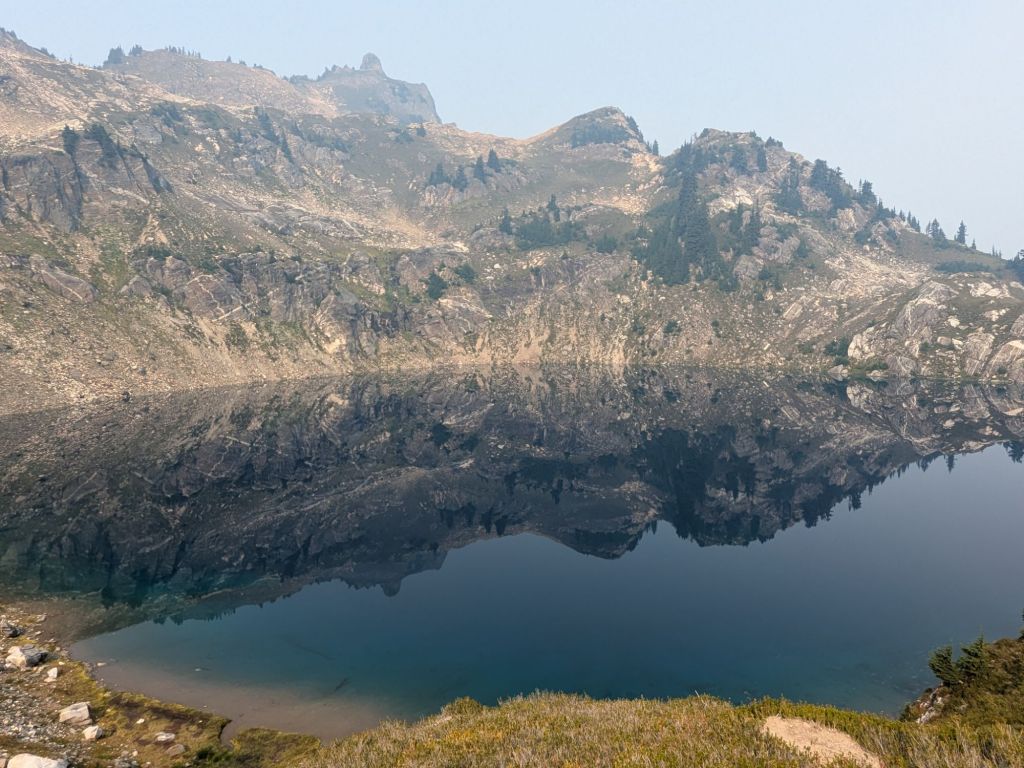
The views from the top of the ridge today were obscured slightly by the wildfire smoke in the air. It’s smoky enough to smell like fire, and irritating the noses and throats of myself and the other hikers. Fires are going on right now in the Olympic Peninsula and to the northeast. While neither is particularly close to the PCT, their smoke seems to blow in on the wind.

It was pretty warm today, and I hiked 24 miles with over 6,000 feet of elevation gain. However, I’m feeling fresh from my town stop in Leavenworth and the miles went by easily.

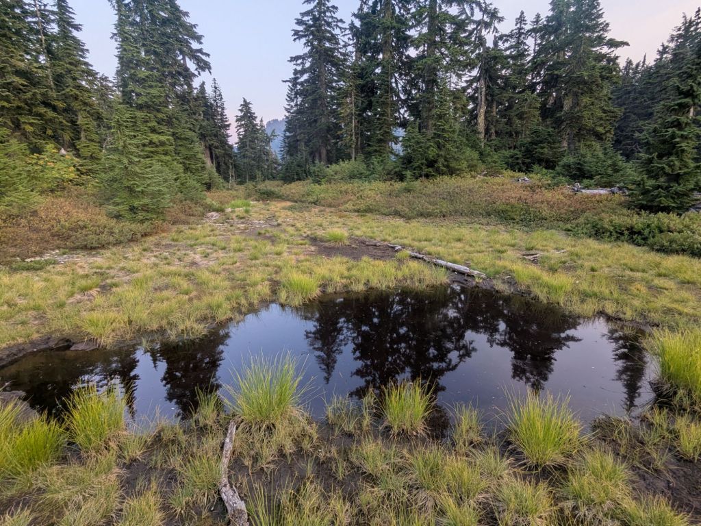
I stopped in the late afternoon to cool off and swim in Sally Ann Lake – a picturesque spot at the base of a large boulder field. After that, there were no good water sources. I ended up filling from a small, mucky puddle, not large enough to be called a pond. The water that came out of it was yellowish, though I was able to remove the chunks and dead bugs using my bandana. I figured that the water couldn’t be that bad – quite a few froglets swam around in it and they seemed just fine. But just in case I carefully treated the water with Aquamira, as I usually do.
I cowboy camped near the puddle-pond under the light of the nearly full moon. It glowed bright orange, perhaps due to the smoke from the fires.
Day 123
Overnight, the smoke grew thicker in the valley where I slept. I awoke to find ash drifting down on top of my sleeping bag. I also had a raging headache and agitated lungs, likely induced by the poor air quality.
Some backpackers on a 5-day trip informed me that the smoke was coming from a small fire relatively close to the valley where I’d slept. I felt unnerved to have slept near a fire I didn’t know about, but relieved that the poor air quality was due to a small fire. That meant that I might have a better shot at hiking out of the smoke plume than I would if the smoke were more widespread and from a larger, more distant fire.
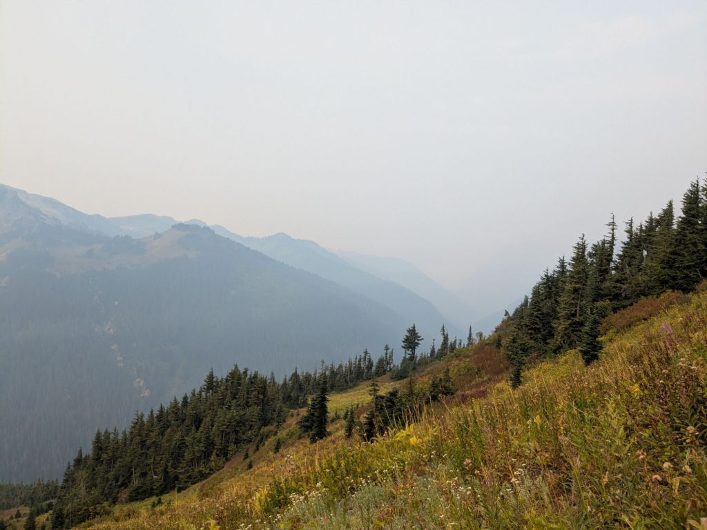
Despite the poor air quality, the hike today was beautiful. I passed near Glacier Peak and Kennedy Peak – two large mountains topped with glaciers. Similar to recent days, the terrain continues to be steep relative to southern Washington and Oregon. There were also quite a few blowdowns today, which slowed my pace even further.
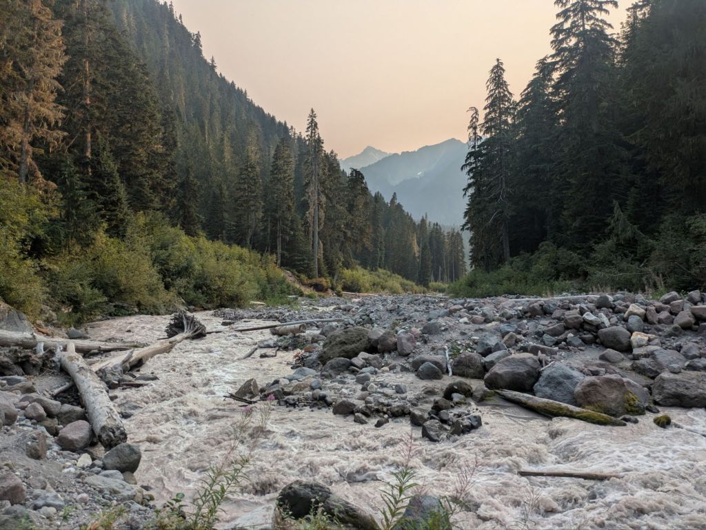
Steep terrain and poor air quality weren’t the only challenges today. Around 5 pm, I arrived on the banks of a large river to find that there was no easy place to cross. After walking a few hundred feet upstream and downstream, I concluded I’d need to ford the creek – something I haven’t done since the Sierras!
Fording was easier said than done. The river was filled with murky brown glacial runoff, completely concealing the river bottom. The water was also absolutely freezing! After making it across, I had to stop and dump a surprising amount of gravel out of my shoes.
Despite the many challenges of the day, I still enjoyed the unparalleled scenery in this area. Washington really can’t be beat. I might like it even better than the Sierras and the unburnt parts of NorCal.
Today marks 4 months on the trail. With only about 5% of the trail left, I’ll finish in a week or so if all goes as planned.

Day 124
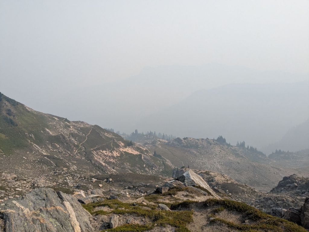
Overnight, a warm wind picked up through the high-elevation valley where I cowboy camped. While this was great for drying my damp shoes and socks, it wasn’t great for the nearby wildfires. When I awoke in the morning, the densest smoke I’ve seen yet on the trail filled the entire valley. I could make out only the closest ridges, and none of the more distant mountains, due to the haze.
My shoes got wet yesterday when I forded a river. My socks got damp when I put them back on and into my wet shoes. This morning, my socks were dry and stiff as boards and the texture of sandpaper. My shoes were still filled with plenty of stubborn silt. It was not a good combination, and before long, my feet were chaffing nearly as badly as in the burn areas near the California-Oregon border.
After a short climb over a small pass, I tackled the first of two long downhills for the day. This one brought me down 3,000 feet over 5 miles. While downhill is usually quick, my pace was slowed by the densely overgrown understory plants and many blowdowns.
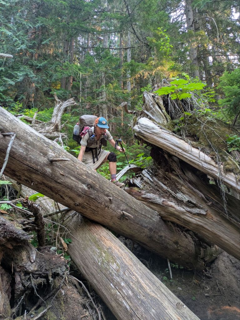
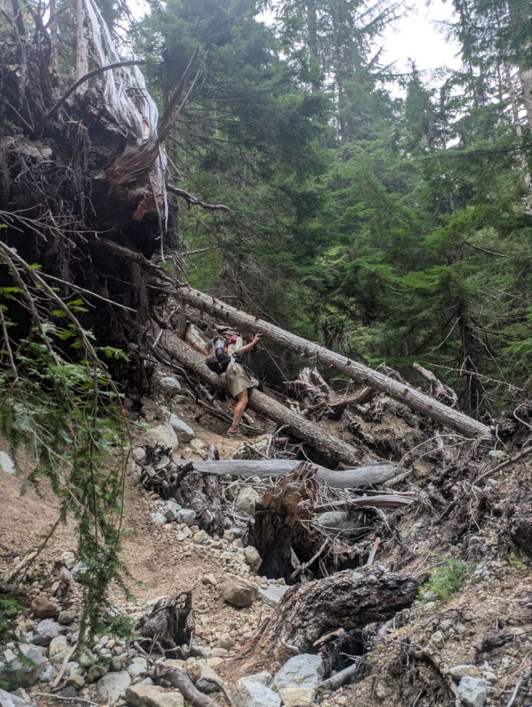
As I picked my way carefully through this mess, I pondered why the trail conditions had deteriorated so much since southern Washington. Since leaving Steven’s Pass, I’ve yet to cross a single road (paved or dirt). And I don’t think I’ll see one until Steheikin. That’s over 100 miles without a road! Likely, it’s just very difficult for trail crews to even access this area to maintain it.
Near the end of the Appalachian Trail, there is a section known as the 100 Mile Wilderness. However, even the 100 Mile Wilderness was crisscrossed with logging roads. These final miles of the PCT, spent climbing over and around huge blowdowns on brushy and washed-out trails, feel like more of a true wilderness to me.
My first long descent was immediately followed by a 2,500-foot climb and then another 3,500-foot drop. Near the top of the second climb, I could just make out the hint of some cool views through the thick wildfire smoke. Even in such poor conditions this area is breathtaking. I cannot imagine how stunning it would be on a clear day.
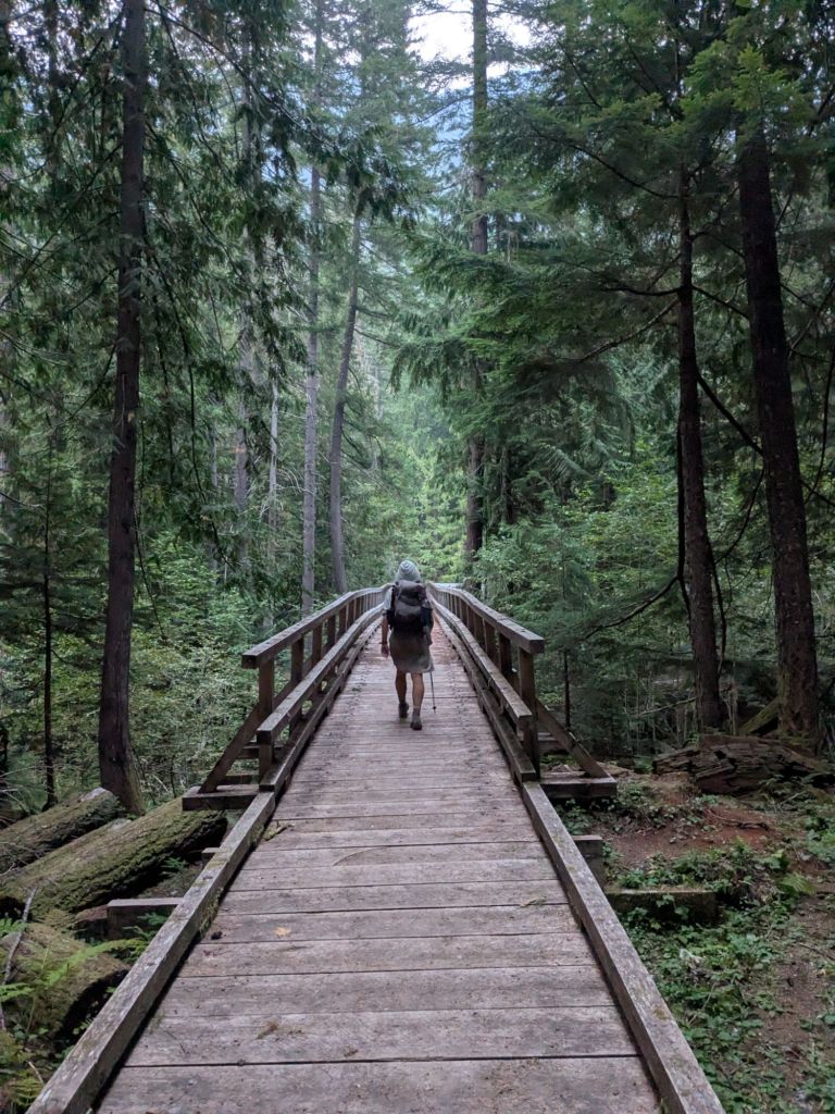
After my second long downhill, I crossed the Suiattle River Footbridge. I fell asleep cowboy camping on the banks of the river, lulled to sleep by the roar of water flowing by.
Day 125
I started the day by nearly wrapping up my feet in leukotape.
When I went to bed last night, my feet looked almost solid red, due to irritation and chaffing caused by my dirty socks. I told myself that in the morning I’d tape up any spots that still looked pink. But that turned out to be most of both feet – including 7 of my toes, my heels, arches, and tops of my feet.
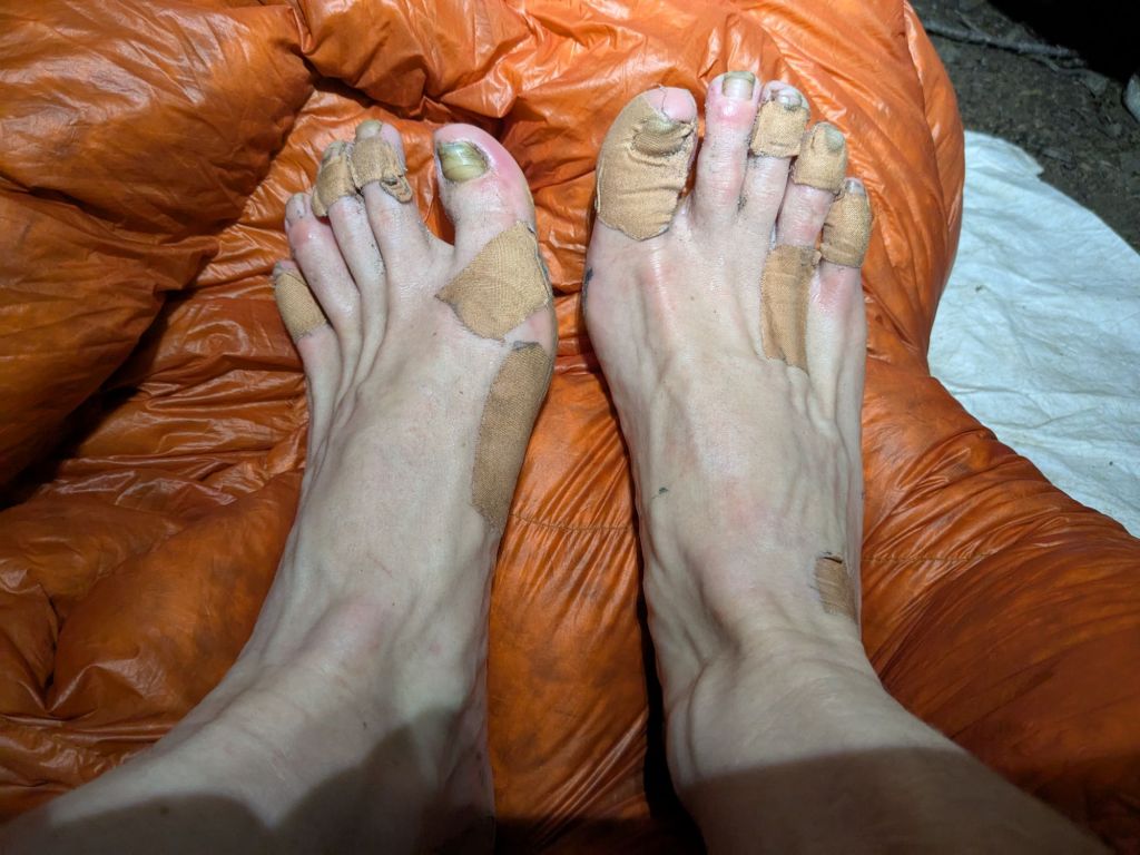
Fortunately, the combination of excessive Leukotape with clean socks worked a miracle on my sad feet. And I soon forgot all about them. Instead, I focused ahead on the climb ahead of me – 3,500 feet of up from the Suiattle River to Suiattle Pass. The climb took all morning, but was gradual and pleasant, through dense forest with massive conifer trees, plush mosses, and delicate understory plants.
Once again today, the wildfire smoke blocked out the views at the top of the pass.
With such thick wildfire smoke, it’s hard to tell if it’s sunny or cloudy. Apparently, this morning it was overcast – it drizzled for a few minutes.

In addition to obscuring the sky, the wildfire smoke blocks a lot of the sun’s rays. Consequently, all day it feels like early morning or late afternoon, even when the sun is high in the sky.
Thankfully, the smoke seemed slightly less dense today than yesterday. I’m hopeful that I will escape from it soon. It would be a pity to end the PCT and walk the amazing final sections with so much of the view hidden from sight.
I camped 4 miles before the trailhead, where I can catch a shuttle to the resupply point of Steheikin. Steheikin is a small town on the shores of Lake Chelan. The town can only be reached by ferry or by hiking in over the surrounding mountainous terrain, as I’m doing.
I fell asleep to the pitter-patter of a soft rain. I hope that it helps stop the current fires and knock some of the smoke out of the air.

Leave a comment