~Crater Lake to MacKenzie Pass (Sisters).
Miles 1,841 – 1,985.
Days 90 – 95.
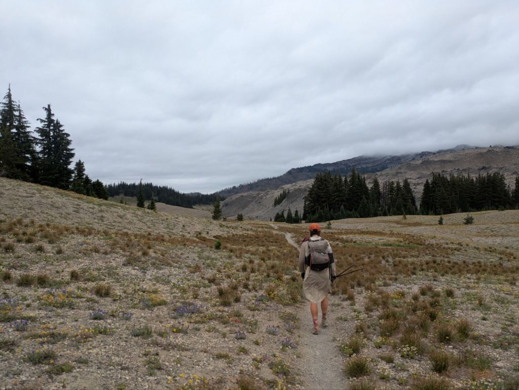
After Crater Lake, PCT hikers find themselves in some of the flattest portions of the PCT so far, with minimal daily climbing and gradual ascents and descents. Despite being “flat”, the trail still crosses through several stunning mountainous areas, such as near the bases of Mt Theilsen, Diamond Peak, and Sisters Peaks.
Day 90
I awoke today and headed directly to a water cache at a road near my campsite. It’s odd, with so much precipitation lately, to not have any natural water sources. This section of the Pacific Crest Trail is surprisingly dry. Today, I have a 10-mile and a 16-mile water carry. These carries would be considerably longer if it weren’t for two well-established caches maintained by trail angels at road crossings in this area.

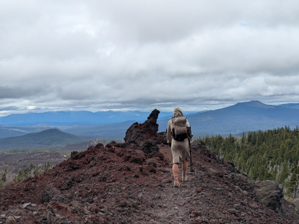
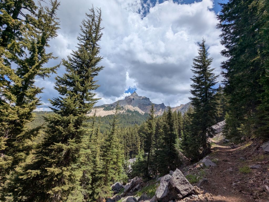
After 10 amazingly flat and fast miles, I reached the second water cache where I topped off my bottles. Then, I tackled a very gradual climb which took me near (but not to the top of) Mt. Theilsen. Mt. Theilsen is an almost unrealistically pointy peak which I’ve seen on the horizon for the last day or so. According to other hikers, the route to the top of this Matterhorn-esque mountain is class 5 climbing.
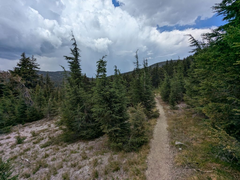
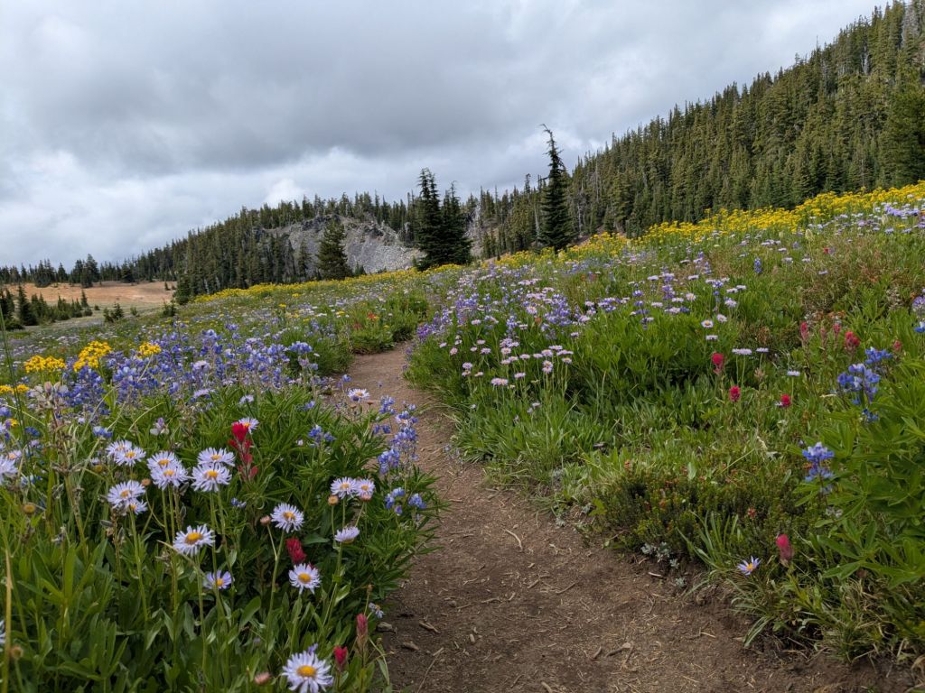
The scenery in general has started to change. The PCT past Crater Lake just feels more… northern! The trees look windswept and the understory seems to hold a lot more moisture and organic matter. I welcome these changes, after months of hot and dry conditions.
Overall, I’m loving Oregon! The scenery is some of my favorite on the trail so far. Before reaching Oregon, I knew very little about it. I’d only heard folks say it would be “flat” and hikers can “make up some time” here by hiking bigger miles. But there is so much more to Oregon! I find myself wanting to linger and enjoy the beauty of its lakes, wildflowers, and unique geology, rather than push big miles.
I tanked up on water again at a small creek, where I also ate lunch and attempted to dry out some of my wet gear from the rain/hail yesterday. Unfortunately, the sun only came out for a total of about 5 minutes during my lunch break. So my equipment stayed damp. That’s just as well, since after lunch, it began to rain again… And then hail again! Fortunately, this time, the hail stayed pea-sized and smaller.
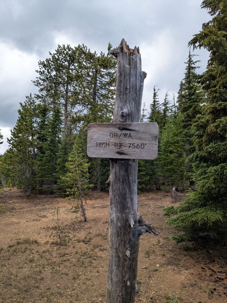
Once the hail subsided, I hit a high point on a gently sloping saddle. If it weren’t for a sign there, I wouldn’t have realized the significance of this minor pass. It is the highest point on the PCT in Oregon and Washington, at a mere 7,560 feet above sea level. While it’s certainly not all downhill from here, I will stay below this elevation, from here to Canada.
After a pleasant walk through lush green forests with on-and-off drizzle, I arrived at my final water source of the day, where I also planned to camp. The water source was a tiny pool, 0.4-miles away and a couple hundred feet below the ridge-top path of the PCT. I jogged down the winding trail to collect my water, then took a (steep) shortcut straight back up the hill to camp. It was by far the steepest hiking I’ve done in this “flat” state.
Day 91
It was cold last night. How things have changed since NorCal, where I’d fall asleep sweating. Last night, I actually slept in my thermal base layers and buttoned my quilt all the way up to the top!
Between the chilly morning temperatures and my exhaustion from my 33-mile day yesterday, I struggled to wake up. I got going at 9:30 am, which is one of my latest starts on the trail yet.
After a few miles, I arrived at a road crossing and water cache, where I topped off my bottles. A lot of other hikers were resting at this cache, and discussing an alternative route. Many hikers were opting to walk on a dirt road to the resupply point of Shelter Cove Resort, skipping 20-some miles of the PCT. This alternative was attractive to many because it was about 10 miles shorter than walking on the PCT to Shelter Cove.
I’m not opposed to alternative routes – I’ve even taken a few myself, such as when I hiked the rim trail by Crater Lake, hitched around the Wrightwood trail closure, and summited San Jacinto via side trails in southern California. However, I’ve been loving the scenery of Oregon and I’m not feeling any rush to take alternative routes just to cut off miles.

And as it turned out, I would have really missed out if I’d shortcut this section. After the road, the trail climbed up to a rocky ridge with mountain views. But the really magical part was the butterflies! Thousands upon thousands of tiny orange butterflies were flying along the ridge-top, in a mass migration. As I crested the ridge, it was like I was walking upstream into an orange river of wings.
And if that wasn’t enough excitement, I also crossed through a good bit of snow! Oregon had a record-breaking snow year this year. Some significant patches still linger, even in August. I walked through one big field of it beneath the base of Diamond Peak.

Unfortunately, the record-breaking snow also means what I can only assume are record-breaking mosquitoes. The landscape is covered in tons of tiny bodies of stagnant snowmelt where the little parasites breed. At my campsite tonight, I experienced some of the worst mosquitoes I’ve seen so far on the trail.
Day 92
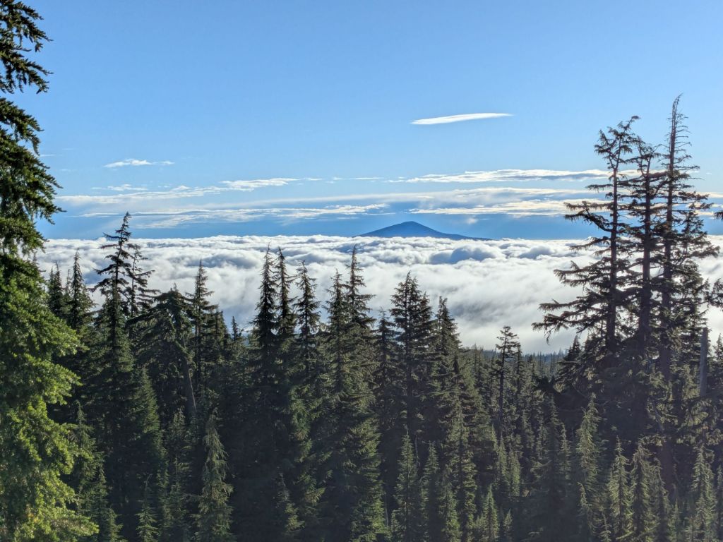
I awoke around sunrise to find my ridge-top campsite now perched above a sea of clouds. It’s amazing how this area feels like the alpine of the High Sierras, when it is in fact only at 6,000-some feet elevation.
Along with the clouds, I awoke to find plenty of condensation all over the top of my sleeping bag. Condensation is a big issue in Oregon so far. Alas, it comes along with the cooler, moister weather that I’ve enjoyed these last few days. I hung my sleeping bag on a tree in the sun as I packed up camp.
After a quick 8-mile hike down the PCT, I arrived at a turn-off. From there, I got off the PCT and walked a mile and a half or so on other trails and roads to Shelter Cove Resort.
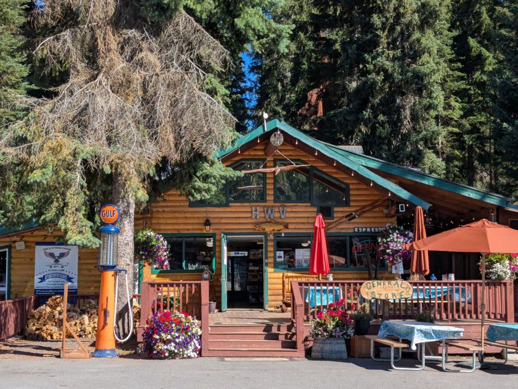
Shelter Cove Resort, on the shores of Lake Odell, is basically a campground, with several cabins, a general store, a small hot food counter, and a boat launch. Many thru-hikers, like myself, walk to Shelter Cove to resupply.
This place was ready for hikers. Outside the general store, there was a white canopy with picnic tables, charging stations, and a hiker box. Unfortunately for me, they were also ready to take advantage of their captive audience. In the general store, I found some of the highest grocery prices I’ve seen on the trail so far. The most shocking of which included $4 for a single 150-calorie fig bar, and $6 for a bag of Lays potato chips. I tried to find the value buys, but still managed to spend $40 on a 2.5-day resupply. I also ate plenty of hot food, before I returned to the PCT around 12:30 pm.
I hiked another 19 miles that afternoon and evening, enjoying the many stunning lakes I walked by. Due to the lakes, this area reminds me of the 100-Mile Wilderness on the AT. I thought about going swimming, but it’s actually too cold today. I even hiked the last few miles to camp while wearing my puffy jacket. It’s been a welcome change in temperature, following my time in the heat of NorCal while crossing burn areas.
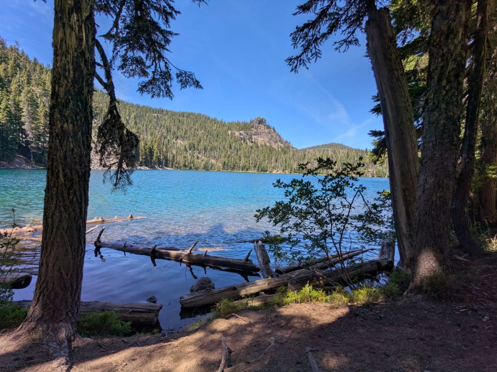
Speaking of burn areas, I will hike into one tomorrow. Tonight, I camped on the shore of a little lake right at the edge of a burn zone. It was one of my most beautiful campsites yet, though I was awoken when a pair of late-night boaters pulled their small vessel onto the land directly in my campsite.
Day 93
I awoke at the lake to a beautiful sunrise across the water. I took advantage of the sun and spread out my sleeping bag on the lakeshore to dry some of the condensation that had collected on it overnight.
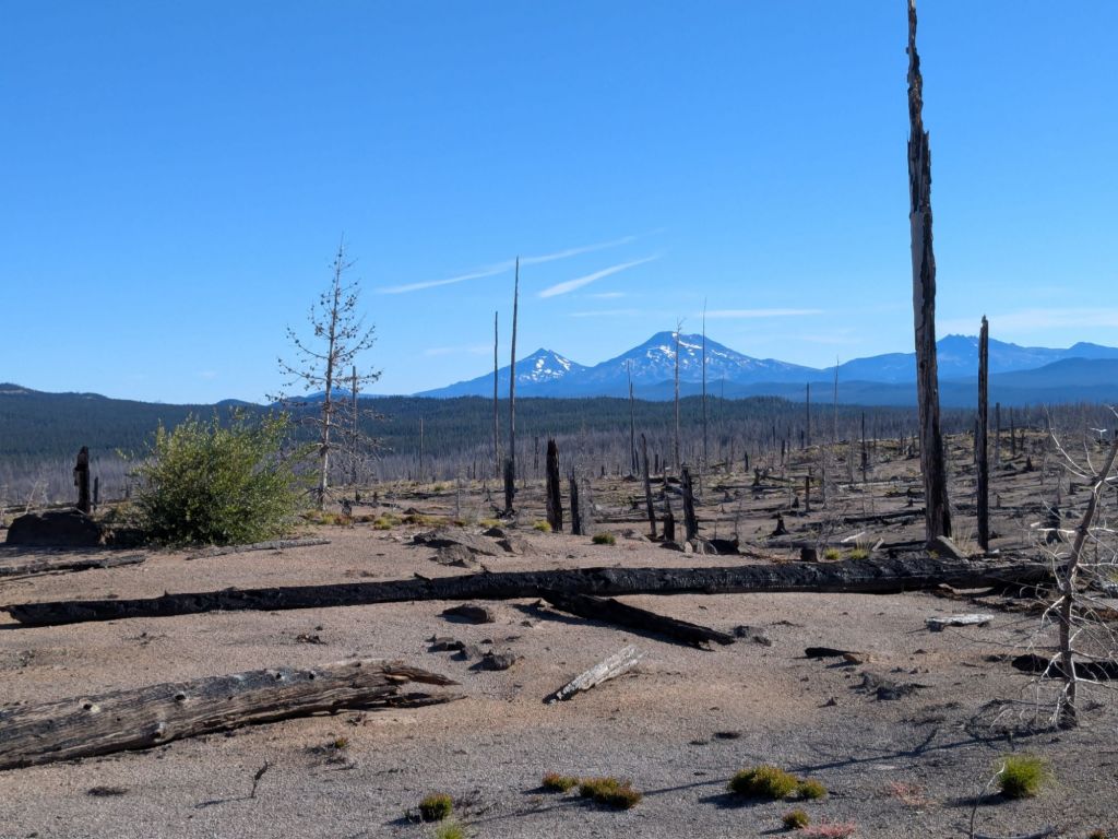
Once I packed up, I crossed through a 5-mile-long burn area. This burn area was from a particularly hot and intense fire. There are almost no standing dead trees, since nearly everything burned all the way to the ground. Even the topsoil burnt away, leaving little but sand and ash behind.
Past the burn area, I encountered quite a few blowdowns on the trail. But this didn’t last long, since I ran into a trail maintenance crew. Since this is a wilderness area, they were removing fallen trees using hand tools only! No machines are permitted in wilderness areas – even for trail maintenance!
I have to applaud their efforts: the trail in Oregon has been immaculate! In Northern California, I became quite accustomed to stepping over lots of blowdowns, especially in the burn areas, which seem more or less unmaintained. In Oregon, it seems that blowdowns are removed quite regularly by crews.
The afternoon was a challenging one, and the second time I’ve cried on the trail (the first was in Big Bear, when I ran out of food going into town, then missed the last bus from the grocery store). I’ve felt increasingly fatigued over the last few days. Though I can’t pinpoint it, something hasn’t felt quite right in my body recently. It’s quite frustrating to feel like I’m getting weaker when everyone else seems to be hitting their stride in Oregon. I’ve contemplated whether I’m getting enough iron or other various nutrients, or if I’m coming down with an illness. But more realistically, I’m probably just tired from having hiked continuously for 3 months.
I’m also likely tired from pushing hard since leaving Ashland. I haven’t hiked a single day under 25 miles since leaving Ashland over a week ago, and I’ve hiked several days over 30 miles. Fortunately, I should reach Sisters very soon, where my mom is visiting me on the trail. I plan to take a much-needed rest there.
Day 94
Thankfully, today was a much better day than yesterday. Partially, this was due to my attempt to improve my attitude in regards to my recent mileage and fatigue level. But mostly, it was due to the phenomenal scenery and geologically significant areas I passed through. Nothing distracts a geology enthusiast like some cool rocks, lava fields, volcanoes, and springs!
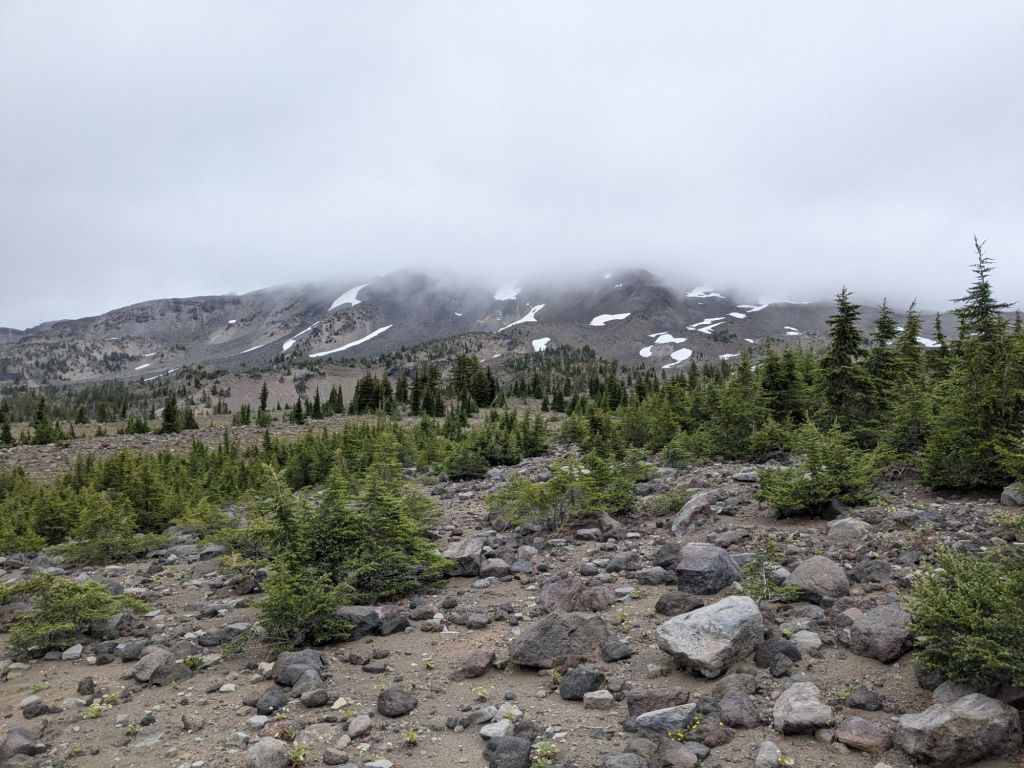
The first area of interest was passing beneath the “Sisters” – two volcanic peaks which still hold ample snow even in August. I’m told that some of the snowfields on these peaks are permanent due to their high elevation.
Next, I walked through the Obsidian Limited Use Area – a 2-mile section of trail where the ground is littered with little chunks of obsidian. Obsidian is a glassy, jet-black volcanic rock. I’ve never seen so much of it all in one spot.
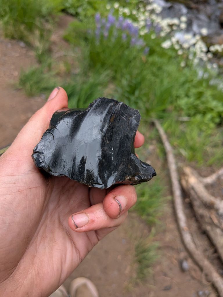
Another highlight of the Obsidian Limited Use Area was Obsidian Falls. I ate my second lunch by this waterfall before continuing upstream. I didn’t follow the creek for very long before it disappeared underground. It’s easy to see why there’s such a large natural spring here. It sits directly at the base of one of the volcanic Sisters, below a huge field of lava rock boulders. Certainly, it’s quite a permeable material for groundwater to flow through! As a former hydrogeology student, this made my day.


A final highlight today was the lava fields. The trail traversed a few fields made of jumbled lava rocks: debris from a long-ago eruption. Fortunately, these trails are quite well-maintained, and the carefully arranged boulders can be navigated with minimal strain on the ankles and knees.
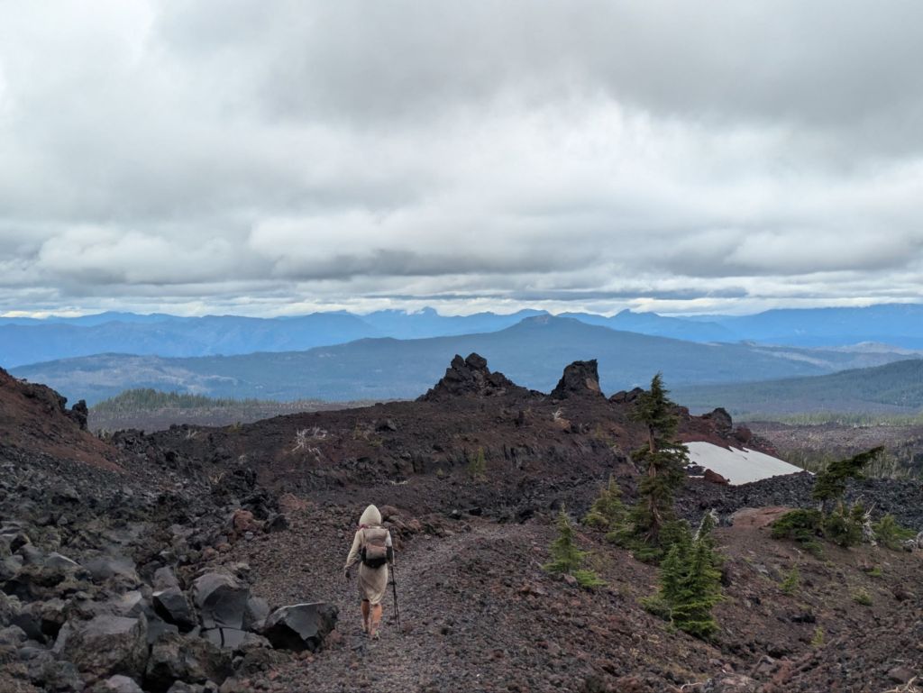

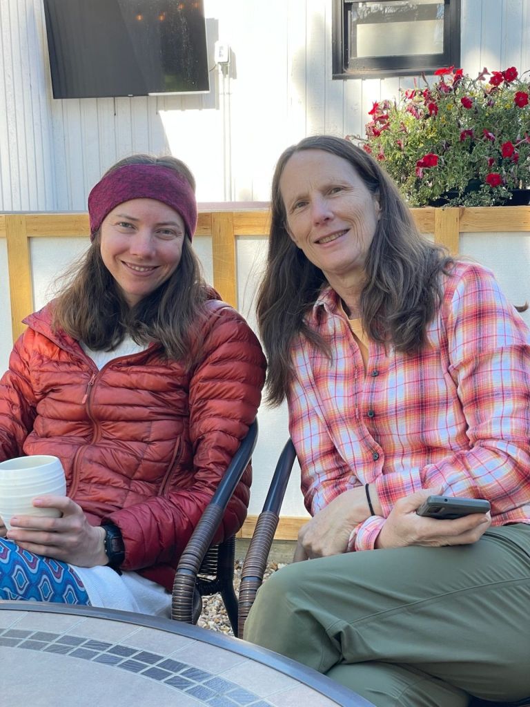
As I neared the highway at MacKenzie Pass, I crossed a final lava field. As I rounded a corner, I came face-to-face with my mom!
My mom and her friend Alex came out to this area to visit me on the trail and do some trail magic. Swish and I followed them back to the car at the trailhead, and we drove down into Sisters, OR. After a 9-day-long hard push since Ashland, I’m extremely ready for a good rest with my mom. The plan is to slack pack (hike without backpacking gear) the 17 miles to Highway 20 tomorrow, then zero the following day in Sisters, OR.

Day 95
Well, I didn’t slack pack today. When we woke up after sleeping in, neither Swish nor I really felt like walking. We decided to zero first and slack pack tomorrow instead.
It was a very relaxing day. With my mom and Alex here with a car, running town errands was a breeze. Normally, I’d run my town errands on foot. Instead, I spent almost no time on my feet today. Just what my tired body needed.
It was good to finally catch up on writing and also, unfortunately, on sleep. Though I get 8 hours most nights on trail, I often find my body is craving even more. But most of all, I enjoyed catching up with my mom, whom I hadn’t seen since March.
It was an especially restorative day, and I feel ready to hike some (slack packing) miles tomorrow.

Leave a comment