Sierra City to ~Belden.
Miles 1,196 – 1,282.
Days 62 – 64.
Past Sierra City, the trail climbs gradually into pine forest-covered mountains. However, the trees are short lived, as soon the trail crosses the Bear Fire burn scar. Here, hikers encounter many blowdowns and limited shade. The section ends with a long downhill to the Feather River.
Day 62
It was a wonderful day.
I woke up early at the Airbnb with Stag and his family and 9 other thru-hikers, where we’d all celebrated the 4th of July the day before.
Stag’s Dad made us eggs, then shuttled the first four of us back to the trail near Sierra City. I was hiking by 9:30 am, which I think is fantastic for getting out of town.
Straight away, there was a big climb. While it looked intimidating on the elevation profile, it turned out to be gradual switchbacks the whole way. Not bad at all.
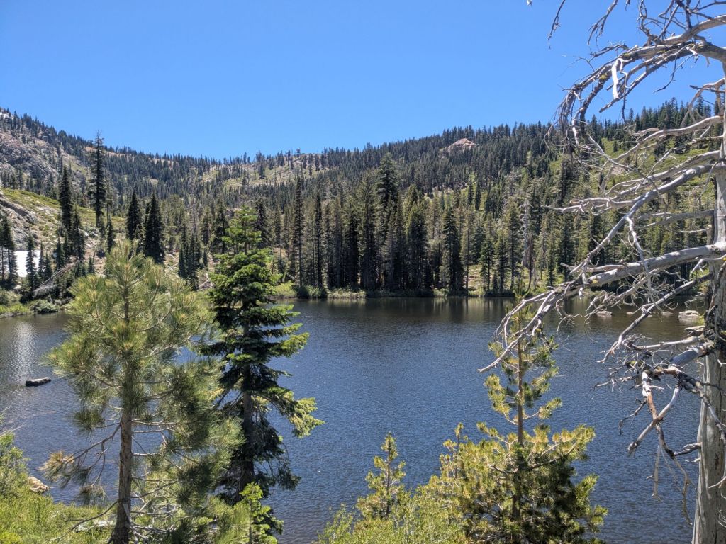
I took lots of breaks throughout the day. At one point, I stopped at a lake and tried to go swimming. I waded up to my ankles before deciding it was too cold to fully submerge. Then, I promptly slipped on a rock and got entirely in the water anyway. Oh well.
There was nothing particularly spectacular about this section of trail. I just liked it. There were dense pine forests and rocky ridges – all pretty easy hiking and pleasant. People are sleeping on NorCal! While the Sierras are spectacular, this is great here too.
I arrived at my final water source of the day, a piped spring, where I’d hoped to camp. However, there were already too many tents there, squeezed into a few tiny, uneven spots. I opted to carry on another mile and found a nice little forested saddle. Perfect for cowboy camping. In total, I covered 25 miles – not bad for a day leaving town!
Day 63
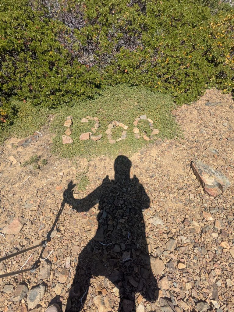
Today, I decided to do a 30-miler. This was kinda a big deal, because I haven’t done a 30-miler in about a month! The last one was the day before Mt. Whitney, near the beginning of the Sierras.
I’ve now been on trail for just over two months! It feels like I’ve been out here forever. It took me a month to hike the first 700 miles, through the desert. It took me an equal amount of time to cover the next 500 miles, through the Sierras!
The harder terrain really impacted my pace, and increased my need for rest, in the form of zeros and neros. But moving forward, the terrain should become a little easier. I plan to start hiking a bit further each day and zeroing a bit less, moving forward. Starting today, with a 30-miler!
To fuel my 30-miler, I had many great snacks. I was also carrying some secret weapons – two different beverages and hiker staples: Mio Energy, a caffeinated mix-in liquid, and electrolyte packets called Kaged that I bought at the Grocery Outlet in Truckee.

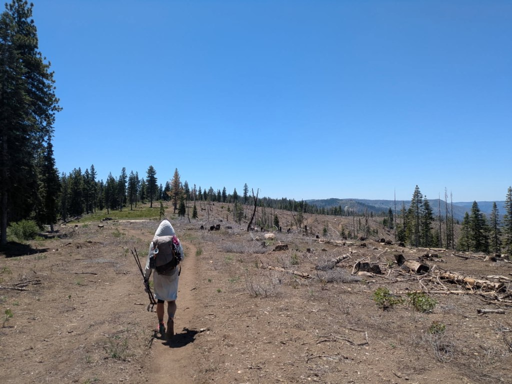
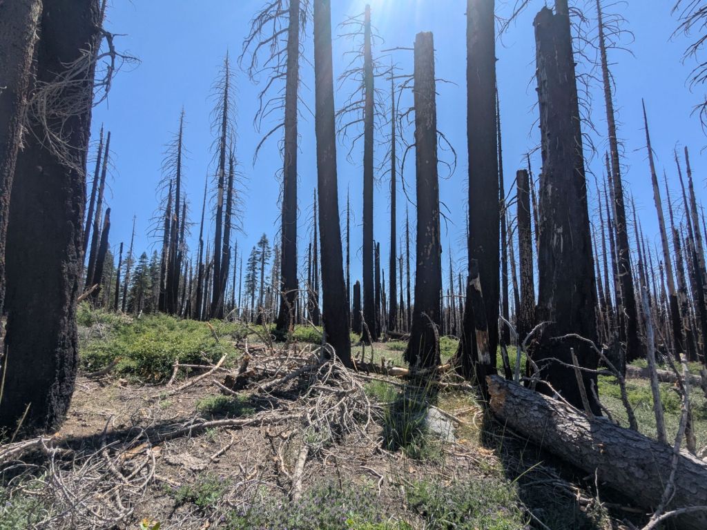
Partway through the day, I entered the Bear Fire burn area. Here, the pine forest turned to patches of standing charred trees. There were also many, many blowdowns crisscrossing the trail to climb over and around. The trail was almost like a jungle gym.
There is also no shade in the burn areas, as the dead trees lack needles. Making matters worse, it’s quite hot out! Today, the high temp was likely at least in the mid-80s. I was sweating profusely throughout the afternoon, and chugging my Kaged electrolyte drink. But still, I found myself feeling drained and craving salt as much as I did back in the desert.
When I stopped for a break, I read the back of one of the Kaged packets. It only had 150 mg of sodium per packet – hardly anything! For comparison, a LiquidIV packet has 500 mg of sodium, and my personal favorite packet, LMNT, has a whopping 1000 mg!
Luckily, I had some pepperoni and nuts – snack foods with plenty of sodium – and was able to avoid the perils of hyponatremia. For now. Tomorrow will be another hot day, and I’m starting to worry about my lack of salt.
It was hot at camp this evening, even after the sun went down. I didn’t need to put on my puffy jacket or leggings. As I lay on top of my quilt, trying to fall asleep, I found my hands, feet, and legs cramping. A sure sign I needed more salt. I’ve succeeded in covering my 30 miles today. But what would tomorrow bring?

Day 64
I woke up feeling dehydrated and depleted. My 30-miler through the burn area in the heat zapped me more than I realized.
Swish, whom I’d camped with last night, as usual, was feeling similarly drained. He’d had the same realization yesterday about the Kaged packets not actually having all that much sodium.
Over breakfast, Swish dumped out his food bag onto the forest floor. Amongst the trash and various snack nuts, he found 5 good electrolyte packets hiding away that he’d forgotten about: a Pedialyte, two TrueLabs, and two LMNTS. Generously, he gave me two of them. It’s not the first time that Swish has had my back in a pinch. And I do my best to have his back as well when I can. Back on the aqua duct before Tehatchapi, I’d given Swish a few of my electrolyte packets when he needed some. Hikers tend to watch out for other hikers. Even when we hike solo, we are never really alone.
Speaking of being alone, I’ve seen almost no other thru-hikers recently. Yesterday morning I passed a group of three. And today, until the evening, I only saw one duo that Swish and I have leapfrogged with for a little while. Apart from that, the forest is empty of hikers. I wonder if some folks skip this section, due to the burn area.
The hike today included a big climb – over a mile of elevation gain. The heat likely reached the high 80s or 90s, and the trail continued crossing in and out of burned areas with no shade. It was not an easy day by any means.
To cope with the heat, I took my first midday siesta break since the desert. I hunkered down in the shade under some living pines from 2 – 4 pm, before continuing on.
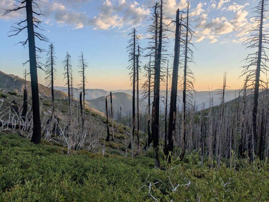
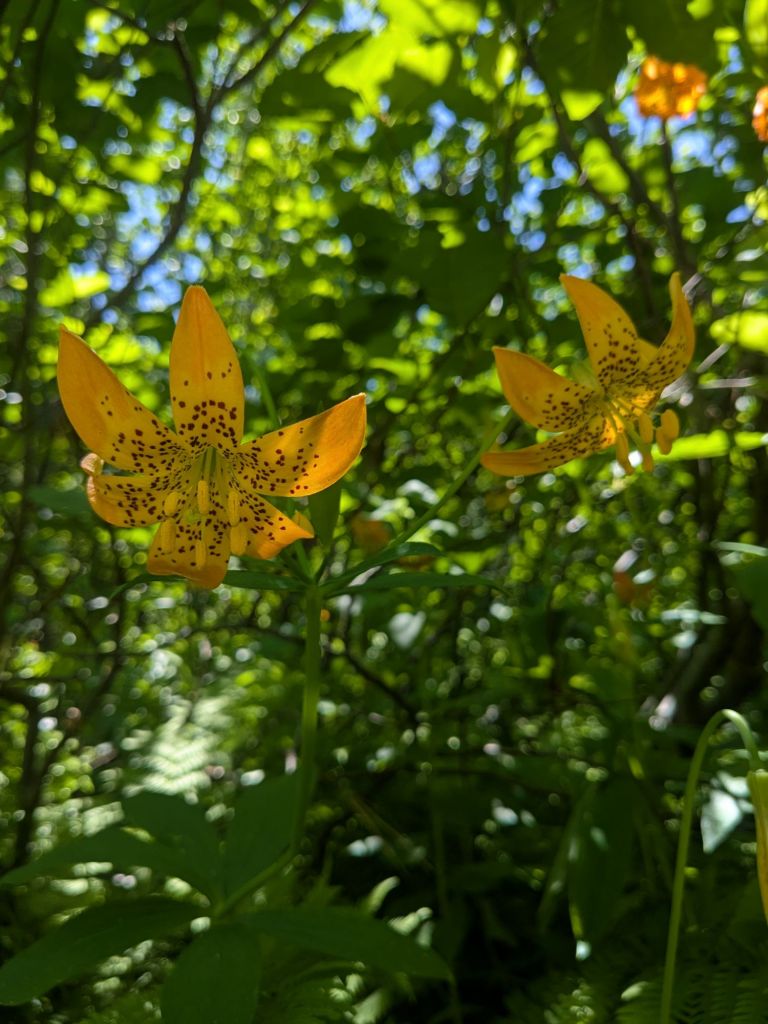
Through the evening as I hiked, the sun’s angle grew lower and the temperature gradually decreased. I entered another burn scar in the evening and found myself actually appreciating this unique area. Though the sight of many dead trees is sad the understory was vibrant, with a rainbow of wildflowers growing up from the ashes.
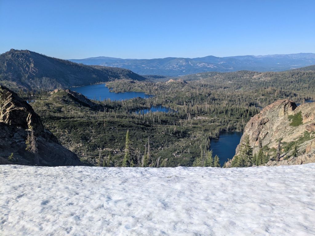
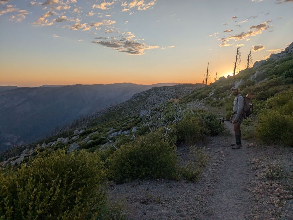
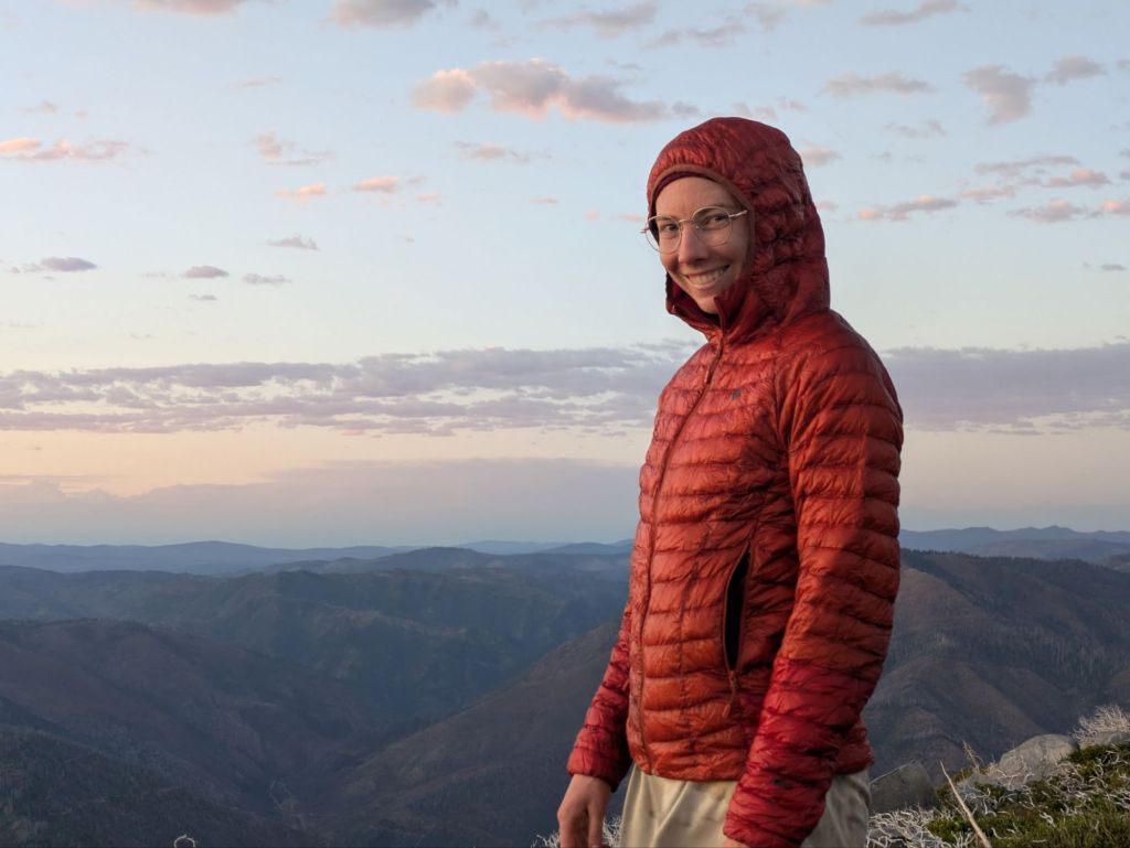
The last part of the day was a beautiful rocky ridge with a 4,000-foot prominence above the river and valley below. It was almost like standing on the rim of the Grand Canyon, in terms of how far I was above the bottom. I camped up there and watched a spectacular sunset right after I made it to camp, around 8:30 pm. Swish and I set up our cowboy camps on the ridge amongst the boulders, trying to find some shelter from the whipping wind.
In total, it was a 29.5-mile day. Not really any easier than a 30. But for some reason, it feels like it should be easier. Tomorrow, I will descend 6 miles to the river below first thing in the morning. There, I would reach the resupply stop of Belden. I don’t really know much about Belden, but I know it’s small. I’m not sure what I’ll find there, but I’m hoping it will have enough that I can cobble together a small resupply to cover the next 45 miles to the larger town of Chester, CA. I’m almost entirely out of food.

Leave a comment