It’s December. So if you’re like me, you’re already scheming up backpacking trips for next summer. If you need a little inspiration, I’ve put together this list of 5 amazing segments of the Colorado Trail that would make incredible 1 to 3-ish night section hikes!
What is the Colorado Trail?
The Colorado Trail is a ~500-mile footpath in Colorado, that goes from Denver to Durango. It crosses through multiple National Forests and Wilderness Areas, showcasing some of the most beautiful scenery of the Colorado Rockies. The Colorado Trail is a multi-use trail, traveled by hikers, backpackers, runners, horseback riders, and mountain bikers.
The Colorado Trail is divided into 33 segments – each with its own distinct character and scenery. Most segments have a trailhead or road crossing at both endpoints. These segments range in length from about 10 to 33 miles.
If you’re interested in learning more, I think you’ll enjoy my post where I rank the Colorado Trail’s 33 segments from my least to most favorite! I’ve hiked all of the segments at least once, and some of them as many as 4 times!
What is a Section Hike?
Many backpackers hike the whole 500-mile Colorado Trail from end to end each summer. Other hikers choose to do shorter trips on this trail – this is called a section hike. Section hiking merely means hiking a shorter portion of a longer trail. On the other hand, thru-hiking is hiking a long trail such as the Colorado Trail in its entirety as one big trip. Other popular trails for section hiking and thru-hiking include the Appalachian Trail, Pacific Crest Trail, Long Trail, and Arizona Trail among many others.
Some section hikers try to piece together a long trail over several years, one section at a time. Section-hikers may travel in pairs to park one car at either end of a section and shuttle themselves back to where they started. Another option is arranging private shuttles and taxis, or using public transportation (when available) to get back to the car. Section hikers may also hike out and back from a trailhead.
To select the Colorado Trail segments that would make the most awesome section hikes, I considered the following criteria:
- Accessibility of the segment’s endpoints (e.g., is there trailhead parking? Is the road to get there paved or dirt?)
- Driving distance from nearby airports and major cities
- Proximity to towns
- Practicality of point-to-point hiking, by arranging shuttles, taking a taxi, using public transportation, or parking a car at either end and driving back
- The scenic beauty and quality of the trail
- Access to cool side trails, interesting alternate routes, and nearby peaks
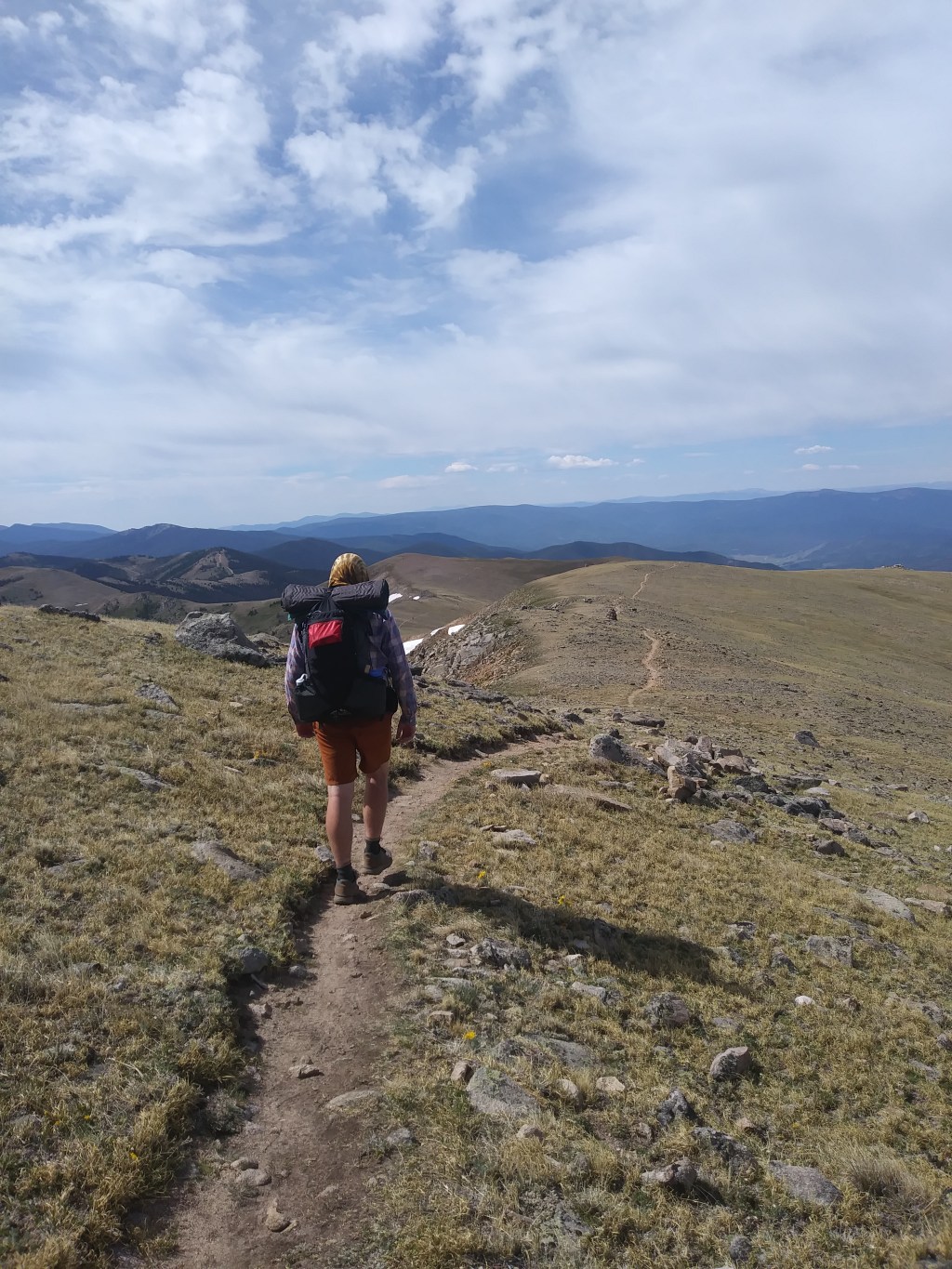
Segment 7
This 13-mile segment is perfect for an overnight backpacking trip. Plus it takes you above treeline to crest the scenic Tenmile Range near Breckenridge, CO! This segment provides a unique opportunity to backpack a point-to-point route by taking advantage of free public transportation!
- Length: 13.5 miles (one way)
- Northern endpoint: Gold Hill Trailhead along CO Hwy-9
- Southern endpoint: CO Hwy-91 (no parking, see note below) near Copper Mountain Ski Area
- Nearby town(s): Breckenridge, Silverthorne, Dillon, and Frisco
- Getting there: the Gold Hill Trailhead is about a 2-hour drive west from the Denver Airport and accessible by paved roads.
- Point-to-point arrangements: park at Gold Hill Trailhead and take the Summit Stage free bus to Copper Mountain Ski Area (be sure to check the bus schedule – external link)! Then hike back to your car. Using the bus may require a transfer and a small amount of additional walking between where the bus drops off/picks up and the trailhead.
Note: there is no parking directly at the southern endpoint of this segment. However, there is parking about a half mile away at the Copper Far East Parking Lot. This parking lot is next to the Colorado Trail, about half a mile before the southern endpoint of this segment.
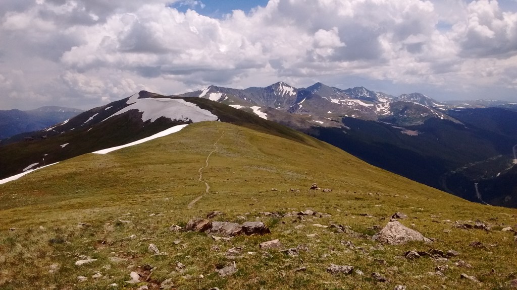
Segment 8
If you read my post ranking each segment of the Colorado Trail from best to worst, you know that segment 8 is one of my top 3 favorite segments! The gently rolling miles above treeline between Searle Pass and Kokomo Pass are especially delightful! The scenery seems distinct from the other northern segments and provides a taste of what is to come in the Collegiate West and San Juans.
- Length: 25 miles (one way)
- Northern endpoint: CO Hwy-91 (no parking – see note above) near Copper Mountain Ski Area
- Southern endpoint: Tennessee Pass Trailhead along CO Hwy-24
- Nearby town(s): Leadville
- Getting there: Tennessee Pass Trailhead is about a 2.5-hour drive west of Denver International Airport on paved roads.
- Point-to-point arrangements: like segment 7, it’s possible to hike this segment point-to-point – though you will need to arrange in advance for this one! One possibility is using a combination of public transportation and taxis or private shuttles. For example, Tennessee Pass Trailhead is a ~10-mile drive from downtown Leadville, so you could arrange a taxi or private shuttle from the trailhead to Leadville. From Leadville, you could potentially catch the Lake County Commuter bus (external link) to the East Village of Copper Mountain Ski Area, which is close to the northern endpoint of this segment. From there, begin your backpacking trip, heading back towards your car at Tennessee Pass Trailhead.
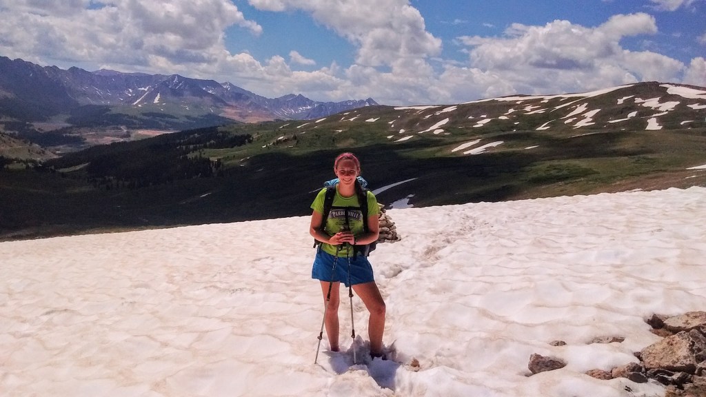
Segment 14
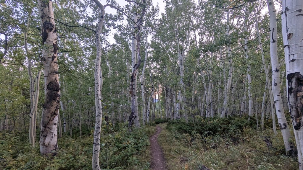
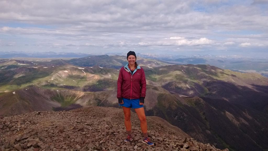
I enjoyed this segment so much that I’ve backpacked it three times! It starts with crossing through a sagebrush steppe, overlooking the Arkansas River Valley. The trail then climbs up through a forest with some lovely stands of aspen trees. This segment also includes the opportunity to tack on a side trip to the top of a 14,000-foot peak, Mt Shavano (external link). Though this only adds about 8 additional miles of hiking, it’s a challenging side trip due to the elevation gain.
- Length: 20 miles (one way)
- Northern endpoint: Chalk Creek Trailhead along County Rd-162
- Southern endpoint: US Hwy-50
- Nearby town(s): Salida and Buena Vista
- Getting there: either endpoint is about a 3-hour drive southwest of Denver International Airport on paved roads.
- Point-to-point arrangements: there is no bus or public transportation between these two trailheads (at least none that I’m aware of). However, there are plenty of paid shuttle drivers (external link) in the Salida/Buena Vista area. If arranged in advance, you could use a private shuttle to get one endpoint to the other (a 32-mile, roughly 40-minute drive).
Segment 20
While this segment is a bit more logistically challenging to section hike than the others in this post, I included it for a few reasons. First, you can access the most remote 14er in Colorado, San Luis Peak, via a very steep 1.5-mile side trail off of this segment! Second, it’s possible to turn this segment into a loop trip by hiking one way on the Colorado Trail and back on the Stewart Creek Trail, which runs parallel to the Colorado Trail one valley over. Finally, this segment goes through the La Garita Wilderness which is exceptionally beautiful in my opinion!
- Length: 13 miles (one way) or ~26 miles (out-and-back or as a loop with Stewart Creek Trail)
- Northern endpoint: Eddiesville Trailhead
- Southern endpoint: San Luis Pass (no vehicle access at the pass; take a side trail 1 mile to jeep access and 2.5 miles to car access)
- Nearby town(s): Creede and Saguache
- Getting there: the Eddiesville Trailhead 5 to 6-hour drive southwest of Denver International Airport or a slightly shorter drive from the Colorado Springs Airport. The last part of the drive is a rough dirt road. According to the Colorado Trail Databook (external link), this dirt road is passable by most vehicles in dry conditions.
- Point-to-point arrangements: the logistics of doing this hike as a point-to-point route would be very challenging (unless you happen to have two jeeps, one to park at either end and even so, the drive between the endpoints is really long). However, because this segment is fairly short, it could make a great out-and-back (or loop…!) from the Eddiesville Trailhead.
- Loop arrangements: instead of hiking out and back on the Colorado Trail both ways, you could take the Stewart Creek Trail one way and the Colorado Trail one way, creating a loop. The Stewart Creek runs roughly parallel to the Colorado Trail, one valley over. One should note that the Stewart Creek Trail goes over the summit of 14,014-foot San Luis Peak and should only be attempted by experienced hikers in good weather.
Segment CW02
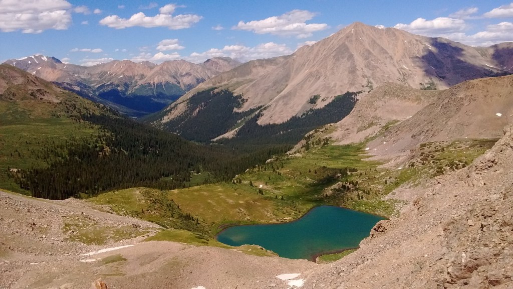
This high-elevation segment on the Collegiate West is perfect for those looking for a challenging trek and 360-degree views of big mountains. If the weather is good, consider camping near scenic Lake Ann (near treeline). The high pass above Lake Ann is hard work but definitely a highlight of the Colorado Trail! After Lake Ann Pass, the trail descends to Texas Creek – a nice low area for camping if the weather is bad. The segment then heads back uphill to end at the scenic paved road on Cottonwood Pass.
- Length: 26 miles (one way)
- Northern endpoint: near Sheep Gulch Trailhead (accessed via a 0.2-mile connector trail from the parking lot).
- Southern endpoint: Cottonwood Pass along County Rd-306
- Nearby town(s): Buena Vista
- Getting there: either endpoint is about a 3 to 4-hour drive southwest of Denver International Airport or a slightly shorter drive from the Colorado Springs Airport. The road is paved to the parking lot at Cottonwood Pass. Driving to Sheep Gulch Trailhead, the last 10 miles are on an unpaved but on a well-maintained gravel road that is usually passable by most vehicles in summer.
- Point-to-point arrangements: there is no bus or public transportation between these two trailheads. However, there are plenty of paid shuttle drivers (external link) in the Buena Vista area. If arranged, you could arrange a private shuttle from one endpoint to the other (a 44-mile drive which takes roughly one hour and 15 minutes).
Join the Conversation: are you planning a section hike on the Colorado Trail? Which segment(s) are you most excited about hiking? Do you have a favorite segment? Let me know in the comments section below!

Leave a comment