
I’ve lived on the northern Colorado Front Range for the last 10 years, and I love it for many reasons. One reason is that it’s easy to access some incredible backpacking areas without driving far. Whether you’re visiting northern Colorado or live here, you won’t want to miss these five stunning high-elevation backpacking trips! These itineraries are perfect for anyone looking for a beautiful but relatively short backpacking route that can fit into a weekend or long weekend! These five trips check all the boxes for a top-notch weekend adventure – which means they feature the following:
- Amazing views, such as getting above tree line or up to an alpine lake
- Easy to access from the northern Colorado Front Range. Why spend extra time in the car when you could spend it backpacking? All these routes are within a few hour’s drive of the I-25 corridor in northern Colorado.
- Weekend-friendly: these routes can be completed during a one or two-night trip, for groups able to cover around 5-10 miles each day while backpacking.
- Short and sweet: perfect for casual trips when you want to spend plenty of time socializing with your hiking buddies and enjoying your beautiful campsite!
- Fantastic side trip options: though these routes are on the short side, many offer access to nearby side trails and peaks – perfect for adventurous hikers looking to add extra miles or tackle a fun scramble up to a mountaintop!
Happy hiking and enjoy!
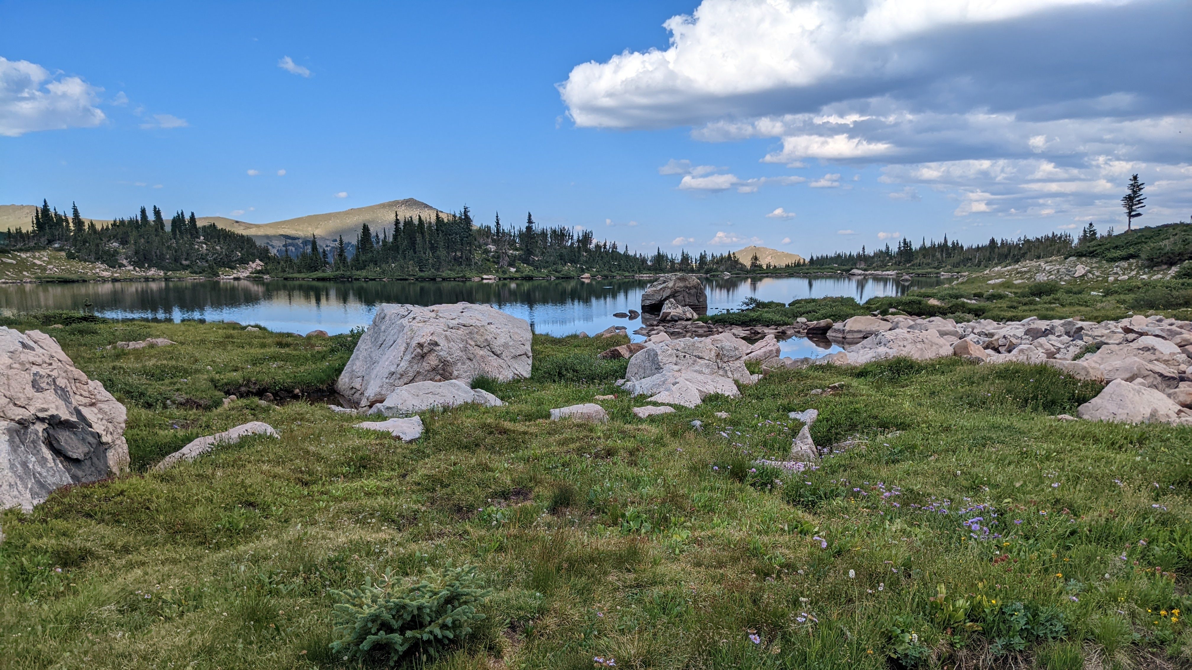
Camp Lakes, Rawah Lakes, and Twin Crater Lakes Loop Trail
Rawah Wilderness
Type: loop trail
Distance: 23.2 miles
Elevation gain: 4,041 feet
What makes it great: spend the nights camping at remote alpine lakes and the days taking in views of several nearby 12,000-foot peaks! Twin Crater Lakes are especially magical and worth the short but steep side trail to reach them. When I hiked this loop, I was pleasantly surprised by the lack of crowds and excellent campsite options.
Challenges: honestly, I mostly have positive things to say about this loop and I don’t feel my photos fully do it justice. AllTrails commenters have noted that sometimes this route has significant blowdowns that take time for trail maintainers to clear due to the remoteness of this wilderness. However, that was not my experience.
Where to camp:
- Night 1: dispersed camping near Camp Lake or Upper Camp Lake
- Night 2: dispersed camping near Twin Crater Lakes
Permits & reservations: none needed (as of 2024); but be sure to check the Rawah Wilderness page on the USFS website for backcountry camping regulations and updates (external link)
Parking: West Branch Trailhead
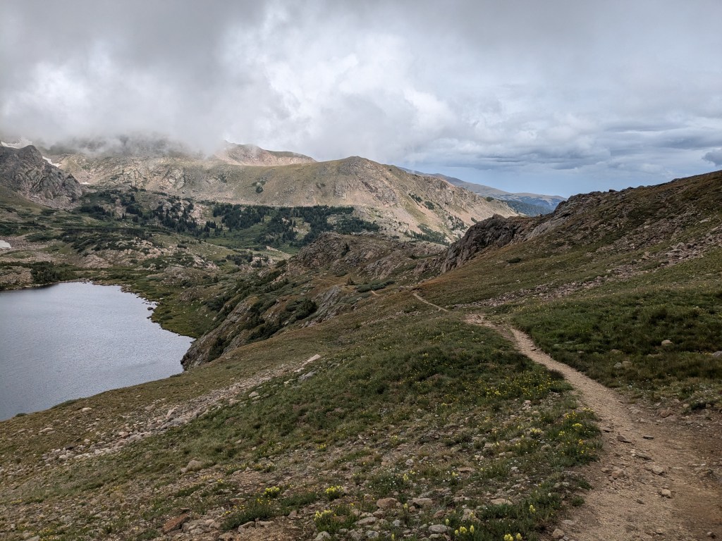
Devils Thumb Pass and King Lake Trail
Indian Peaks Wilderness
Type: loop trail
Distance: 15.3 miles
Elevation gain: 3,336 feet
What makes it great: view interesting rock formations (e.g., Devil’s Thumb) and you’ll join the Continental Divide Trail for a couple miles for a scenic alpine ridge walk. Additionally, Skyscraper Peak (12,385 feet) could be summited as a side trip from this loop, adding just a few extra miles of hiking.
Challenges: be sure to plan well in advance for this trip, as it can be difficult to secure a last-minute backcountry permit for the Indian Peaks Wilderness, especially for a weekend. Most permits become available at the beginning of the season and fill up quickly. However, some permits are released three days in advance, for last-minute planners (like me!). The miles closest to the trailhead experience especially high traffic on the weekend and you can expect to share this trail with a variety of users.
Where to camp:
- Night 1: Jasper Lake or Devil’s Thumb Backcountry Zone
- Night 2: Middle Boulder Backcountry Zone (e.g., near Bob and Betty Lakes)
Permits & reservations: you will need to book overnight permits here (external link)
Parking: limited road-side parking at the Hessie Trailhead (fills up quickly) or take the free shuttle to the trailhead (external link) from Nederland on summer weekends
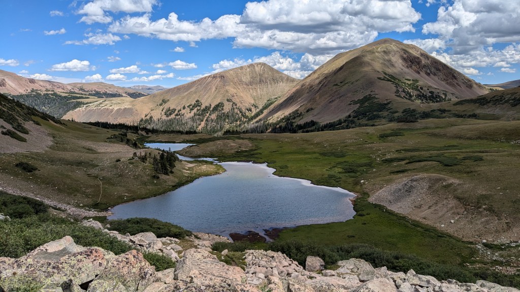
American Lakes
State Forest State Park
Type: out and back
Distance: 7.1 miles
Elevation gain: 1,456 feet
What makes it great: camp in the shadow of the iconic Nokhu Crags! With fewer total miles than the other routes on this list, this trip is a bit more beginner-friendly. However, there are opportunities to add side trips from your campsite! When I hiked this route we spent two nights at Michigan Lakes to spend a full day exploring the area around our campsite without our full packs. I recommend trekking up the short but rocky trail to Snow Lake. You could also summit one of the nearby peaks, such as Lulu Mountain (12,217 feet) on the border of Rocky Mountain National Park.
Challenges: the window to backpack in this high-elevation area in northern Colorado without snow is quite short. There’s a good reason these mountains are called the “Never Summer Range”.
Where to camp:
- Night 1: dispersed sites near Michigan Lake
Permits & reservations: you will need a Colorado State Parks Pass. You should also check for updates and read all backcountry camping regulations on the State Forest State Park webpage (external link)
Parking: American Lakes Trailhead
Cirque Meadows and Emmaline Lake Trail
Roosevelt National Forest and Comanche Peak Wilderness
Type: out and back
Distance: 11.5 miles total (to Emmaline Lake)
Elevation gain: 2,112 feet
What makes it great: this trail boasts wonderful views of steep mountains and tarn lakes carved out by glaciers. There are several designated campsites along the Emmaline Lake Trail, between about 2.5 and 4.5 miles in. In my opinion, the most scenic sites are about 3.5 miles in, at Cirque Meadows. You can set up camp at one of these sites, then continue up to Emmaline Lake (~11,000 feet) without your backpacking gear as a daytime excursion. Alternatively, hikers looking for a longer and more challenging side trip could tackle the trail up to Mummy Pass (~11,400 feet) and Fall Mountain (12,258 feet), which branches off of the Emmaline Lake Trail near the first campsites.
Challenges: along the Emmaline Lake Trail, camping is only allowed in a limited number of designated sites. Keep this in mind, especially if you are planning a trip on a summer weekend when many other backpackers will be out too. There is no reservation system, so if you arrive late in the evening, the best sites may already be taken.
Where to camp:
- Night 1: designated campsite near Cirque Meadows (you can use this campsite as a base camp to do side excursions without your full backpacking pack).
- Night 2: designated campsite near Cirque Meadows again
Permits & reservations: none needed (as of 2024), but camping is permitted in designated backcountry sites only, on a first-come first-serve basis. You can find updates and backcountry camping information on the Emmaline Lake page and Comanche Peak Wilderness page on the USFS website (external links)
Parking: Emmaline Lake Trailhead
Colorado Trail Segment 7
White River National Forest
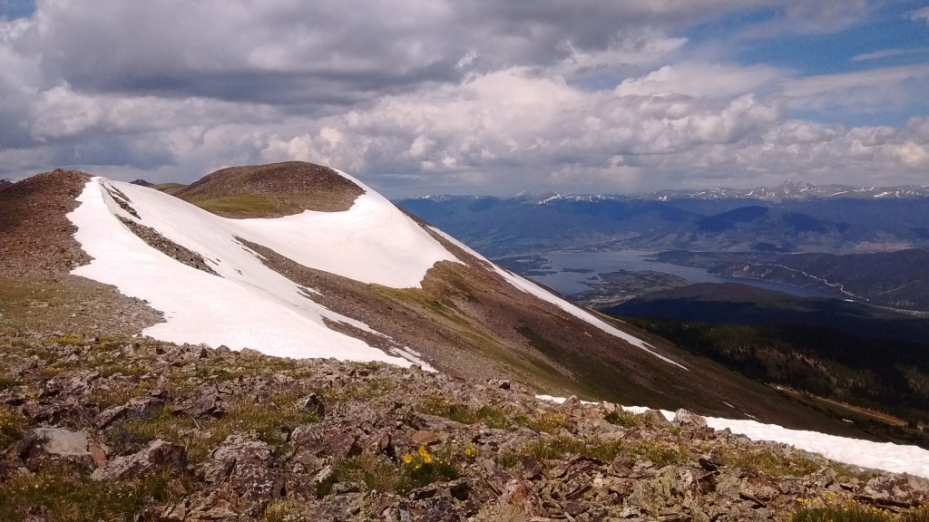
Type: point-to-point (catch the bus back!)
Distance: 13.5 miles
Elevation gain: 3,687 feet
What makes it great: crest the scenic Tenmile Range near Breckenridge, CO! Plus, this is a unique opportunity to backpack point-to-point and then catch the Summit Stage free bus back (check the bus schedule – external link)!
Challenges: the point-to-point nature of this trail makes the logistics a little more complicated than a loop or out-and-back hike. In addition to usual trip planning, you’ll need to consider bus stops, bus schedules, and transfers.
Where to camp:
- Night 1: various dispersed camping options along the Colorado Trail, e.g., near Miner’s Creek
Permits & reservations: none needed (as of 2024); you should check backcountry regulations and updates on the USFS website’s page for White River National Forest (external link)
Parking: Gold Hill Trailhead
I hope you found a hiking trip you love!
Have you tried any of these backpacking routes? What did you think? Leave me a comment at the bottom!

Leave a comment